Sprinkles and flurries possible Tuesday but overall precipitation chances lacking

-
6:22

Ballot drop box court case
-
1:26

Hundreds attend the newly expanded Baird Center’s open house
-
2:07

Memorial Day weekend expected to be busy for travel
-
0:47

9 priests ordained at ceremony in Milwaukee
-
2:15

GOP calls to unite on abortion, embrace mail-in voting during...
-
0:58

City of Milwaukee hosts Big Truck Day at Red Arrow Park
-
2:49

Few storms possible Saturday evening
-
1:59

Schlesinger’s Saturday Showcase (5/18)...Spring Cleanup, Summer...
-
5:53

’It’s OK, not being OK’: Local woman opens up about stigma...
-
2:48

Superintendent Posley one-on-one: Why MPS budget moves teacher...
-
2:02

Architectural teams honored at the 27th Annual Mayor’s Design...
-
2:39

WIAA rules Campbellsport track star will be able to compete in...

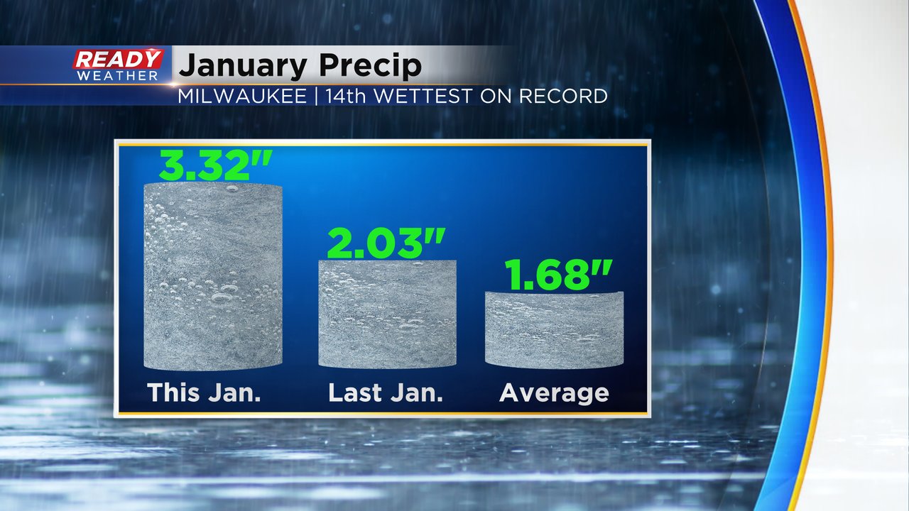
This January has been pretty wet. Most of it has been rain or some sort of wintry mix, but we did start the month with some consistent snow from the 10th to the 17th. We are doing just fine on snowfall and rain for the month and are currently well above-average with just two days left in the month. January 2024 is currently the 14th wettest on record with total precipitation of 3.32" which is well above last year's 2.03" and the average 1.68".
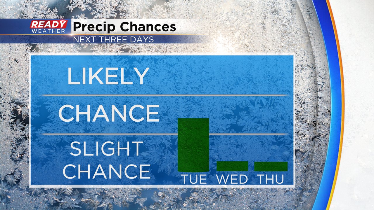
We could see a few areas of drizzle, flurries or sprinkles on Tuesday. Air temps for all of southeast Wisconsin are well into the middle 30s and even around 40 in some spots so there's no risk for any road impacts of icing or freezing but some damp and/or wet roads will be possible.

After Tuesday the rain/snow/precipitation chance goes well down. While we can't rule out some flurries or sprinkles in the next few days with clouds it overall looks dry for the next week. The next chance for any bigger storms isn't until the end of next week!
Download the CBS 58 Ready Weather app to track any flurries or sprinkles that develop with the CBS 58 Ready Weather app and track any new precipitation chances that pop up.