Scattered showers and storms expected Tuesday afternoon and evening

-
1:58

Delafield police release body cam footage showing life-saving...
-
0:41

Family accepts posthumous degree in honor of Sade Robinson
-
1:29

Car enthusiasts enjoy car show and demos
-
0:55

16-year-old body recovered at Quarry Lake Park in Racine County
-
1:29

Lion’s Den Gorge Nature Preserve
-
3:33

Green Bay collector amasses magnificent collection of the same...
-
2:42

Hometown non-profit approaches 4,000 dogs saved
-
3:44

America’s only known female coppersmith lives in Wisconsin....
-
4:09

Unlock the secrets of sweet dreams during better sleep month
-
2:25

’It’s a sensory safari’: Milwaukee students get immersive...
-
3:24

’Takes a lot of time, dedication’: UW-Whitewater wheelchair...
-
3:43

One Hometown boxer proves he’s no lightweight with ’Super...

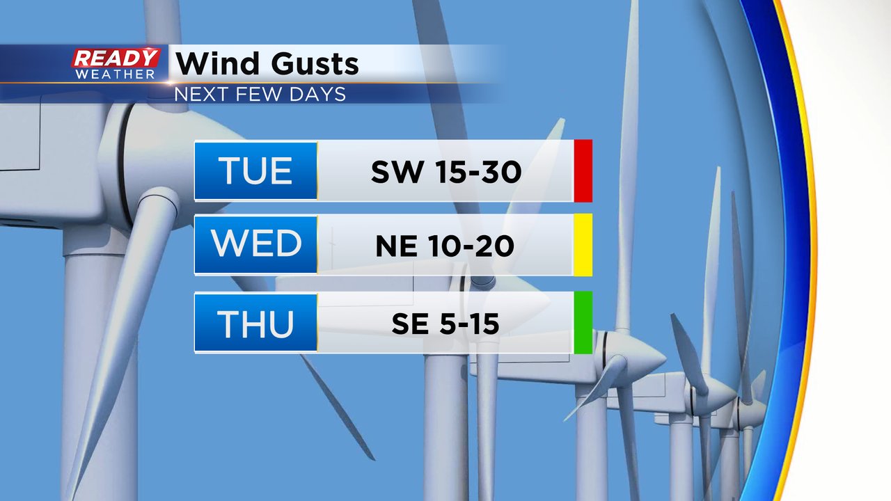
Tuesday will be another warm day with highs reaching the upper 60s to around 70 with a partly cloudy sky in the morning then some storm chances in the afternoon and evening. The wind stays gusty with a southwest wind pushing 30 mph at times. That wind stays strong Tuesday night but shifts to the north then a breezy NE wind is expected Wednesday with light wind on the way Thursday.
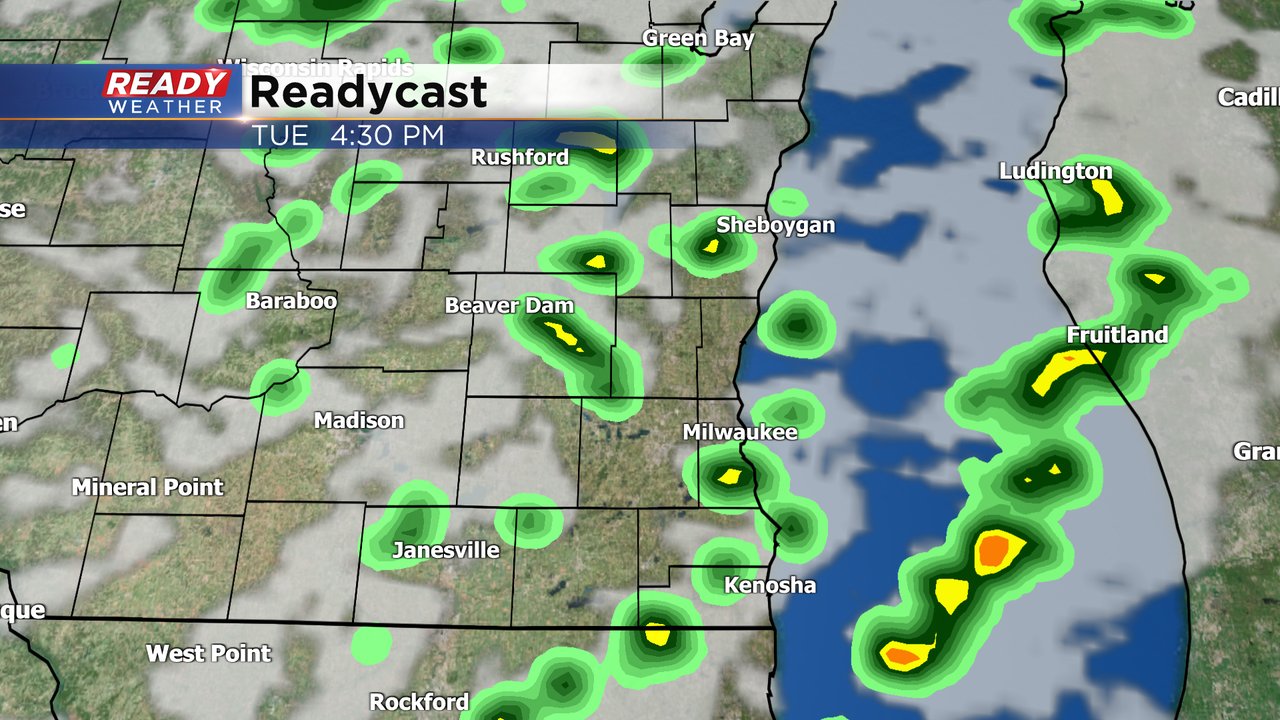
There's a good chance for at least a few showers and storms Tuesday afternoon and evening. The timing window looks best from 2-8 PM. Overall the rain looks pretty light with less than a tenth of an inch of rain expected for most of southeast Wisconsin but higher totals are possible in thunderstorms.
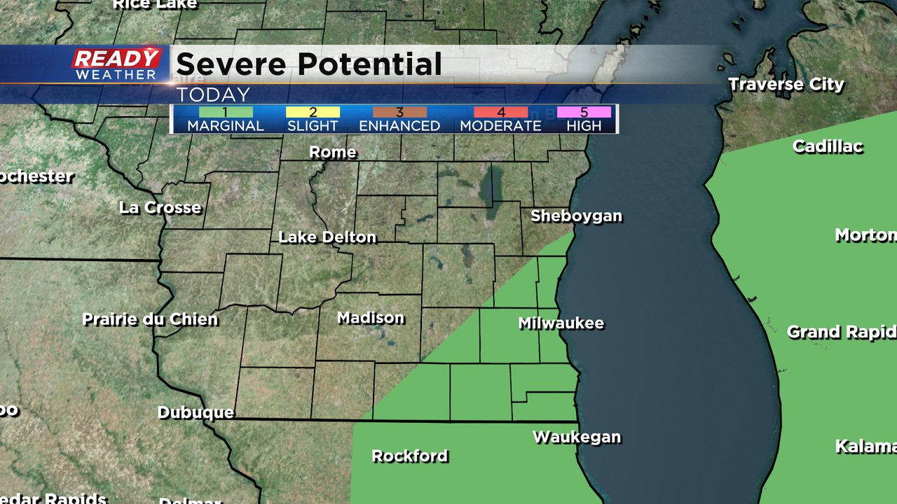
With all the warmth throughout the day we could get enough energy to see some very isolated strong to severe storms. Small hail and gusty wind may be a possibility with any storms that do develop so the Storm Prediction Center has added parts of southeast Wisconsin to the Level 1 Marginal Risk for severe weather.
Download the CBS 58 Ready Weather app to track the showers and storms Tuesday.