Scattered showers and storms return Thursday afternoon and evening

-
1:58

Delafield police release body cam footage showing life-saving...
-
0:41

Family accepts posthumous degree in honor of Sade Robinson
-
1:29

Car enthusiasts enjoy car show and demos
-
0:55

16-year-old body recovered at Quarry Lake Park in Racine County
-
1:29

Lion’s Den Gorge Nature Preserve
-
3:33

Green Bay collector amasses magnificent collection of the same...
-
2:42

Hometown non-profit approaches 4,000 dogs saved
-
3:44

America’s only known female coppersmith lives in Wisconsin....
-
4:09

Unlock the secrets of sweet dreams during better sleep month
-
2:25

’It’s a sensory safari’: Milwaukee students get immersive...
-
3:24

’Takes a lot of time, dedication’: UW-Whitewater wheelchair...
-
3:43

One Hometown boxer proves he’s no lightweight with ’Super...

Besides a few sprinkles or isolated showers the morning showers on Thursday are expected to stay dry. That changes in the afternoon and evening when scattered showers and storms are likely.

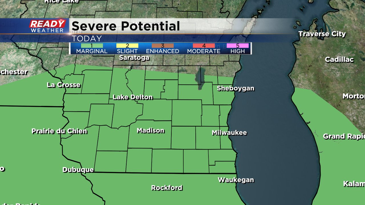
A few of the storms during the afternoon could be on the stronger side. All of southeast Wisconsin is currently in the Level 1 Marginal Risk. A few isolated strong storms are possible with small hail and gusty wind. The tornado threat is pretty low but not completely zero. That tornado risk is better in areas that see the warm front so we will track the front closely.
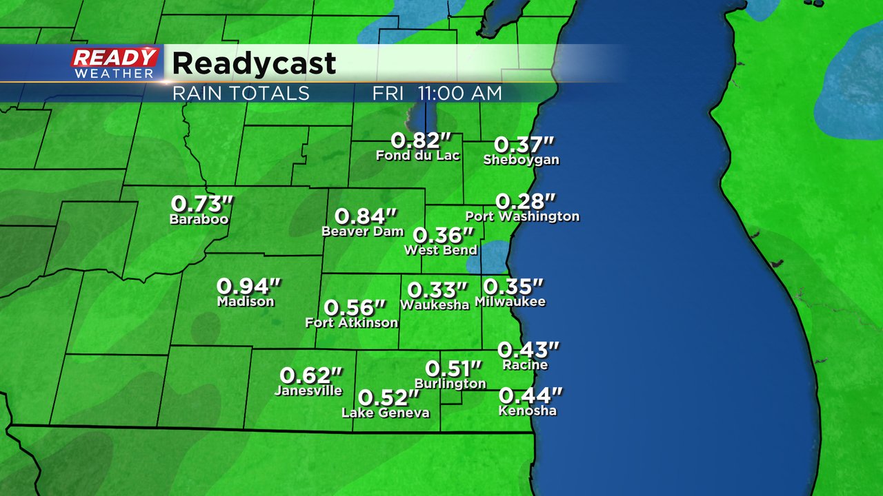
All of southeast Wisconsin should expect a good soaking rain Thursday into Friday morning. Around a half inch of rain is likely for most of the area with most ending in the 0.25-0.75" range. Those that see thunderstorms could see an inch or more. Most of the rain ends as we are heading out the door Friday morning.
Download the CBS 58 Ready Weather app to track the rain with the interactive radar.