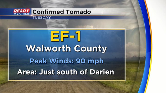
Update: Confirmed tornadoes from Tuesday's Severe weather outbreak


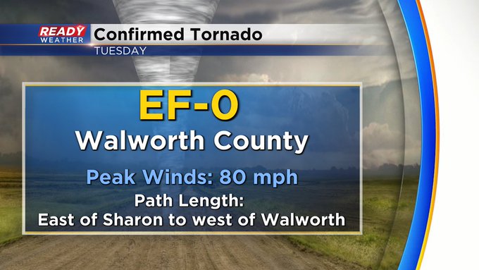
Update: The National Weather Service survey crews have sent over preliminary details on confirmed tornadoes from Tuesday afternoon. One tornado has come in with a rating of EF-0 with peak winds of 80 mph. This was just east of Sharon to west of Walworth.
Three rounds of storms rolled through southeast Wisconsin Tuesday. The first round in the morning didn't have any strong to severe storms with it but plenty of steady and heavy rain as well as lots of thunder and lightning. The second round in the afternoon sparked a few tornado warnings and severe thunderstorm warnings with large hail. A final round moved across southeast Wisconsin during the evening with a few more tornado warnings and some strong wind gusts over 50 mph. Rain totals by the end of the day ranged from 1-2.50" with some localized locations seeing a bit more.

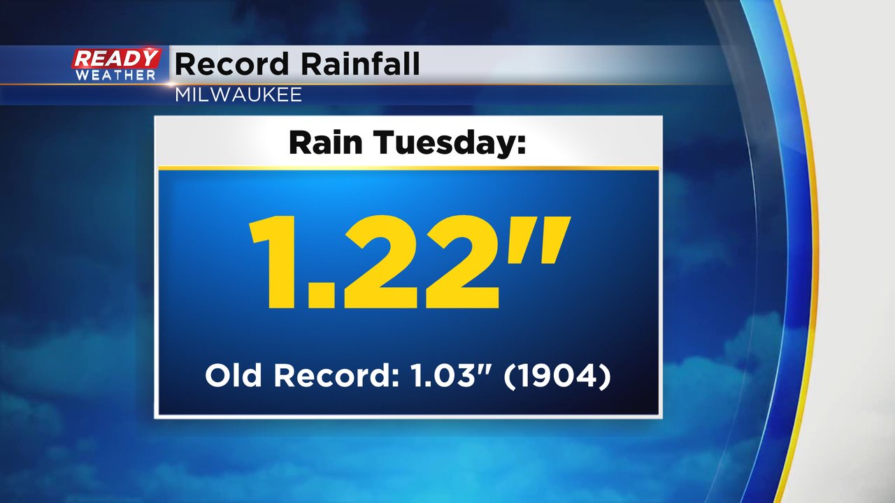
The 1.22" of rain picked up Tuesday in Milwaukee set a record for rainfall for the day beating a 120-year-old record of just over 1" set in 1904.
In addition to the heavy rain we had plenty of storm reports. Western Jefferson and Kenosha Counties both reported funnel clouds in evening although no tornadoes were confirmed with that round. The afternoon round of storms in Walworth County had plenty of wind damage repots and is being surveyed Wednesday for possible tornadoes.
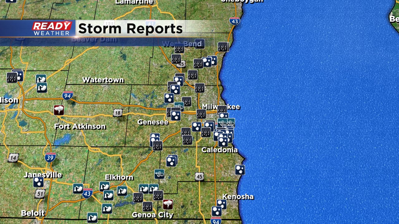
Over a dozen hail reports were sent in Tuesday as well. Most of the hail was small from dime to nickel size but it came down hard and covered the ground in spots. The largest hail was in northern Racine County and southern Milwaukee County with hail the size of ping pong balls and golf balls.
A lot of southeast Wisconsin saw hail yesterday with the largest hailstones in southern Milwaukee County and northern Racine County with hail up to 1.75". pic.twitter.com/uTXG1Bpsb1
— Justin Thompson-Gee (@JustinTGee) May 8, 2024
The forecast quiets down for Wednesday with sunshine but more showers are possible Wednesday night into Thursday. Thankfully without any severe threat this time. Download the CBS 58 Ready Weather app to track the next round of rain.