Sprinkles and flurries possible Tuesday but overall precipitation chances lacking

-
1:58

Delafield police release body cam footage showing life-saving...
-
0:41

Family accepts posthumous degree in honor of Sade Robinson
-
1:29

Car enthusiasts enjoy car show and demos
-
0:55

16-year-old body recovered at Quarry Lake Park in Racine County
-
1:29

Lion’s Den Gorge Nature Preserve
-
3:33

Green Bay collector amasses magnificent collection of the same...
-
2:42

Hometown non-profit approaches 4,000 dogs saved
-
3:44

America’s only known female coppersmith lives in Wisconsin....
-
4:09

Unlock the secrets of sweet dreams during better sleep month
-
2:25

’It’s a sensory safari’: Milwaukee students get immersive...
-
3:24

’Takes a lot of time, dedication’: UW-Whitewater wheelchair...
-
3:43

One Hometown boxer proves he’s no lightweight with ’Super...

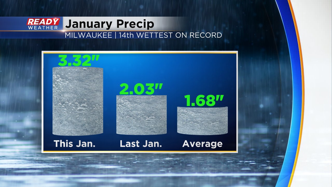
This January has been pretty wet. Most of it has been rain or some sort of wintry mix, but we did start the month with some consistent snow from the 10th to the 17th. We are doing just fine on snowfall and rain for the month and are currently well above-average with just two days left in the month. January 2024 is currently the 14th wettest on record with total precipitation of 3.32" which is well above last year's 2.03" and the average 1.68".
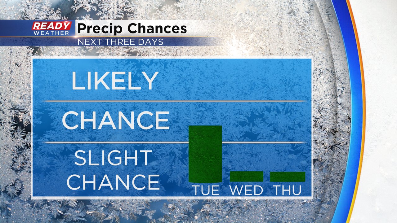
We could see a few areas of drizzle, flurries or sprinkles on Tuesday. Air temps for all of southeast Wisconsin are well into the middle 30s and even around 40 in some spots so there's no risk for any road impacts of icing or freezing but some damp and/or wet roads will be possible.

After Tuesday the rain/snow/precipitation chance goes well down. While we can't rule out some flurries or sprinkles in the next few days with clouds it overall looks dry for the next week. The next chance for any bigger storms isn't until the end of next week!
Download the CBS 58 Ready Weather app to track any flurries or sprinkles that develop with the CBS 58 Ready Weather app and track any new precipitation chances that pop up.