Warmth returns with more shower and storm chances

-
1:58

Delafield police release body cam footage showing life-saving...
-
0:41

Family accepts posthumous degree in honor of Sade Robinson
-
1:29

Car enthusiasts enjoy car show and demos
-
0:55

16-year-old body recovered at Quarry Lake Park in Racine County
-
1:29

Lion’s Den Gorge Nature Preserve
-
3:33

Green Bay collector amasses magnificent collection of the same...
-
2:42

Hometown non-profit approaches 4,000 dogs saved
-
3:44

America’s only known female coppersmith lives in Wisconsin....
-
4:09

Unlock the secrets of sweet dreams during better sleep month
-
2:25

’It’s a sensory safari’: Milwaukee students get immersive...
-
3:24

’Takes a lot of time, dedication’: UW-Whitewater wheelchair...
-
3:43

One Hometown boxer proves he’s no lightweight with ’Super...

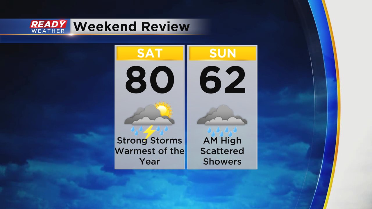
The weekend was a bit up and down. Saturday hit 80 degrees and was the warmest day of the year. Most of the day was dry before strong storms arrived in the evening. Sunday saw highs in the low 60s during the early morning hours and then dropped into the 50s by the afternoon. Light showers lingered throughout the day.
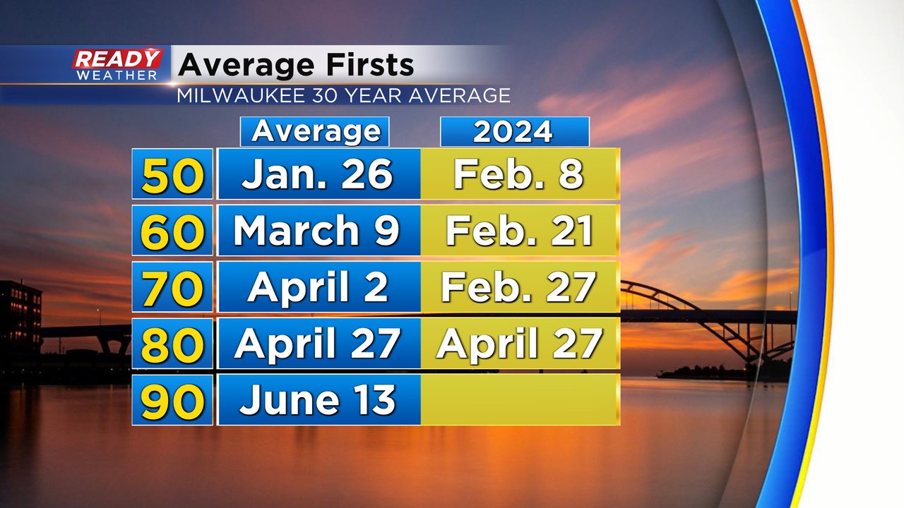
Hitting the first 80 of the season on Saturday was also the exact average date for our first 80 degree day. Now we look ahead to the 90s which don't usually happen until June.
Temperatures this week are warming back up. 70s return on Monday then the rest of the week stays warm in the upper 60s and low 70s.
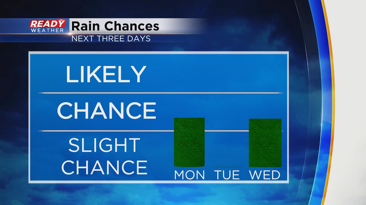
We saw a brief area of steady rain Monday morning but the rest of the day the rain chance looks pretty isolated with a few more showers through the late afternoon then drying out this evening. Tuesday looks all dry but Wednesday could see some showers or storms but timing is uncertain.
Download the CBS 58 Ready Weather app to track the temperatures and rain chances.