5 PM Weather Update: Severe threat over, tornado watch cancelled

Updated: 5:00 p.m. July 1, 2018
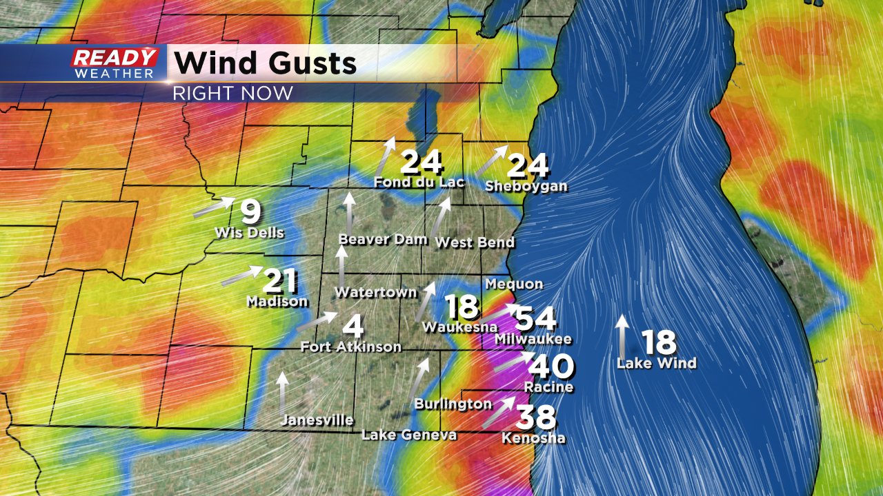
The severe threat for southeast Wisconsin is over. Severe storms with strong wind gusts were felt all across the area with reports of trees down in most counties. As the storms exited Milwaukee's airport recorded a wind gust of 54 mph.
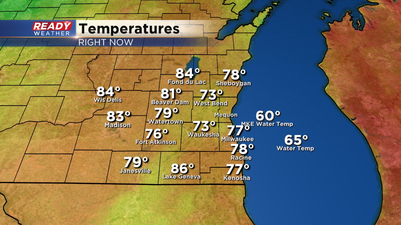
Now that the storms along the cold front have passed through the temperatures are dropping. most spots are seeing temps in the rain cooled 70s.
Monday will be much more comfortable with highs in the low 80s and lower humidity.
------
Updated: 3:30 p.m. July 1, 2018
Severe storms are currently moving across southeast Wisconsin. Widespread tree damage has been reported across parts of Ozaukee County near Grafton and Cedarburg.
Tree damage in downtown Cedarburg from the storm! @cbs58#readywx#wiwxpic.twitter.com/ztVCUawx2K
— Chris Nelson (@1ChrisNelson) July 1, 2018
Currently, two severe thunderstorm warnings are in effect for Sheboygan County until 4 p.m. and Dodge, Fond du Lac, Washington Counties until 4:15 p.m.
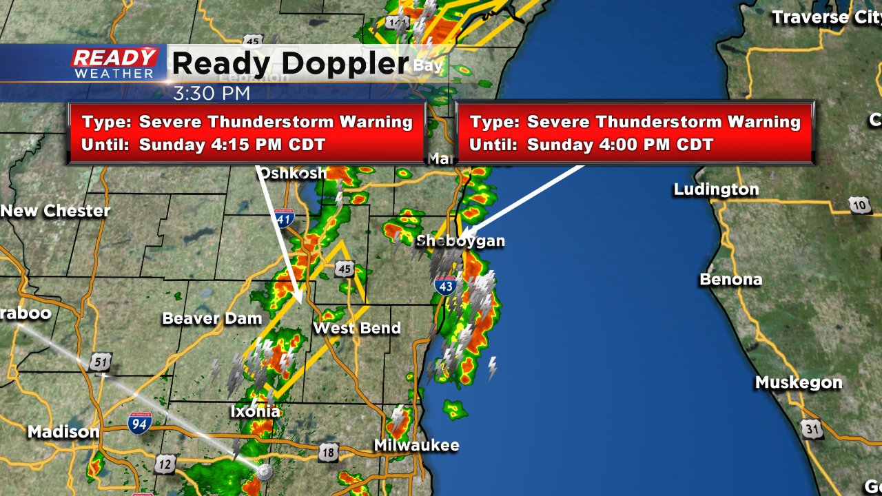
Storms are expected to exit southeast Wisconsin around 6 p.m. to the east. More warnings are likely.
------
Showers and storms continue to fill in to our west. There are storms ahead of the main line that are starting to pop. Storms this afternoon that are individual will need to be watched closely for rotation, especially across our northern areas.
Storms this afternoon are still expected to arrive between 2 pm and 6 pm.
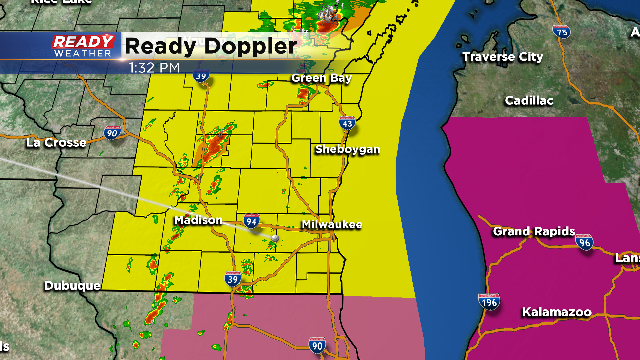
A tornado watch has been issued until 7:00 pm. The atmosphere has become very unstable this afternoon. Temperatures have spiked into the 80s with dewpoints well into the 70s.
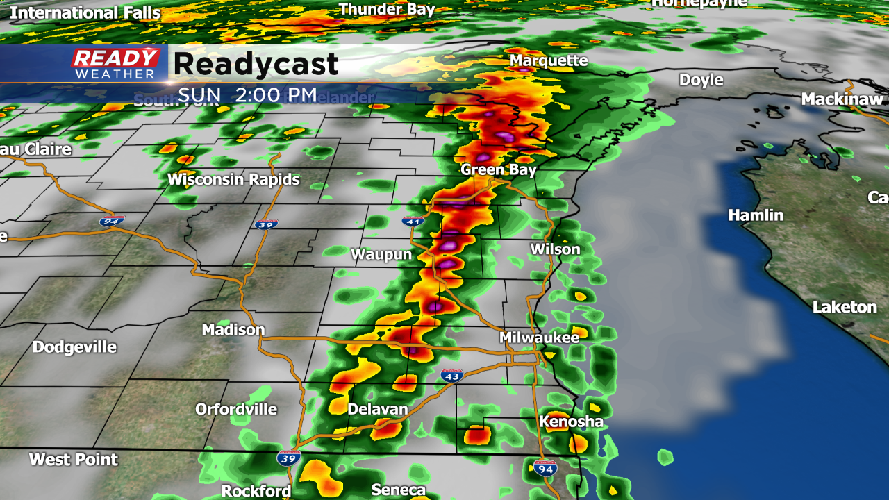
The heat and humidity ahead of a cold front will create strong to severe storms capable of producing large hail, damaging winds, and isolated tornadoes. The storms will coincide with peak heating, allowing them to really fire up quickly.
The storms will move through between 2 pm and 6 pm. We will continue to monitor the storms as they fire up.