Another blast of heat for a top 20 hottest summer so far
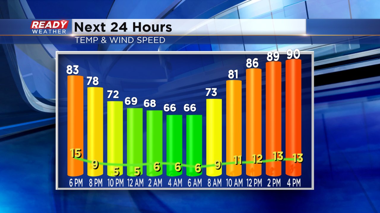
Summer so far in southeast Wisconsin has been very cyclical so far. We get a few days of hot and humid weather followed by cooler temperatures with rain and then repeat. The past few days have tried to break that pattern. After lots of heat and humidity last week temperatures cooled down, but this time without the rain. We get another blast of heat on Monday and then stay pleasant the rest of the upcoming week.
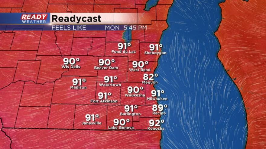
High temperatures Monday will get close to 90° with increasing humidity.
With dew points in the upper 60s it will feel more like the middle 90s.
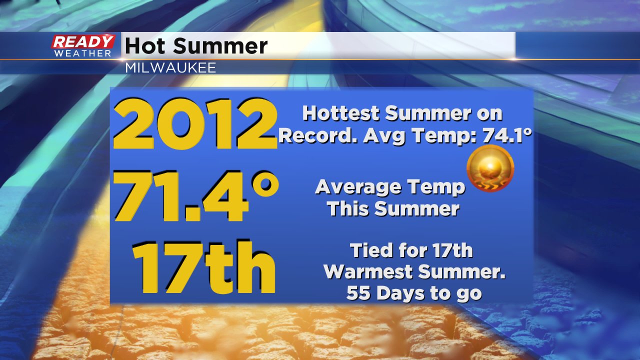
The latest blast of heat comes after what has overall been a hot summer. We are almost halfway through meteorological summer which starts June 1 and lasts until the end of August. With about 55 days to go the summer of 2018 is on pace to be a top 20 hottest summer on record. The record hottest summer was just a few years ago in 2012 when the average temperature was 74.1°. Through this past Friday, which only had highs in the 70s, the average temperature in Milwaukee is 71.4° which is tied for the 17th warmest on record.
Of course temperatures will fluctuate the next month and a half, but if you think it's been a warm summer so far you are correct.
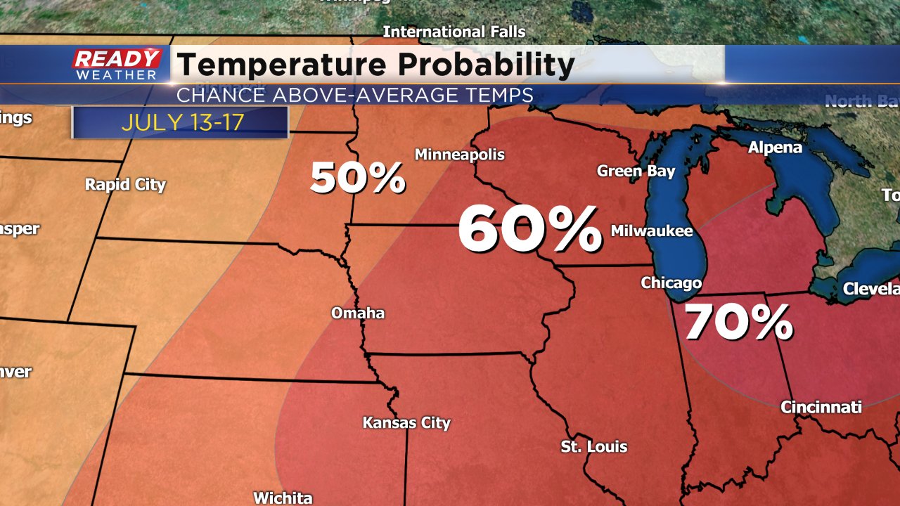
The warmth will continue this upcoming week with latest predictions showing a 60% chance of above average temperatures next weekend.
There are some signs that temperatures will cool for the second half of July. Download the CBS 58 Ready Weather app to track the 10-day and the changes.