Flood Watch....Storms and Heavy Rainfall
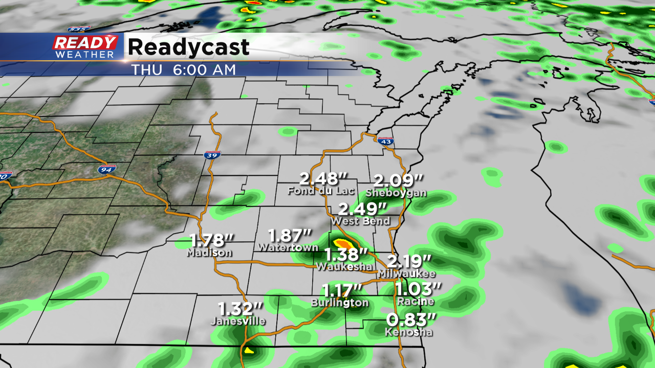
A slow moving storm system will provide scattered showers and storms across southeastern Wisconsin over the next 36 hours. The greatest threat will be locally heavy rainfall throughout the day on Wednesday.
The Flash Flood Watch doesn't include Milwaukee, Racine, Kenosha, and Walworth counties; however, that could change if the models project heavier rain in that zone.
Right now it appears that there will be several waves of showers and storms starting late tonight and into Wednesday morning. Scattered storms could redevelop by the afternoon and evening on Wednesday. Storms that fire back up could produce hail and gusty winds.

Overall the area will have a chance to pickup 1" to 3" of rain into early Thursday morning. Due to the convective nature of the storms, it's tough to pinpoint where the highest totals will occur. More rain and some storms are expected for Friday before we clear out for the weekend.