Chance for snow and cold going into Christmas
You've probably heard chatter about the chance for a big storm system just before Christmas and the possibility of cold air. As of Sunday, both are still possible, but there is plenty of uncertainty with that big storm.
First of all, we are talking about a storm that is still four days away and cold that is seven days away so there is plenty that could change. In fact, weather models have been doing a lot of that over the past few days - changing. Going back, on Thursday the chance for snow and a white Christmas looked real good, Friday that chance went down a bit, Saturday it was back up and some runs on Sunday keep it all rain. See the uncertainty?
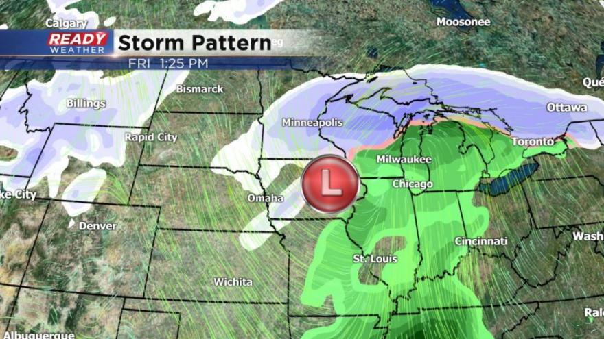
Here's the latest run of the GFS (American) model. This has been the second run in a row that brings the low farther north and leaves most of southeast Wisconsin with mostly rain.
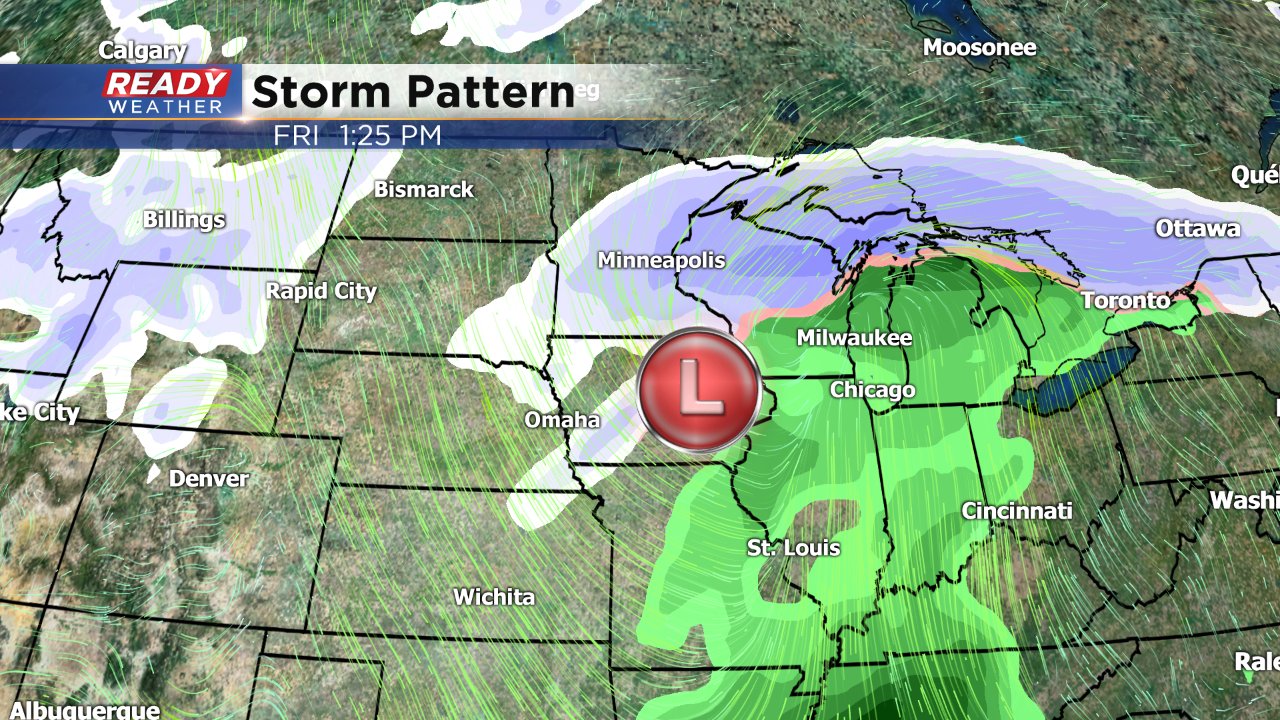
Even with the low shifting north or south it does look like southeast Wisconsin will be right in the area where just 50 miles will separate a lot of snow from every little, so prepare for both.
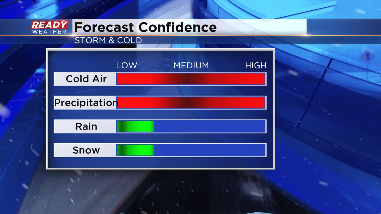
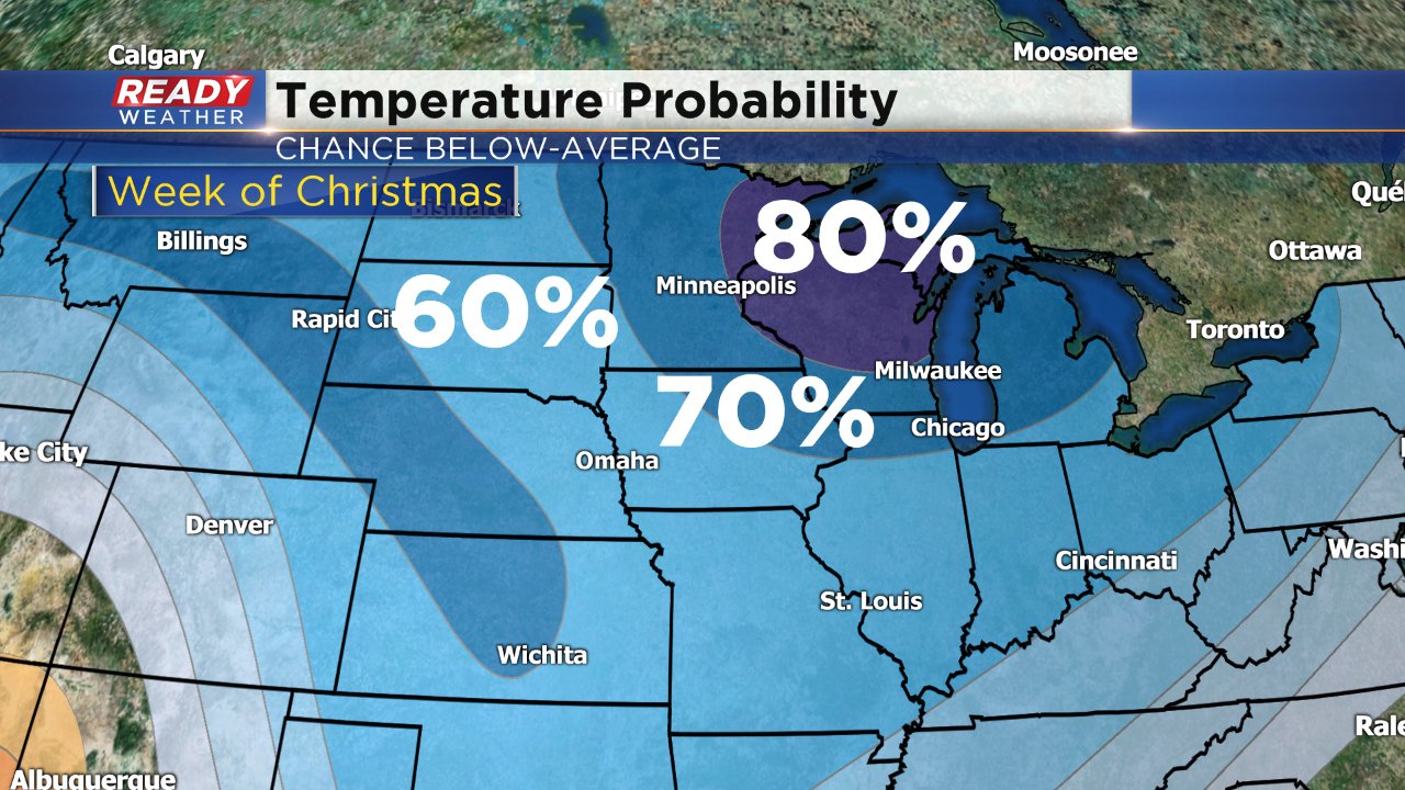
The confidence in our cold forecast is much better. Regardless of where the center of the low pressure sets up cold air will follow when it leaves. Right now the Climate Prediction Center puts southern Wisconsin in a 70 to 80 percent chance of below-average temperatures just after Christmas. The average high on Christmas Day in Milwaukee is 30°. The current Ready Weather 10-day has low 20s for highs on Christmas and only teens for highs for the days after.
So here's where our confidence stands: We are confident that a storm will impact Wisconsin towards the end of the week. We are also confident that the coldest air of the season will follow with below-zero wind chills likely. What's we aren't confident in is the type of precipitation that will fall. Rain, snow, and an icy mix of both are all in play. Don't look for credible snow or rainfall maps until Tuesday evening at the earliest. Download the CBS 58 Ready Weather app to stay up to date on the latest forecast developments.