Damaging winds and arctic cold!
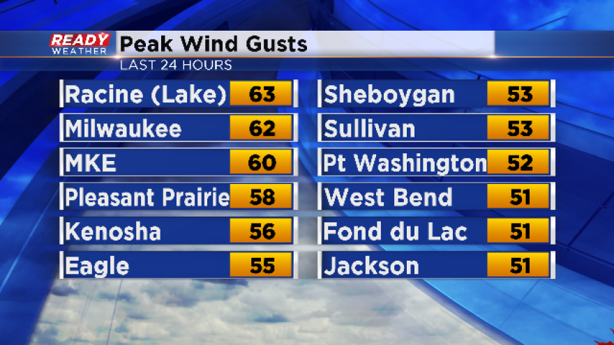
The winds of change have blown the roof off of the area today! Temperatures have dropped some 30 to 40 degrees compared to yesterday, and the wind chills were a complete shock to the system this morning and afternoon. Take a look at the wind gusts above.
Keep in mind a severe thunderstorm wind gust is 58 mph or greater, so some of the gusts we had were equivalent to damaging winds we experience in the summer. Trees and power lines were compromised with some of the strongest wind gusts across the region.
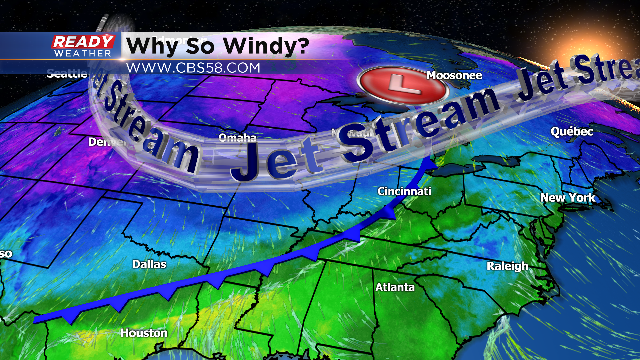
So why were the winds so strong? It all starts with the strong jetstream aloft. The jeststream was cranking over 150 mph, and is typically strongest during the winter months.
The jetstream aloft created the low pressure area at the surface where we live. As the jeststream winds increased, the low quickly deepened. Winds around the low draw colder air south while warmer air moved well north.
The greater the difference in temperature, the larger the pressure change. That pressure change crates very strong winds at the surface.
Even though the wind advisory will end at 6:00 pm, we are still expecting breezy conditions tonight and Wednesday, so plan on wind chills in the teens.