Excessive Heat Warning Friday and Saturday

-
2:03

’I’m still with you’: Wauwatosa 911 dispatcher helps woman...
-
2:23

What could a ban on noncompete agreements mean for Wisconsin...
-
2:08

Milwaukee Diaper Mission highlights helpers during National Volunteer...
-
19:35

Groundbreaking starts for multimillion-dollar renovations at...
-
1:39

Bond set at $100K for Campbellsport man charged with bestiality
-
0:25

Waukesha parade memorial groundbreaking date set for May 8 at...
-
1:05

Spring frost
-
4:04

Celebrating America’s top emerging sport during National Pickleball...
-
3:55

Local financial advisor talks tips on protecting against identity...
-
2:03

Widespread freeze expected Thursday morning
-
3:18

MIAD’s 50th anniversary paints the perfect backdrop for its...
-
2:03

MPS considers booting 2 charter schools out of district buildings

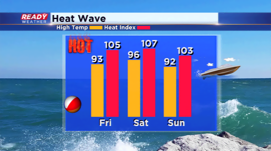
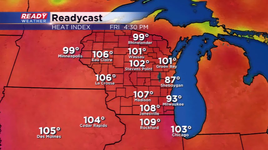
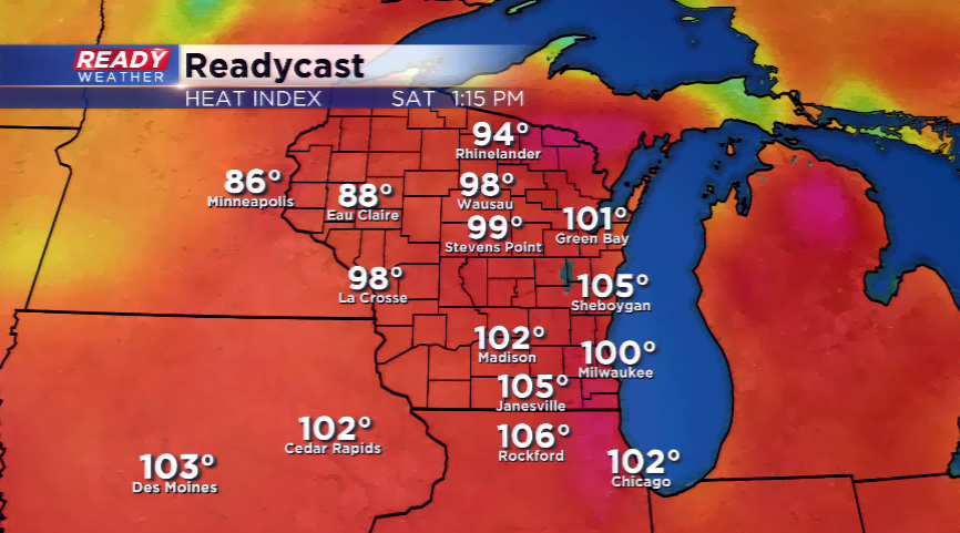
A very hot and humid next two days are on tap for southeastern Wisconsin. Heat index values could reach dangerous levels between 100 and 110 degrees. High temperatures could rise into the mid and upper 90s, while dew points could range in the mid and upper 70s. It will be a very soggy and icky weather pattern. This is why the National Weather Service has tabbed parts of southeastern Wisconsin, everyone except Ozaukee and Sheboygan, under an Excessive Heat Warning. The criteria for the warning are heat index values approaching 110 and highs well into 90s.
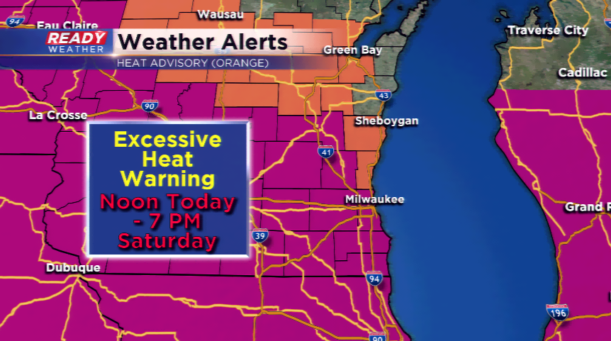
A Heat Advisory is still in effect for Ozaukee and Sheboygan Counties; the lake will be their friend this weekend, helping to moderate this major heat wave. Both warnings and advisories will start at noon today and run until 7 pm Saturday.
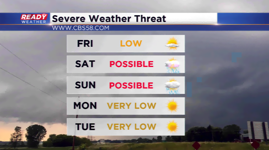
There’s a slight chance of a storm this morning with a complex of thunderstorms out west, but most of that MCS will die out before it gets into central Wisconsin. The front that will give some relief late this weekend could kick up storms by Saturday night and Sunday. Some of these storms could turn severe. Temps will still be in the low 90s on Sunday, then 80s for most of next week.