Late Afternoon Severe Weather Update
Posted: Jun 22, 2017 3:38 PM CDT
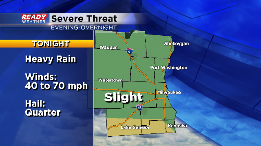
The SPC has downgraded most of southeastern Wisconsin to a marginal risk for strong to severe storms tonight. The exception is Walworth and Kenosha counties along the Wisconsin/Illinois border.
This has been a complicated forecast with lingering showers and clouds from morning convection. The best instability is occurring over the border across northern Illinois where sun and clouds and hot and humid conditions exist.
We are still expecting strong showers and storms late this evening into the overnight; however, small hail and gusty winds are more likely for our area.
We will continue to watch the area for any new watches or warnings.