More record highs could fall early this week
The unseasonably warm weather pattern continues for early this week. The record high was crushed on Friday by three degrees, and the area was in arm’s reach of records over the weekend. In all, three straight days hitting 90 degrees or warmer is incredibly impressive for the end of
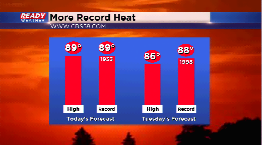
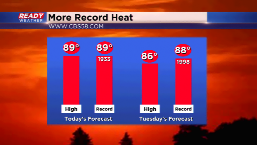
Another record could fall today. The record high for Monday is 89 degrees set back in 1933. Highs easily could run into the upper 80s and lower 90s to start your week. Highs could be a little cooler on Tuesday with daytime highs a few degrees cooler than what’s expected for today. The record tomorrow is 88 degrees set back in 1998.
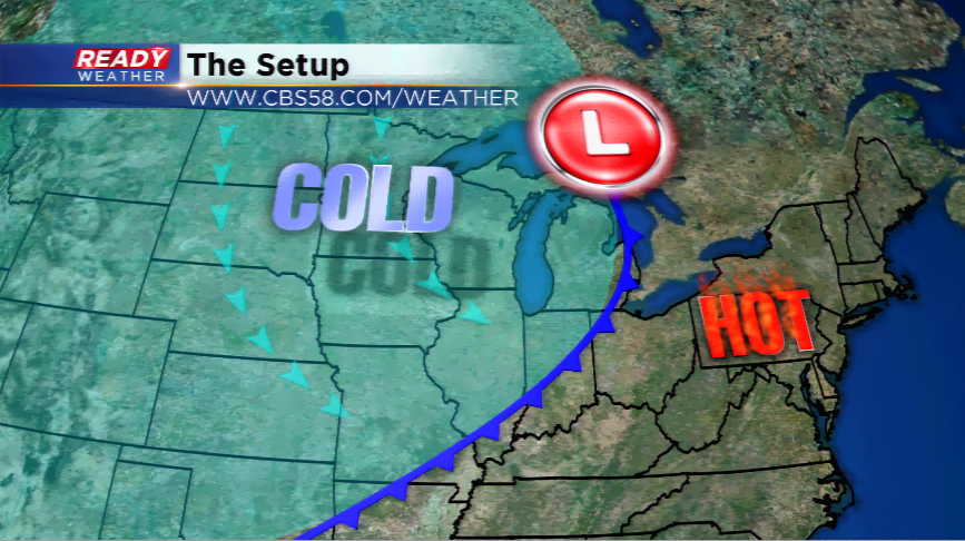
When does this weather change? Soon. A strong cold front will power through the area tomorrow and Wednesday. This front will generate showers and storms, and usher in