One big chance for severe storms and heavy rain this week
The weather has been very active and stormy the past weeks causing lots of tree damage and flooding, especially in our southern communities. Most have had enough with the storm chances and are looking forward to a nice break. Overall, that break will happen during this next week but there is one good chance for storms.
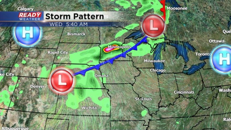
A cold front will push through the Upper Midwest on Wednesday arriving in southeast Wisconsin during the afternoon and evening. With heat and humidity forecast to return after a brief break Monday and Tuesday there will be enough instability in the atmosphere for severe storms. Our entire viewing area is already under a rare Day 4 "slight" risk for severe weather. Right now it looks like strong wind and large hail will be the main threats, but heavy rain is also likely.
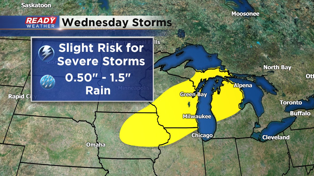
Current weather models are showing about a half inch to inch and a half of rain Wednesday evening into Thursday morning. That amount of rain won't help flood concerns, but it shouldn't hurt them too much. If rain totals start going higher above the 2" mark that's when flooding concerns will return.
There's still a few days for the timing, threats and heavy rain on this storm system to change so stay tuned to Ready Weather for the updated forecast and download the Ready Weather App.
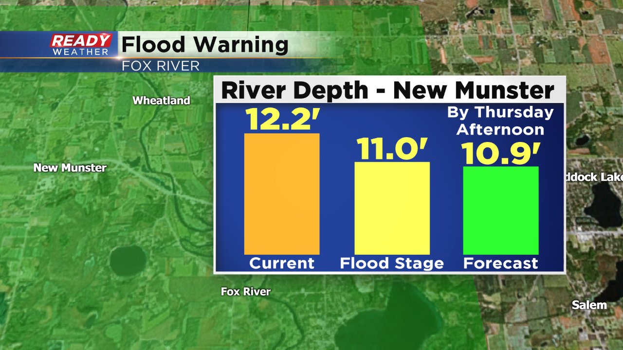
The current forecast for the Fox River at New Munster, which is the last remaining flood warning in our area since the historic flooding, is expected to dip below flood stage Thursday afternoon. If parts of the Fox River get over 1" of rain Wednesday, that warning will likely get extended for a few more days.