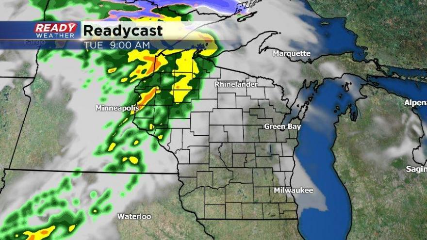
Rain Making It Back in the Forecast Tuesday
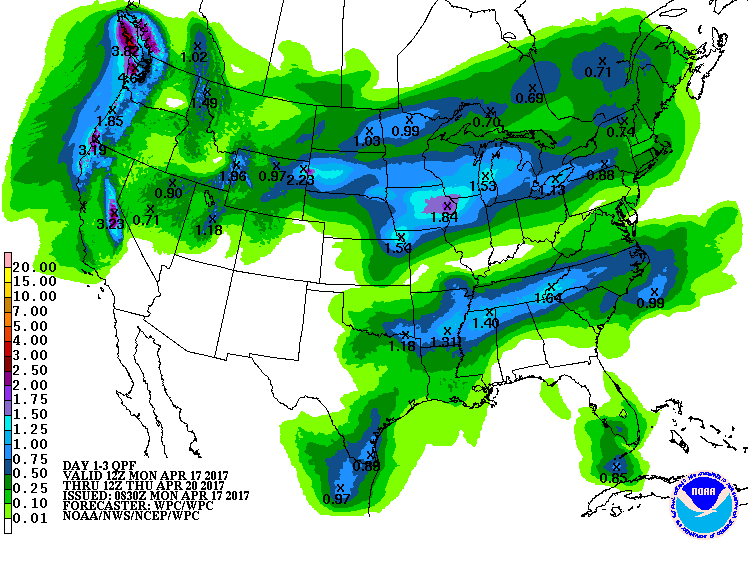
2017 has featured an above average start to the rain and precipitation season. Precipitation totals are at 11" since January 1st, 3.38" above the norm. Keep in mind, this time last year, we only had 5.66". Guess what? More rain is scheduled to slice through the region starting Tuesday.
Most of the precipitation will stay to the west and northwest during the day, but once the front swings in, rain and t'storms are possible into Wednesday. The front is expected to stall out on Wednesday, which will help fire up more showers and t'storms. The Storm Precipitation Center has outlined extreme southern Wisconsin for a risk of stronger storms. As of now, the biggest risks would be hail, gusty winds, and especially heavy downpours. A few of our forecast models have hinted at over an inch of rain, if not more. This activity would linger into Thursday with a trough keeping Wisconsin as its target.

A drier weather pattern is anticipated later this week and this weekend. We will certainly not be talking about 80s like last week. Highs should be around average in the mid 50s.