Heavy rain and flash flooding in parts of the area today

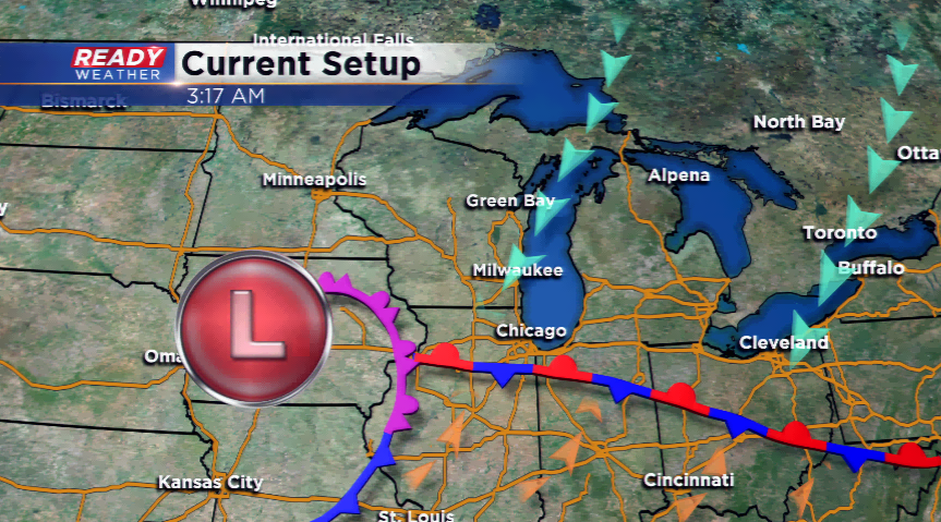
A stalled out low pressure system and stationary front continues to pump in showers around southeastern Wisconsin, and this will be in the forecast for the end of the week. There will be a large divider with who sees little rain, and who sees a heavy dose.
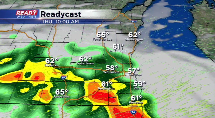
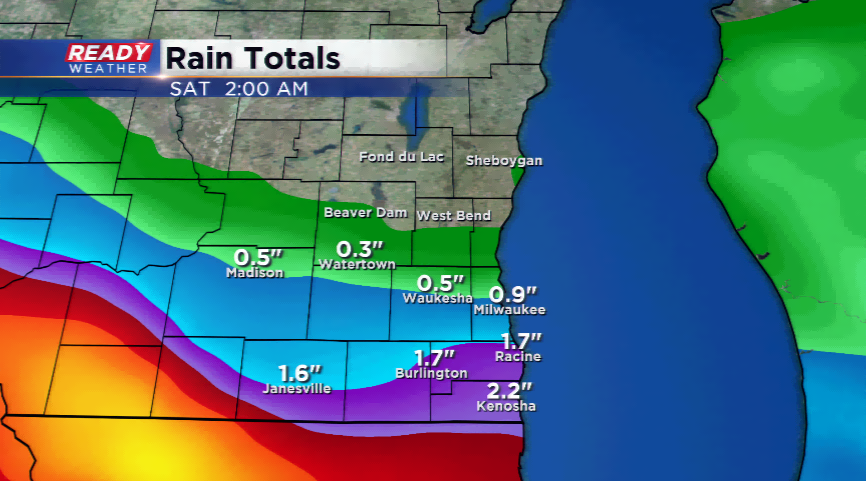
This divider looks to be along I-94; if you’re south of the interstate, better chances of seeing a good soaking rain with thunder. Little rain activity is possible north of the boundary. The models data has been pretty consistent now with outlining the extreme southern tier of the viewing area with the most rainfall.
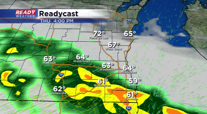
There will be several waves of rain today, while tomorrow is looking to be more scattered once the low and front budge and move out. Already at Mitchell, the airport has picked up 4.14” of rainfall for the month, 1.62” above average, and more than we typically see in the month of June. The monthly average is 3.90”. With more rain today, we could be at 5” when this system marches out.
Always looking at the positive, the rain will exit by the weekend. We will feel the influences of the low still on Sunday with clouds and cooler than average temperatures. By Sunday, the sun returns and the forecast shows a pleasant day.