Showers and storms return for Tuesday
The pattern continues to ramp back up as Fall is now in full force! This time of the year it's typical to get cold fronts that move through the area every several days. Our 10 day forecast will feature plenty of them.
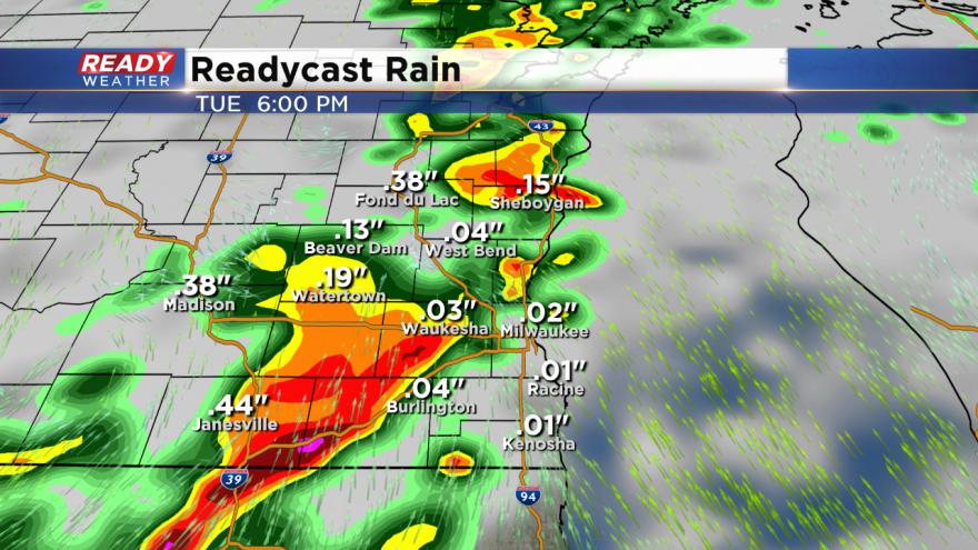
Take a look at the graphic above! Showers and storms are forecast to roll across our area between 4 pm and 8 pm on Tuesday. The storms that move through will have a limited severe weather threat.
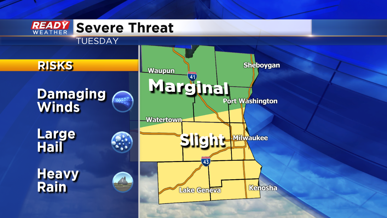
The greatest chance for strong to severe storms will occur along and south of I-94. The main severe weather threat with the line of storms will be damaging winds and locally heavy rainfall. Small hail is also possible; however, widespread hail is not expected.
Once the front blows through dry weather will return for Wednesday and Thursday, before another system arrives for Friday.