Snow could edge into Wisconsin late this week

A sharp cut-off on who might see some snow or a wintry mix and who will see nothing this week continues to be the main forecast concern the next few days. The storm system will push in by late Friday and early Saturday and will edge right on the line of southeastern Wisconsin.
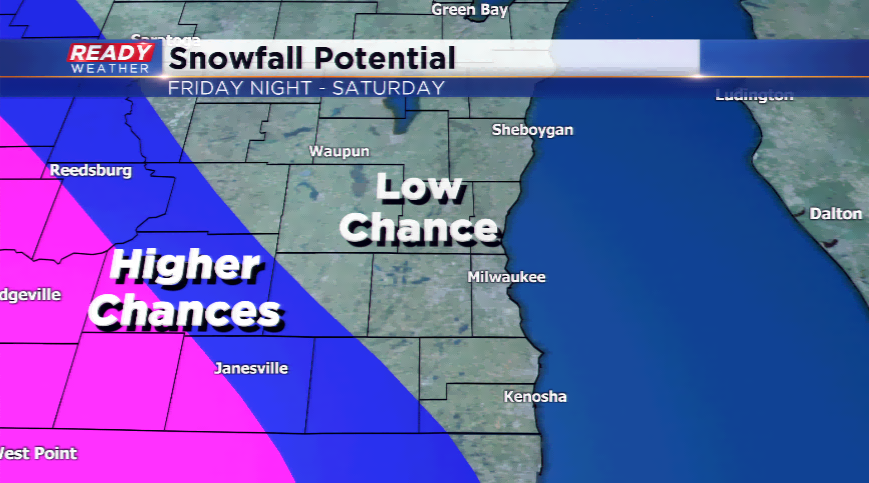
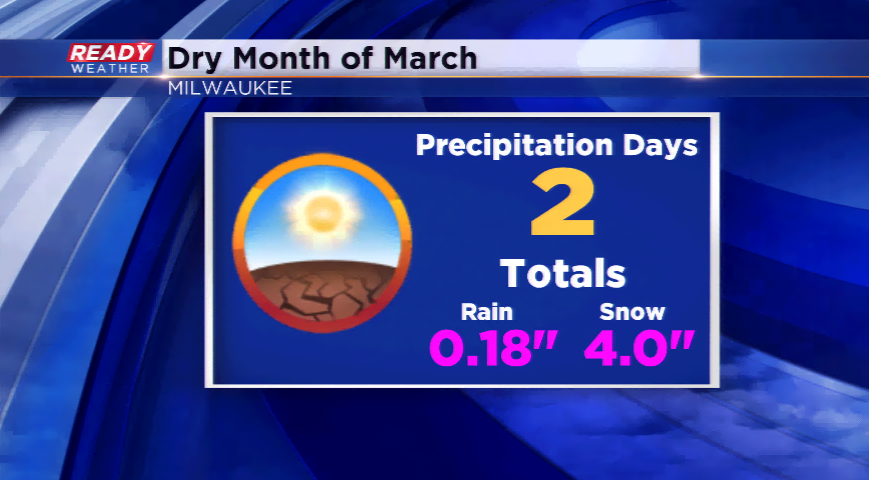
The computer models have not quite yet come to consensus, but at this moment it looks like most of southeastern Wisconsin will skip another precipitation chance. The area has not seen measurable precipitation in over two weeks, which is leading to fire dangers in Wisconsin. The timing will be late Friday night and early Saturday before heading south into Illinois.
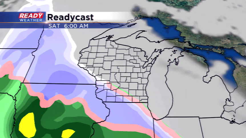
The heaviest snowfall will take place in southwestern Wisconsin, Iowa, and Minnesota where several inches will be possible. It will be a narrow band of heavy snowfall. This is something we will watch closely and have more updates the rest of the week.