Tornado Watch for SE Wisconsin Until 1 AM
A tornado Watch is issued for most of Wisconsin!
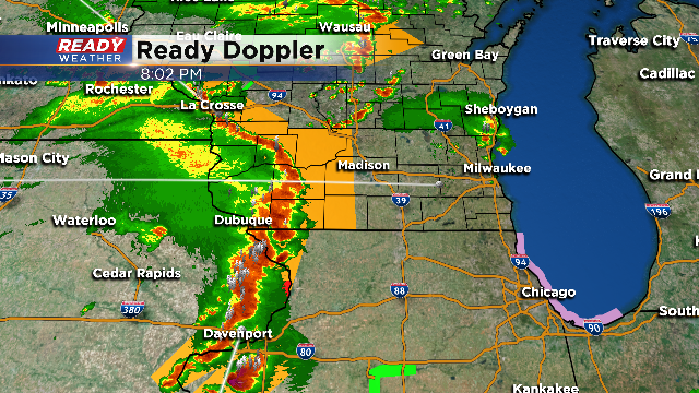
Severe Thunderstorm Warnings are now popping under the peak heating of the day. A warm, humid and breezy air mass is in place with plenty of instability building. Storms firing at this time have produced quarter hail and damaging wind gusts.
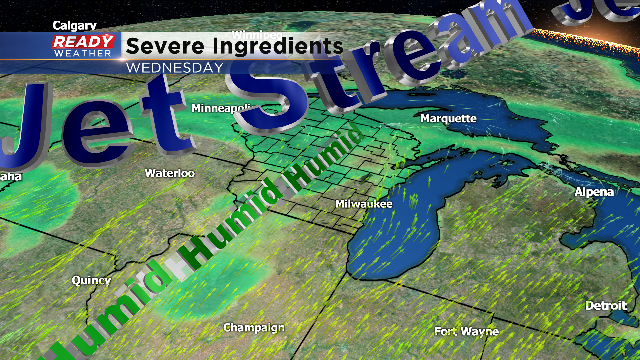
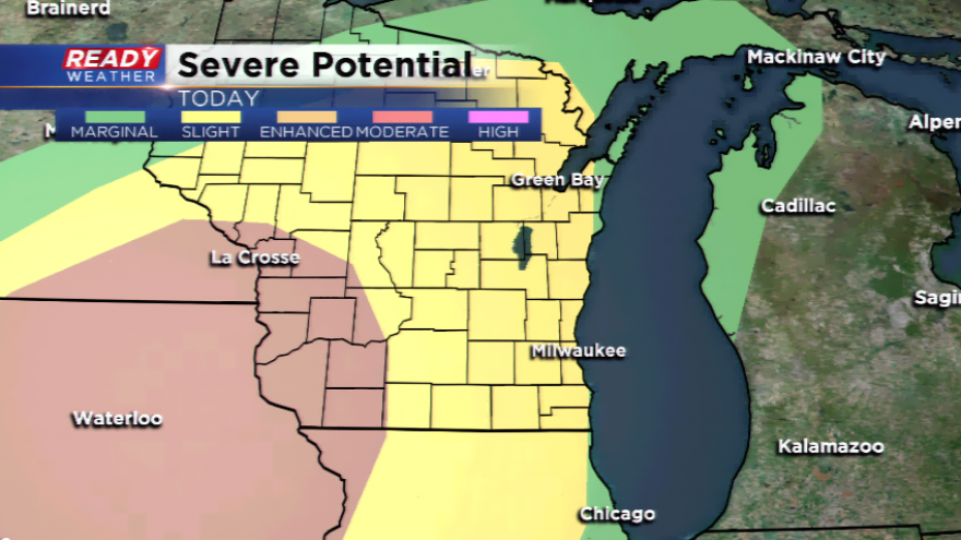
The best dynamics for severe weather will be in southwestern Wisconsin; however, the storms that develop out west could reach into our areas and hold some of their steam. Wind shear will be maximized across SW WI this evening, and that's where tornadoes will likely form. An update on the overall risks from the SPC has the viewing area under a *slight* risk for severe weather and an *enhanced* risk out west. Earlier, portions of lakeshore were under just a *marginal* risk, but now have been upgraded. Large hail, damaging winds, and heavy downpours are the biggest concerns. An isolated tornado or two cannot be ruled out. There is a lot of energy upstairs in the atmosphere along with moisture and warmth. This will help fuel the thunderstorms during the daytime and evening hours. Make sure you have a way of getting severe weather updates, watches and warnings.
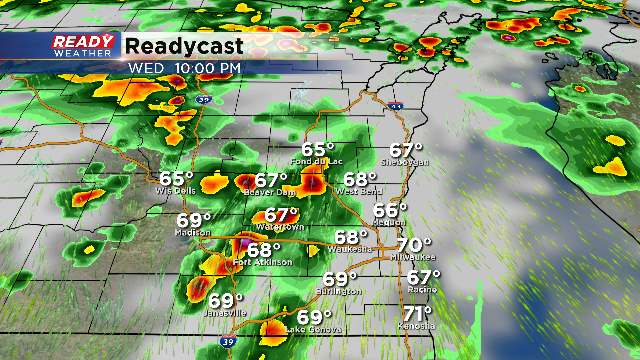
It looks like two rounds of storms will occur. The first will be during the late afternoon and early evening. The second batch will come through closer to 10 pm.
A cold front will pass through the area Thursday. Ahead of the front, highs will still climb into the 70s around the region with a few scattered showers.