Storms Return Thursday...Strong to Severe Threat
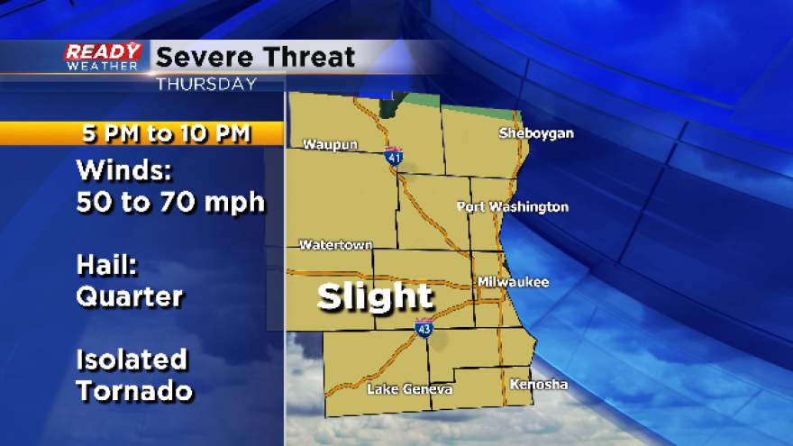
Thursday is going to be a very active day across southeastern Wisconsin. We are expecting two rounds of thunderstorms, and some of those will likely be strong to severe.
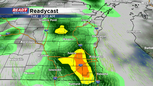
The first round will occur late Wednesday night into early Thursday morning. Those storms will be elevated in nature, and could produce small hail and gusty winds. There could be some marginally strong to severe storms overnight; however, the best chance for severe storms will occur late Thursday afternoon into the evening.
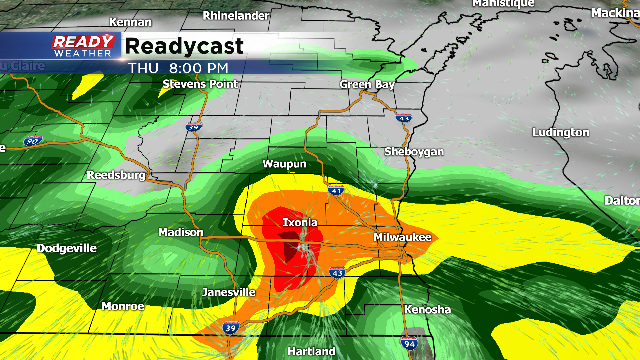
A cold front will approach from the north by Thursday evening. Ahead of the front we will expect temperatures to spike into the middle to upper 80s. Humidity will increase out of the south to create a very sticky atmosphere. Storms will likely hold off until the late afternoon and evening on Thursday,.
Storms that blow up could produce large hail and damaging winds. While the overall tornado threat is low, there could be enough wind shear ahead of the front to produce an isolated tornado. There should be the main line storms, but individual cells that develop ahead of the line are the ones to watch closely.
The storms will likely continue through midnight and move out in time for Friday morning.