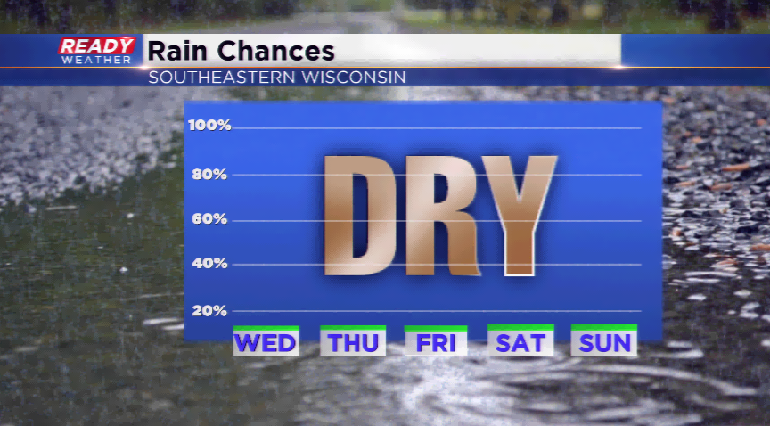
Thank Hurricane Florence for the dry, nice weather lasting in Wisconsin
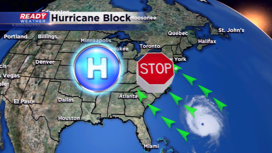
We can thank Hurricane Florence for barreling toward the eastern seaboard for blocking high pressure. This big ridge will keep the lovely weather in the forecast the rest of the week and weekend.

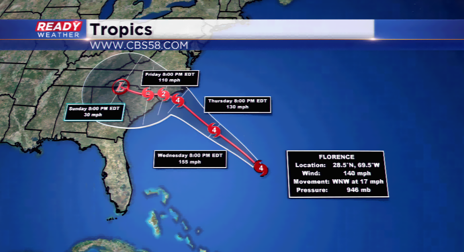
Florence is expected to make landfall as a major hurricane into North Carolina by Thursday night and early Friday. It’ll be the worst hurricane to hit that area of the country since Hurricane Hugo in 1989. They’re expected to see winds in excess of 130 mph, with rainfall totals over a foot, if not more.
The hurricane will act as a road block for any incoming systems trying to head east. Since the high is planted over our heads, the dry pattern we have been experiencing will continue until early next week. In the meantime, besides the dry weather, we will see highs in the 70s to around 80 into Monday. It should stay mainly sunny during this time period, too. A cold front on Tuesday will drop in ushering in rain, storms, and much cooler air for the rest of the week.