Valentine's Day Weather And Warmth
A holiday for hugs and snugs is coming up this weekend. This time around you'll really want that buddy to huddle with to stay warm, and it's going to be a snowy one too! Here's a quick look back at the last five Valentine's for Milwaukee.
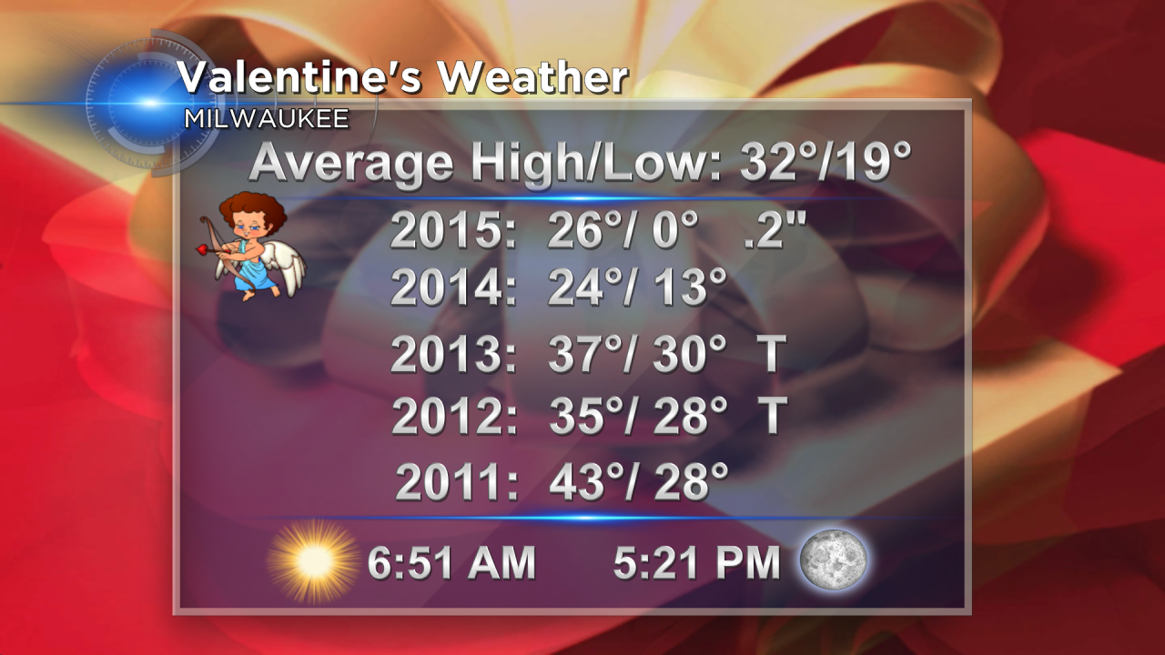
Looks like this year will be fairly similar to last year with a cold start and some snow. Prior to that we had mostly dry conditions and some warmer Valentine's weather. Ahhh the 40s... Don't worry we've got too, later in the extended outlook.
Check out the snowfall potential for Sunday. Light snow should begin during the morning, and likely stick with us for the rest of the day. Additionally, winds will increase out of the southeast at 10 to 20 mph. That may lead to reduced visibilities and poor travel conditions. The snow will be light and powdery so slippery roads are likely and blowing snow will also be a concern.

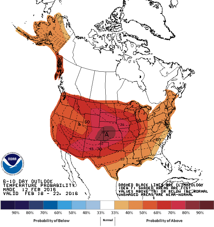
Beyond that, there is hope for some better weather! High temperatures on average are now at 32°. And we'll climb back up to that mark early next week. By the later half of the week, we'll be anxiously awaiting the 40s, which should arrive by Friday. The Storm Prediction Center of the National Weather Service has a sixty percent probability of above normal temperatures through that following weekend.
As a friendly reminder, our CBS58 Weather App is free and available for Apple and Android devices. We'll continue to update our weather blogs on the cold and snow. You can also upload your great weather pictures to the app, right from your photo library on your phone. We'd love to show them off for you! Lastly, you can keep tabs on the hour by hour forecast as frigid wind chills and snow may impact any weekend plans you have.
I'm meteorologist Rebecca Schuld