We Miss Out on Major Rain, But Showers Possible Friday Night!
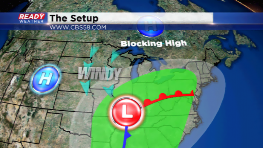
We can thank our fair weather friend, high pressure, for keeping the big rain away. Our lawns, streams, and rivers are also thanking it. Rainfall totals around the Ohio River Valley from this system is once again totally over 2”, if not more in some locations. This is leading to Flash Flood Watches and Warnings for a number of counties in that area. With the blocking high, rain stays just to our south in the Chicago surburbs and a state away.
The influences this storm system will have on our area are clouds and wind. Parts of the area will see partly to mostly cloudy skies, but our northern counties will see more sun and this will trend the temperatures higher. Sandwiches in between low pressure to the south and high pressure to the west, WIND. The wind will pick up tonight and last into this weekend. Expect it out of the north, not a warm direction. Highs stay cooler than average in the 50s along the lake, 60s inland.
Rain chances will be around Friday night and Saturday with a weak sling of energy from the north. Most of the activity will wind down by early Saturday morning. The rest of the weekend will bring sunshine, but windy conditions for Saturday. The winds die down by Sunday. A much better setup comparing it to last weekend!