Wild spring weather this weekend
With yesterday being the first day this month we hit 50 degrees, there’s a good chance we could be even warmer today, and in some parts of the area, even warmer tomorrow.
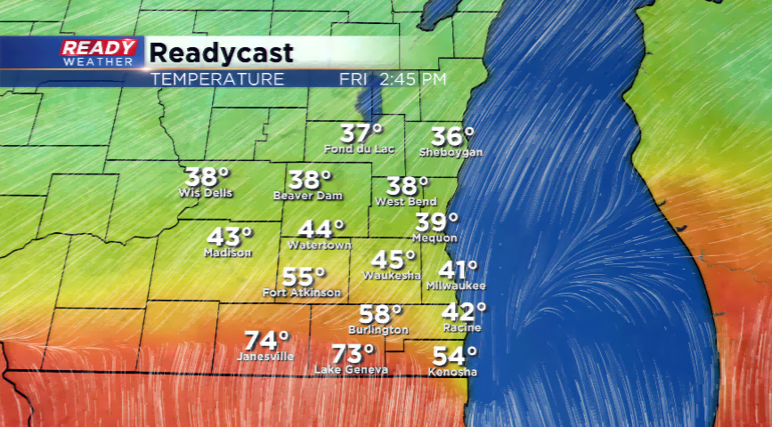
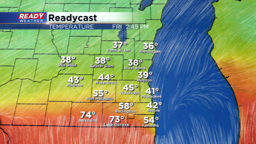
A spring storm is setting up to hit the Midwest and Great Lakes late this week and over the weekend. With a warm front stationed around the Illinois and Wisconsin border, this will leave a huge separation in temperatures. Our in-house computer model is hinting at the chance to see 60s, even 70s, in the extreme southern parts of Wisconsin while a chunk of the northern areas could be in the 30s. Lake Michigan and its lake breeze will play a huge part in tomorrow’s weather and what the numbers will look like.
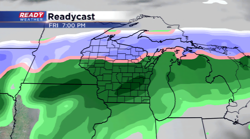
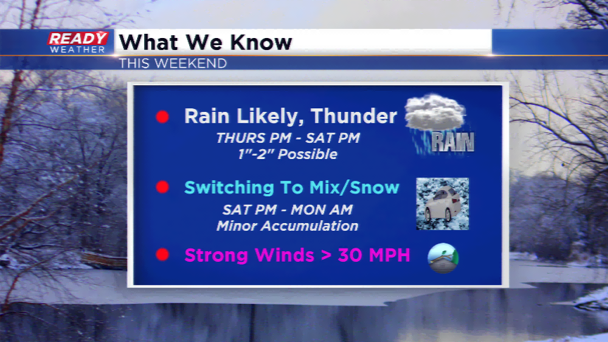
With a strong low level jet and a decent surge of moisture, rain is expected to roll in by Thursday night and Friday, then into the weekend. With the track of the low staying in northern Illinois, this will keep us in the warm sector of the storm for most of the duration. However, on the backside of the storm there could be a mix or snow developing later this weekend. The quicker the cold air moves in, the more
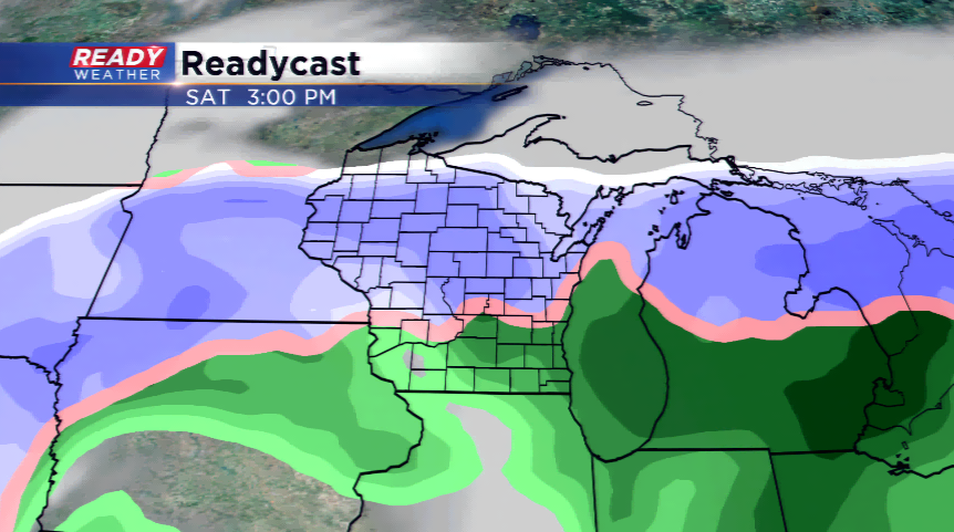
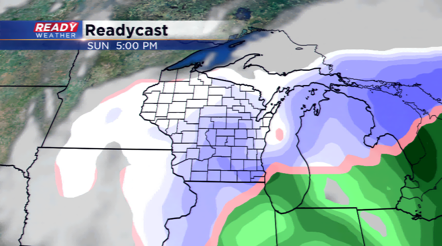
The possibly of a few inches of rain will be there along with a mix of sleet, ice, and snow. Make sure to keep an eye on the forecast for any weather alerts and breaking information!