Winter Storm Watch has been issued for Sunday
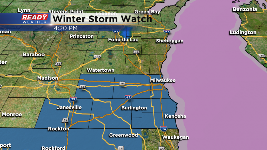
The NWS has issued a Winter Storm Watch for Milwaukee, Racine, Kenosha, Waukesha, Walworth, and Jefferson counties for Sunday.
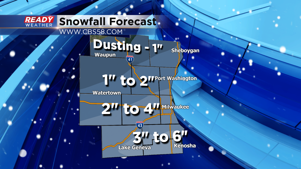
The track of the low remains in question; however, even if the track deviates some, we still expect accumulating snow across the southern part of our area. The general watch outlines an expected swath of 3" to 6" with locally higher totals. Snow at the start could be limited along the lakefront due to the warmer waters and a slight onshore flow. By the afternoon and evening the winds quickly turn northwest! The lowest totals are expected across our northern counties.
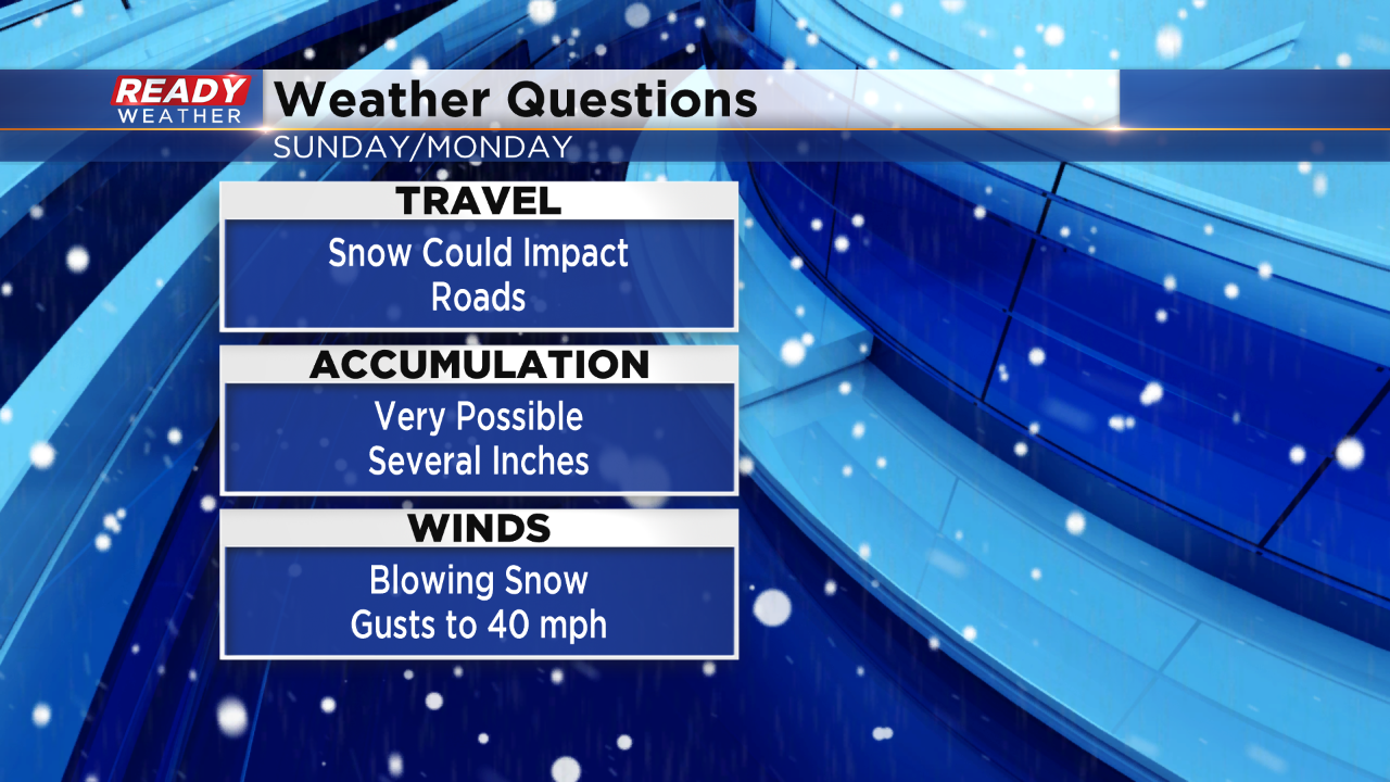
A mix will develop Sunday morning and likely turn over to snow during the afternoon and evening. Snow and strong winds will create low visibility issues. Travel south toward Chicago could be impacted Sunday afternoon and evening. The snow is forecast to wrap up into early Monday morning.
There remains a level of uncertainty with this system. Our WSI RPM model keeps the snow completely out of our area for Sunday. That's an outlier at this point. Most of the models bring in snow for our southern counties. We will continue to update you on the latest changes. If you have travel plans on Sunday I would urge you to do them during the morning.