Chilly weekend ends with another snow chance
So far this April has been anything but spring-like in southeast Wisconsin. Temperatures have been well-below average every single day and snow has been recorded three out of the six days. That chilly and snowy trend continues this weekend.
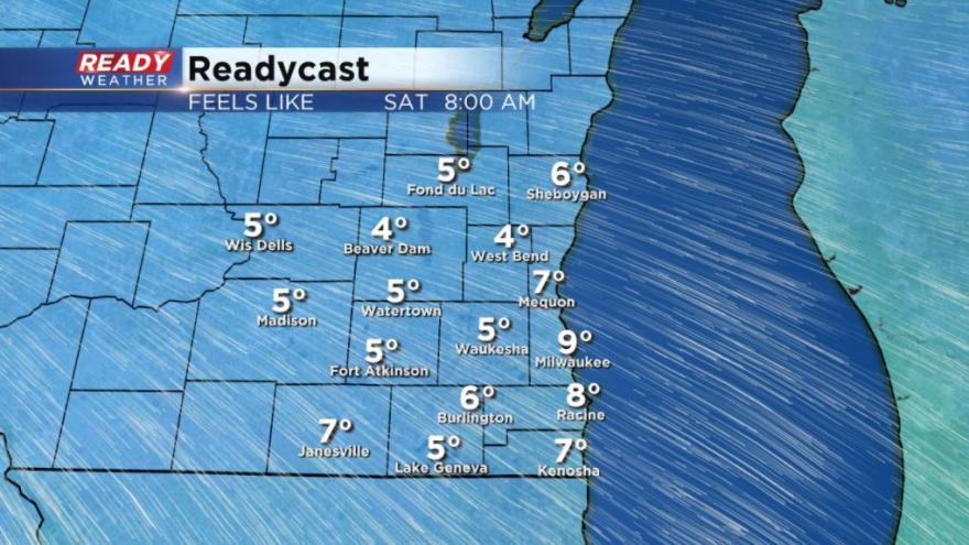
Temperatures Friday night will drop thanks to a mostly clear sky. Lows will be in the teens for most inland spots and around 20° lakeside. Thanks to a lingering breeze gusting to 20 mph wind chill values for the 7th day of April will be below 7° for some.
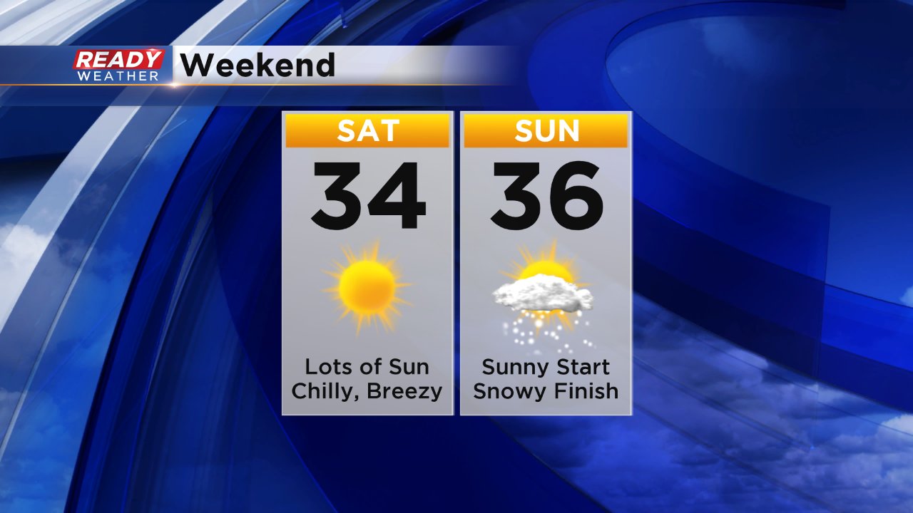
High temperatures Saturday and Sunday stay about 15° below-average in the middle 30s. The good news is it will be sunny with lots of sun expected Saturday and Sunday morning. By Sunday night another storm system arrives with a chance for snow.
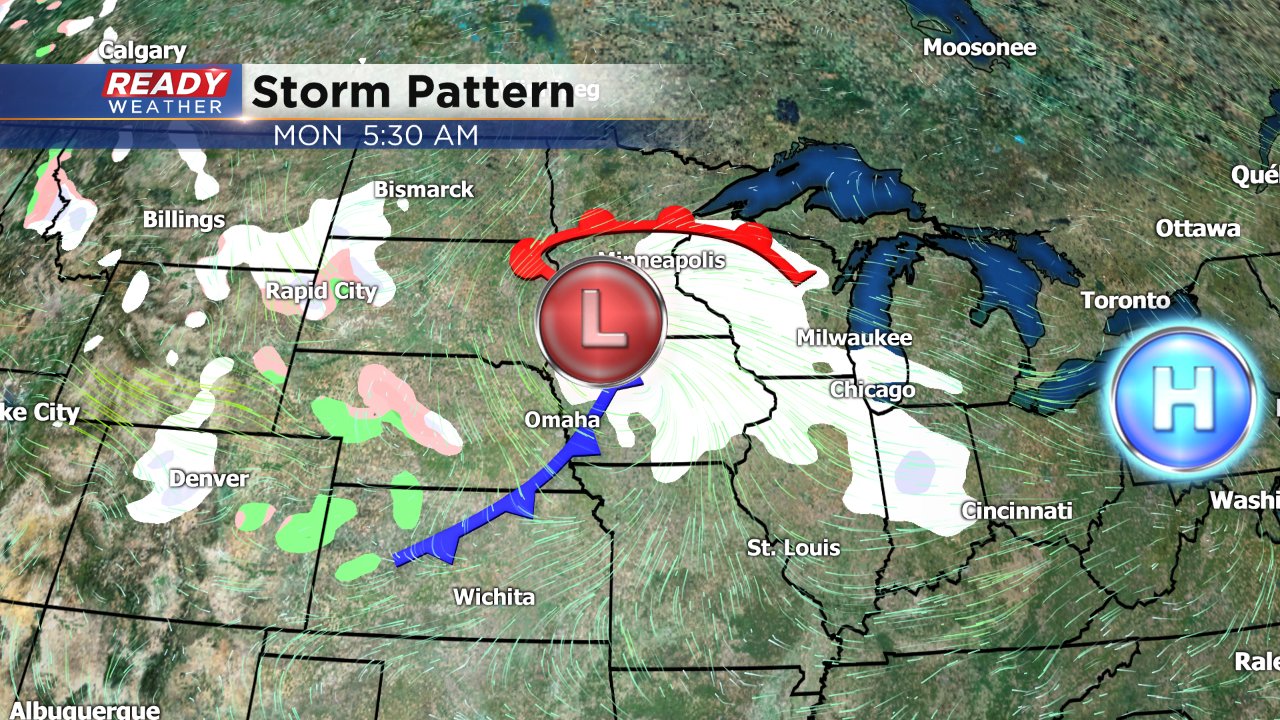
Although weather models have been consistent with the track of the storm Sunday night into Monday there are some signs that the storm will weaken before it reaches Wisconsin. Snow still looks likely, but amounts are going down. Still, a couple of inches looks possible for some with highest amounts in western spots.
Download the CBS 58 Ready Weather app to follow the changes for the storm and see when the temperatures finally start to warm up!