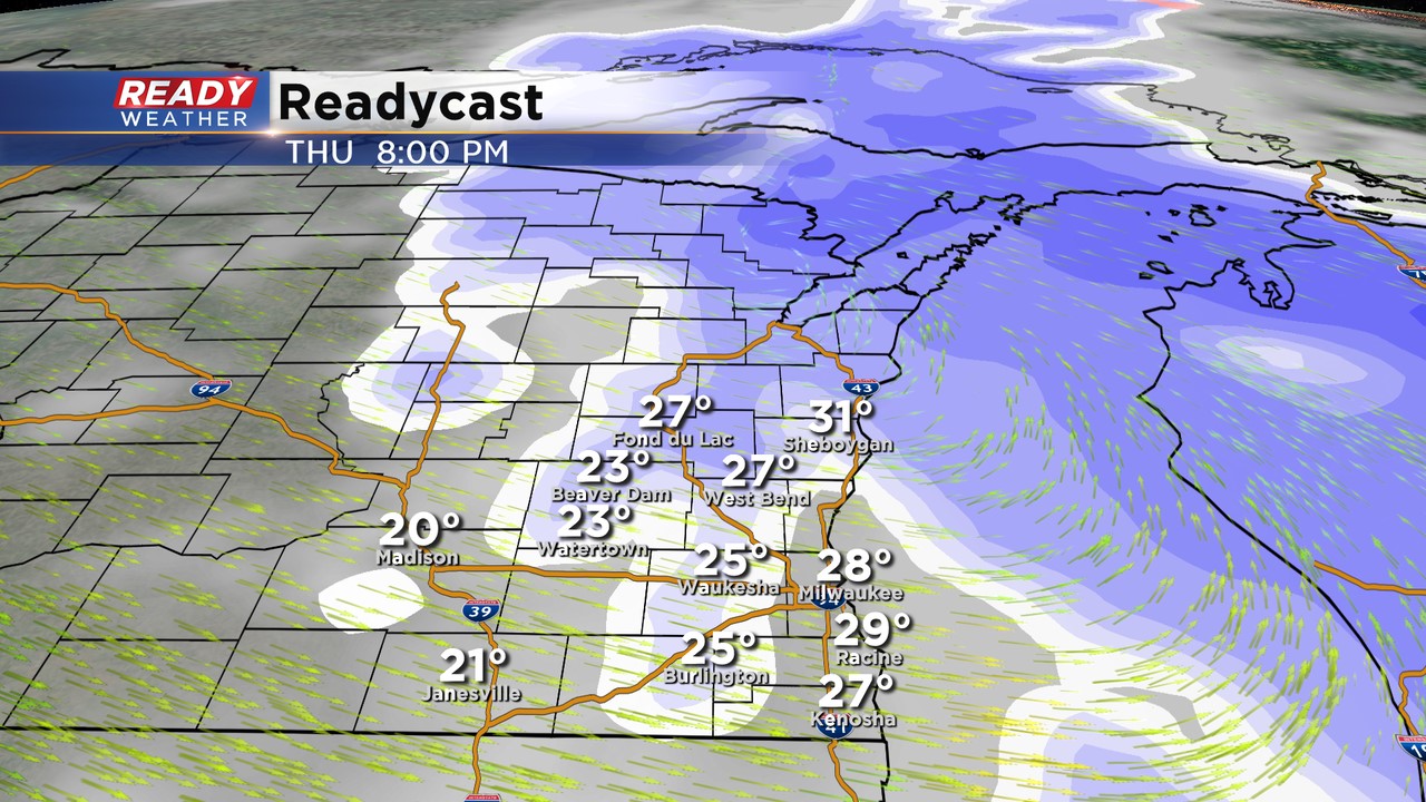
9:00 PM Update: Snow winding down by 10 pm.


Updated 9 PM Feb 4, 2021
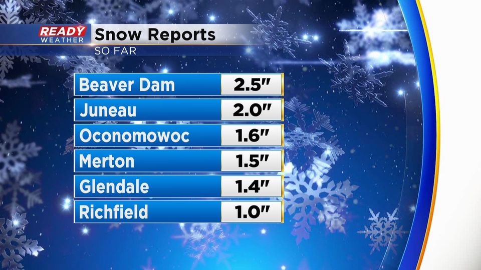
Most areas have picked up between 2" to 4" of snow. Light snow is possible through 10 pm; however, we aren't expecting much more accumulation.
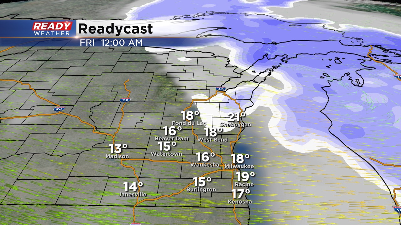
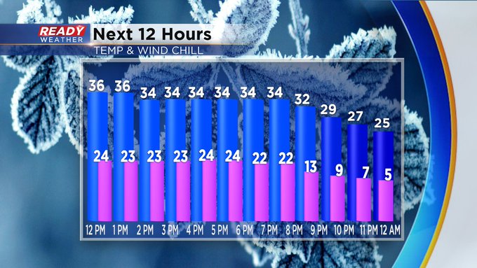
The arctic front is arriving across the area. Winds are now gusting over 30 mph as temperatures drop. A flash freeze is expected between 10 pm and 1 am as temperatures fall into the teens from west to east.
It's important to clear sidewalks and driveways now. Rock salt won't be effective as temperatures drop into the single digits and the teens.
______________________________________________________________________________________________________________
Updated 6 PM Feb 4, 2021
Snow showers are expected to continue through 8 pm. Many areas have already picked up 1" to 4" of snow. Another 1" to 2" is possible before the snow moves out between 8 pm and 10 pm.
Slick roads this evening remain a problem, especially secondary roads and side streets. The wind swill really pick up between 9 pm and Midnight as the arctic front arrives. Wing gusts over 30 mph are expected.
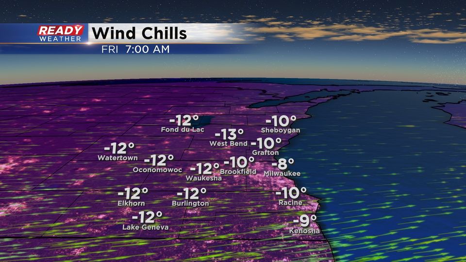
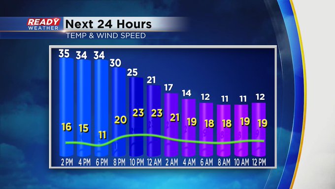
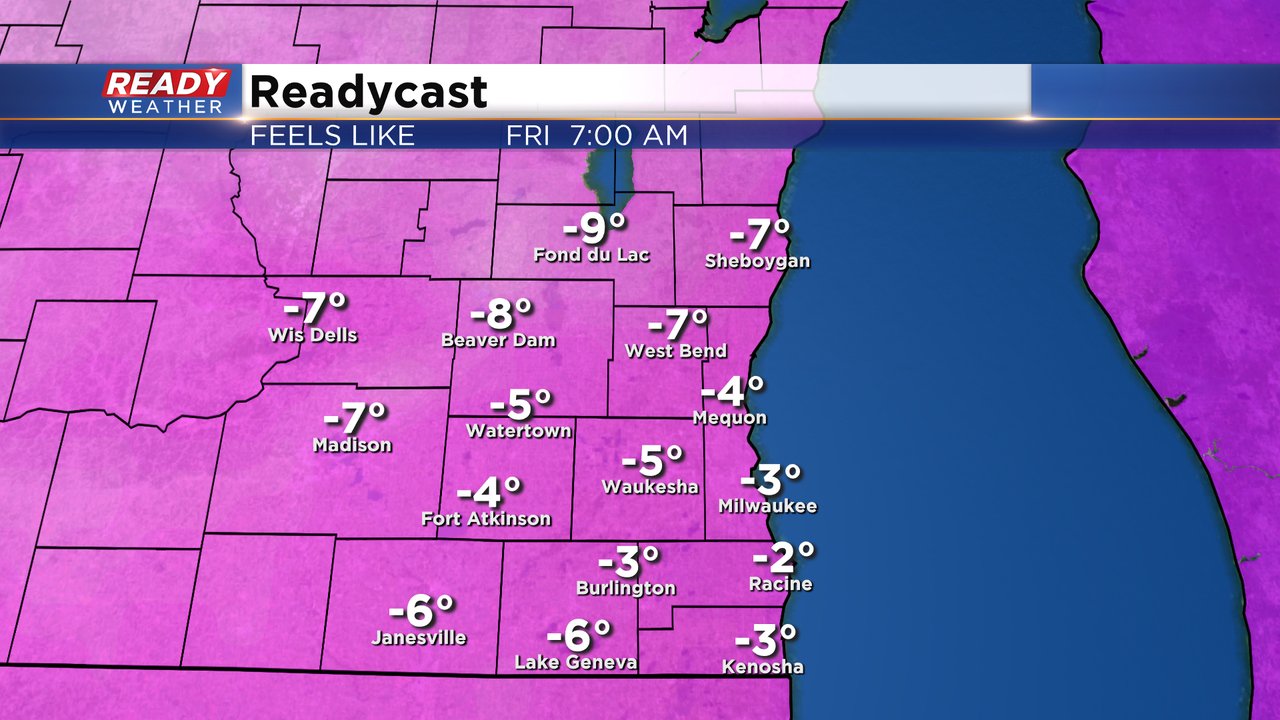
Wind chills Friday morning are expected to drop between -5 and -10!
______________________________________________________________________________________________________________
Updated 5 PM Feb 4, 2021
We are starting to get some snow reports across the area this afternoon. Several more inches are likely through 8 pm tonight. The snow is causing very slick conditions across the area, especially side roads.
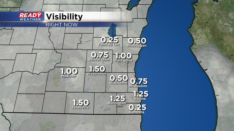
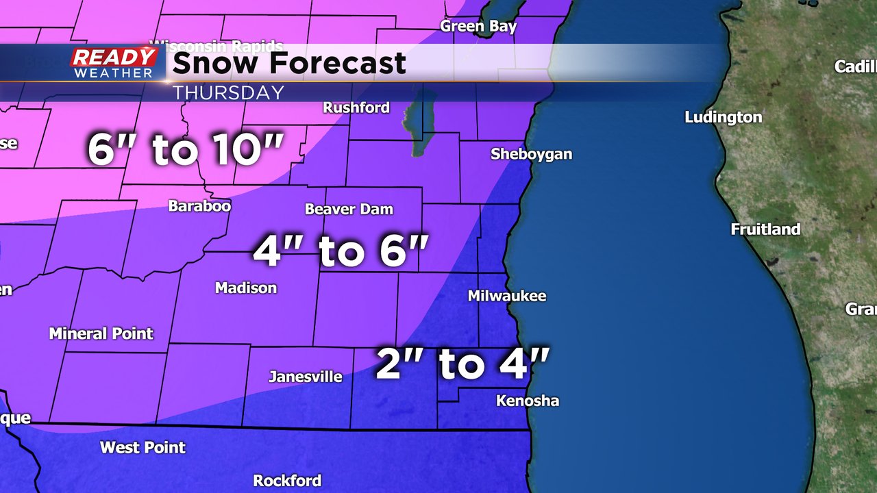
Heavier snow is also reducing visibility. Please use caution while driving. The snow should move out between 8 pm and 10 pm. We still think most of the area will pick up 2" to 5" total.
The coldest air is moving across western Wisconsin. This blast of air will move across our area between 9 pm and Midnight. A flash freeze is expected along with blowing snow overnight!
______________________________________________________________________________________________________________
Updated 3 PM Feb 4, 2021
The mix has completely transitioned to all snow this afternoon. We expect the snow to continue throughout the rest of the afternoon into the evening. Snow is expected to end between 8 pm and 10 pm. Most areas will pickup 2" to 4" of snow before it moves out. Roads will be slushy and snow covered, so please use caution.
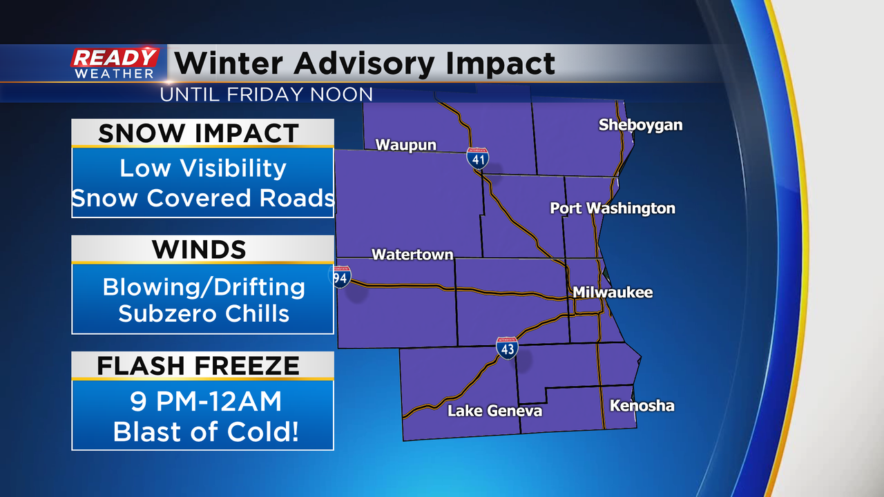
The problem tonight will be a flash freeze. This is a sudden drop in temperature that will cause major slick areas in a very short amount of time. The flash freeze will begin in our western counties around 9 pm and move east through Midnight.
Unfortunately, wind chills by Friday morning will be subzero. The advisory goes until Noon Friday for blowing and drifting snow due to the strong winds.
______________________________________________________________________________________________________________
Updated: 1:00 p.m. Feb. 4, 2021
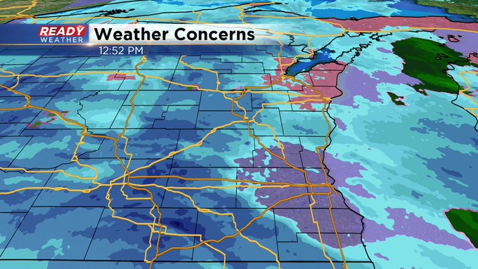
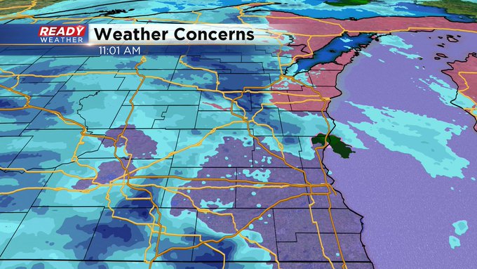
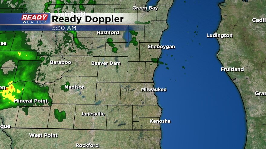
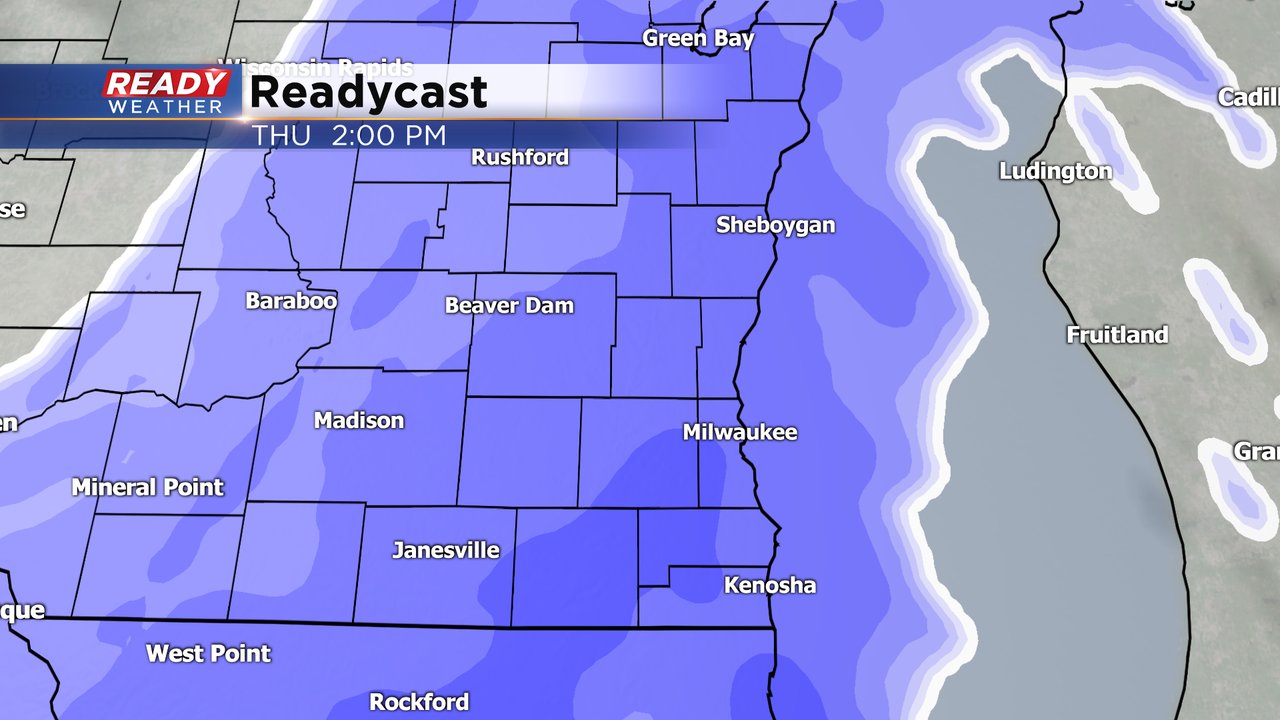
Snow is closing in on the viewing area. Here's a check of Ready Doppler:
Updated: 11:00 a.m. Feb. 4, 2021
While we've had some light freezing rain early on, the radar is now showing generally snow. And it's hitting our outlying areas late this morning. As of now, Milwaukee is still quiet.
Updated: 9:18 a.m. Feb. 4, 2021
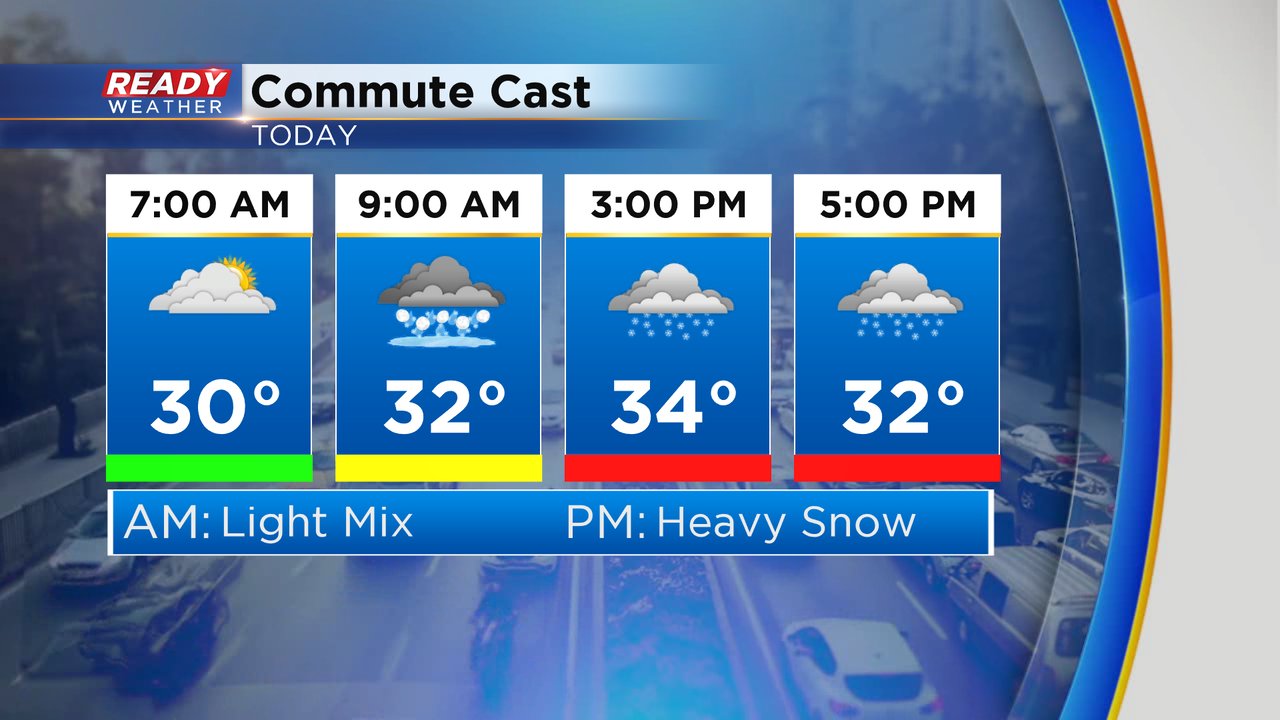
Wintry mix is starting to move in from west to east across our viewing area. A little light freezing rain has been reported so watch for slick roads but temperatures are hovering around freezing so widespread icing is not expected. The wintry mix should switch over to all snow by late morning with heavy snow still on track for the afternoon and evening. 2-6" of snow is still expected for most of southeast Wisconsin.
The morning commute was fine for the entire viewing area but the afternoon and evening commute will be a much different story with the heavy snow and a few inches of snow already on the ground. Expect roads to be in rough shape from noon through 10 p.m.
This will be a very slushy snow and with temperatures dropping fast later tonight expect the snow to freeze over very quickly with slick roads and blowing snow an issue for Friday morning.
------
Posted: 6:36 a.m. Feb. 4, 2021
Welcome to another day with wintry weather! A little wintry mix will move in mid-morning on Thursday with 9 AM looking like a good start time. The mix will then switch over the all snow by late morning and noon at the latest. Once the snow starts it will come down fast with heavy snow expected for most of the afternoon through early evening. Roads will quickly become snow covered during the afternoon with a rough commute expected from the time kids get out of school through the evening.
All of southeast Wisconsin is under a winter weather advisory. The advisory starts Thursday morning and lasts through noon on Friday. The bulk of the accumulating snow will wrap up by late Thursday evening but some blowing snow will likely linger through Friday morning which is why the advisory goes so late.

A little ice is still a possible threat Thursday morning but heavy snow during the afternoon and evening with a big impact on the roads is a bigger threat. Expect a blustery wind for most of Thursday becoming very strong Thursday night with blowing snow and dropping temps.

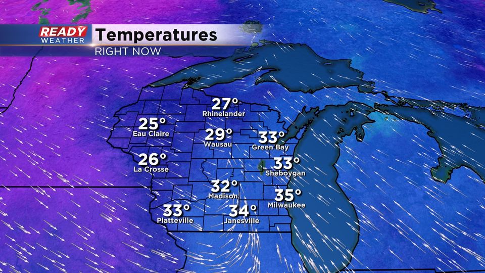
No real changes to the snow forecast over the last 24 hours with 2-6" still expected for most of southeast Wisconsin. Our wester and northern counties have the best chance to see the most snow with 4-6" there. Lakeside and southern spots are in the 2-4" range. Central and Northern Wisconsin are still expecting the most snow with up to 10" there.
Cold air is a big story with this storm as well. Wind chills will stay reasonable during the day Thursday and then drop into the single digits below-zero Friday morning. Saturday will be even colder with wind chills to -20 and Sunday will likely be the worst of it with wind chills to -30.
Download the CBS 58 Ready Weather app to track the snow with the storm and see how cold it will get where you live.