Major winter storm could bring rain, mix late this weekend
As we continue to shovel out from the biggest snowstorm of the season around the viewing area, another major storm is expected to hit the area late this weekend and into Monday. In the meteorology world, this is very far out to look at timing, how much snow, etc. But it does appear all computer models are showing the developing of a vigorous low pressure system that will impact the area.
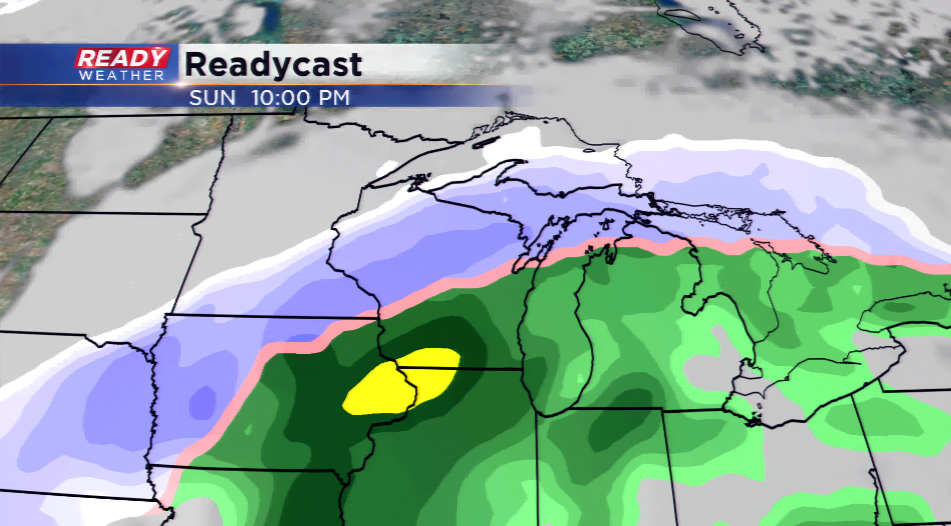
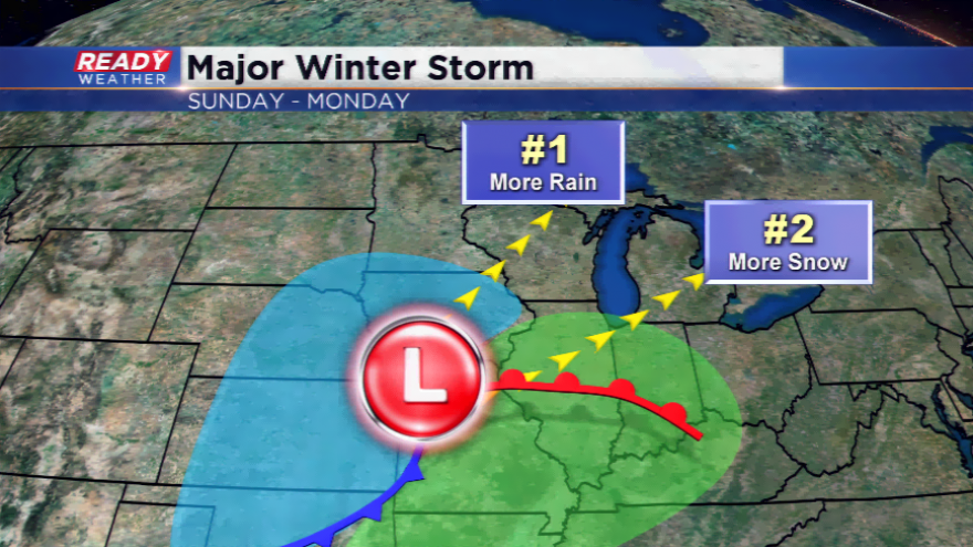
Here’s what we know right now – the storm looks to roll into the area for Sunday and Monday. Both of our main computer models we look at long term, the GFS and Euro, have mainly rain for southeastern Wisconsin while the northern part of the state could get hit hard by heavy snowfall. The GFS has a higher solution for moisture available with the potential for an inch or more of rainfall, and a sooner track. This could mean precipitation could start earlier on Sunday morning. The Euro is slightly slower and less moisture available.
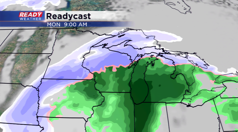
We look for model consensus before throwing out snowfall totals and timing of the storm. The track of the low is key, and the farther south it does into Illinois, the better chance of the viewing area to see accumulating snow. If low pressure continues to show north, this means we will stay in the warm sector of the storm and see rain. Even though there's a chance it will be mainly rain it appears for SE Wisconsin, there could be a mix or light snow developing on the backside of the low by Monday.

I think the safe thing to do at this point is keep a check on the forecast the rest of the week as this storm continues to develop.