3 PM Update: Advisory upgraded to Winter Storm Warning for some
THIS WEATHER BLOG IS OUT OF DATE. FOR AN UPDATE INCLUDING NEW SNOW TOTALS CLICK HERE.
------
Updated: 3:15 p.m. April 14, 2018
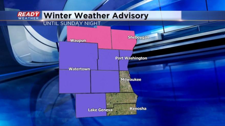
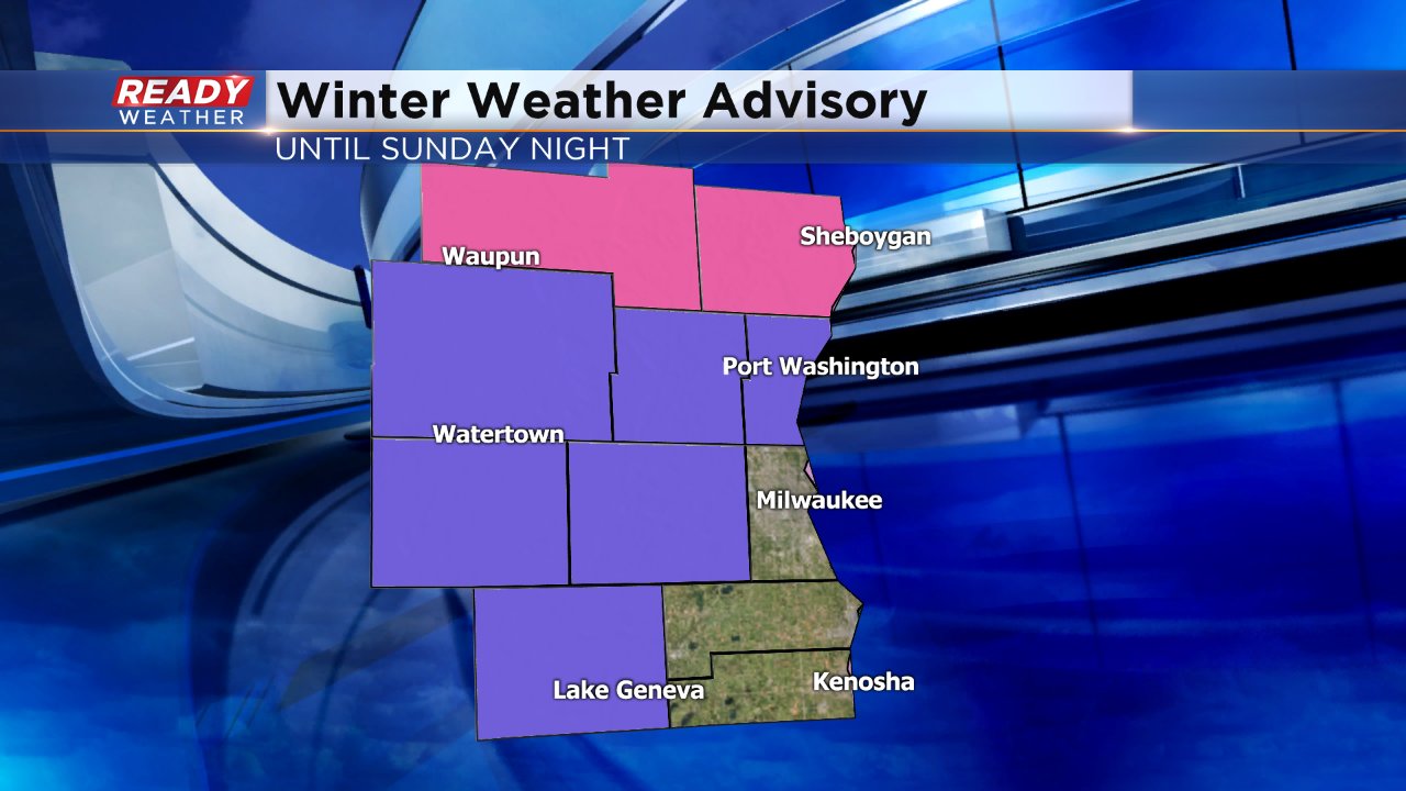
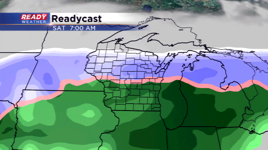
The National Weather Service has upgraded Fond du Lac and Sheboygan Counties to a Winter Storm Warning. They have also added Walworth County to the Winter Weather Advisory. Milwaukee, Racine and Kenosha Counties are not currently included in any winter weather advisory, watch or warning.
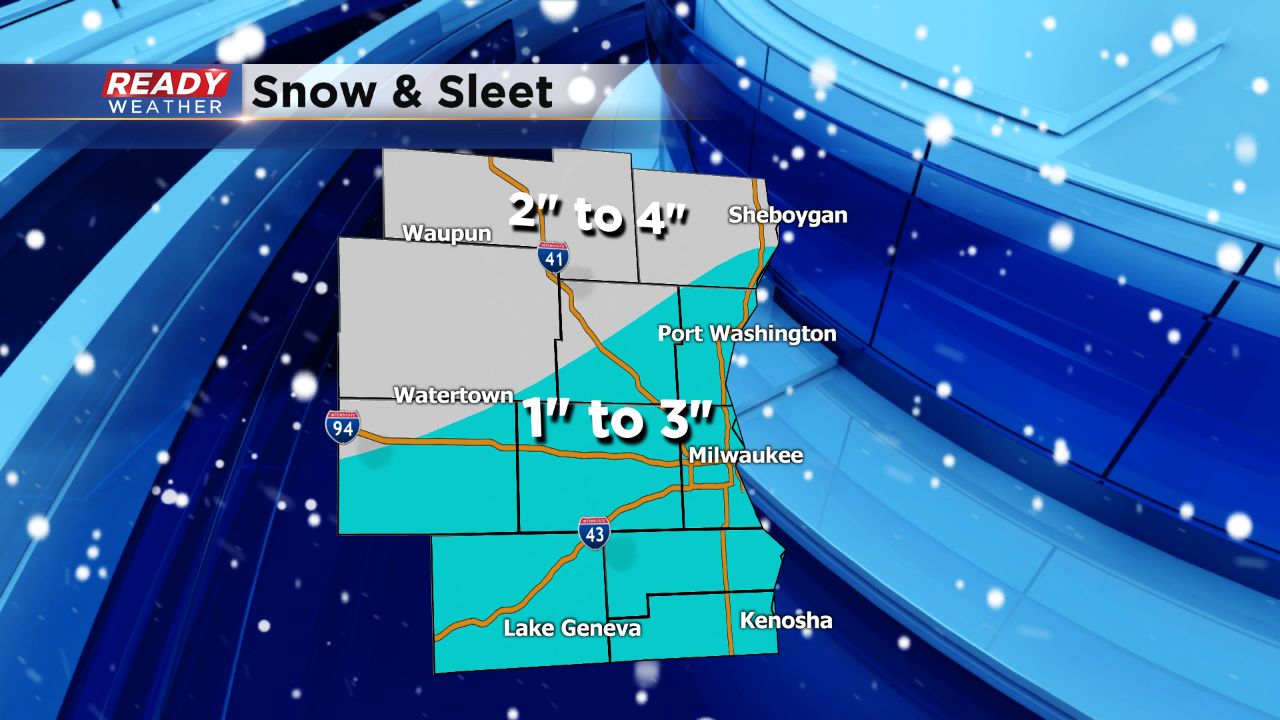
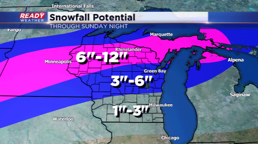
Snow totals in northern counties look to be higher with over 4" of snow possible combined with some freezing rain and sleet.
New snowfall map in the works. Check back soon.
------
Updated: 11:44 a.m. April 14, 2018
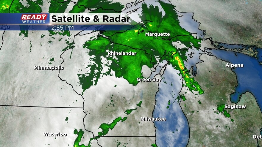
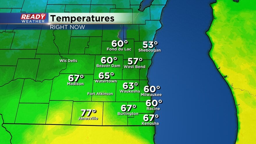
A wintry mix of snow, drizzle and sleet is still falling in some northern counties. Southern spots are mostly just dealing with heavy drizzle making it very gloomy.
Temperatures have been holding steady all morning in the low to middle 30s, but a few northern spots are around 32 causing concern for roads to become slick and icy.
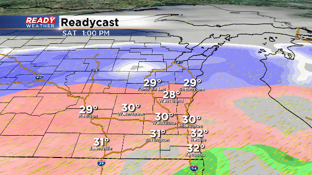
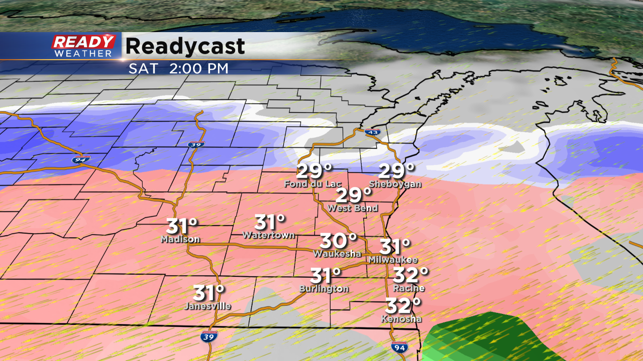
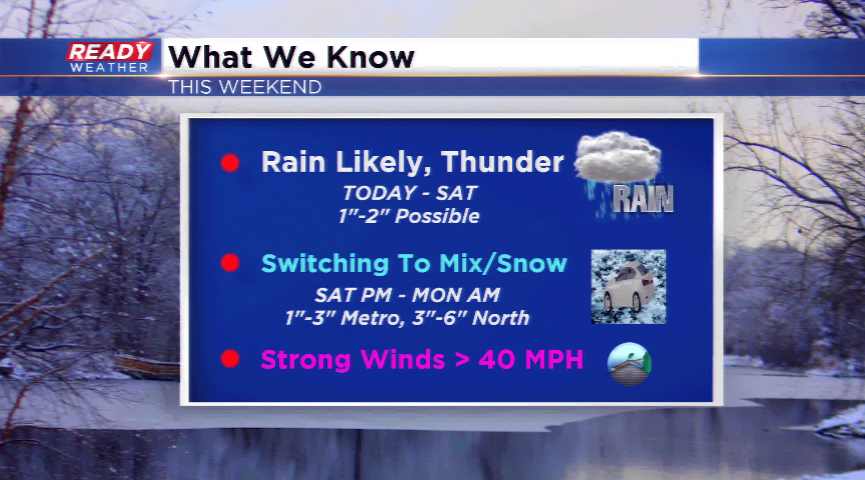
As the afternoon goes on a wintry mix is expected to move south with all of southeast Wisconsin seeing mainly a sleet and snow mix by evening into Sunday morning. 1-3" of snow and sleet is expected for most with a few higher totals in northern spots.
Peak wind gusts around 50 mph were felt overnight and are now slowly coming down. Expect wind gusts around 40 mph to continue the rest of the day and stay windy most of the night. The wind advisory stays in effect until 7 p.m.
------
Updated: 8:10 a.m. April 14, 2018
For most of southeast Wisconsin the major impact of our messy weekend storm has been steady overnight rain and very strong wind. Most spots across the area have already picked up over a half inch of rain. Wind has been very strong overnight with some spots gusting over 50 mph. A wind advisory is in effect until 7 p.m. Saturday evening with more gusts up to 50 mph.
Here's a list of some of the top gusts from overnight:
| Sheboygan | 52 mph |
| Racine | 46 mph |
| Waukesha | 46 mph |
| West Bend | 45 mph |
| Milwaukee | 45 mph |
| Kenosha | 43 mph |
| Port Washington | 42 mph |
| Watertown | 36 mph |
Although most of the area has seen just rain, a wintry mix including freezing rain and snow has been falling in northern counties mainly in Dodge, Fond du Lac and Sheboygan Counties. There are reports of ice accumulating on power lines, trees and roadways and some reports of accidents and slide offs. With the strong wind and a soggy ground thanks to 24 hours of showers downed trees are not surprising.
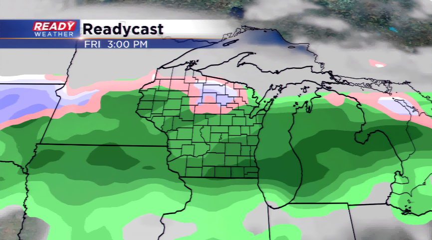
Here's a look at current radar conditions:
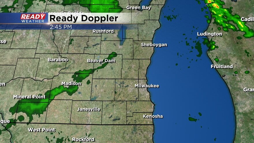
Air temperatures are staying just above freezing so mass ice accumulation is not expected.
The rest of the forecast remains mainly on track. Temperatures should hold steady or fall most of the day in the low to middle 30s. Although there will be some dry parts of the day, showers are expected to roll back in especially this afternoon with a wintry mix likely eventually switching to snow Sunday night.
------
Overnight Update:
Looking over the latest computer model guidance it appears that rain and sleet remain likely for Saturday afternoon and evening. Most of the area will start with rain on Saturday. The exception will be Fond du Lac and Sheboygan counties where a morning mix is possible.
Sleet could continue through Saturday night into Sunday. This event will hinge upon some warmer air aloft, so if that changes slightly, there could be pockets of freezing rain as well. Bottom line a true mix is likely across the area on Saturday into Sunday morning.
In addition to the mix, strong winds could gust over 50 mph. A wind advisory has been issued across the area for Saturday. Those strong winds could produce lakeshore flooding.
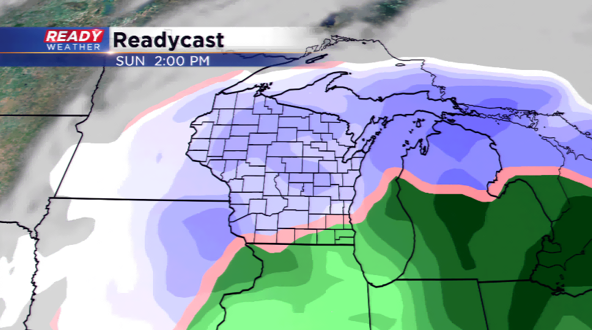
Sunday afternoon should bring a transition to all snow. That snow will continue Sunday night into Monday morning.
Overall the sleet will cut into totals, so 1" to 3" of sleet and snow look likely for the area by Monday morning.
6:00 PM Update: The winter storm watch has been replaced with a winter weather advisory. Sheboygan, Fond du Lac, Dodge, Washington, Ozaukee, Jefferson, and Waukesha counties.
Those areas under the advisory will have the best chance for accumulating snow an sleet. While some freezing rain is possible, most of the mix will be sleet and snow.
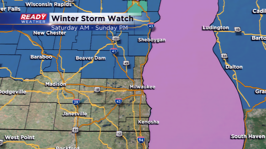
3:00 PM Update: Winter Storm Watch for Fond du Lac, Sheboygan, Washington, and Dodge counties for Saturday and Sunday
There is good news after looking over the latest computer models. It doesn't appear we will get blasted with very heavy snow out of this event; however, there's a good chance to experience more sleet. Sleet will really cut into snow totals, but it also will create slick roads on Saturday and Sunday
Tonight we will continue to have more rain move across southeastern Wisconsin. An additional 1" or 1.5" will be possible going into Saturday afternoon. It gets very tricky on Saturday. The atmosphere starts to cool, and the rain will likely mix with sleet. Sleet and rain are expected through Saturday night into Sunday morning. While some freezing rain is possible, the more predominant precipitation type will be sleet.
Sleet could continue through Sunday morning before changing to snow by Sunday afternoon and evening. Snow showers are forecast to continue through the Monday morning commute. Most of our area will see a mix of sleet and snow between 1" to 3". Slightly higher totals will occur across our northern counties.
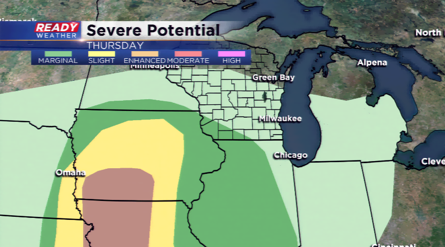
10:00am Update: A few severe thunderstorm warnings have been issued this morning in our northern areas for large hail. Reports out of Sauk and Columbia Counties have indicated golf ball-sized hail. These storms are moving east very quickly and will be out by the noon hour.
7:00am Update: There are thunderstorms rolling through IA and western WI that have sparked a Severe T'Storm Warning. The threat for showers and weaker storms are possible in our area. The main focus continues to be on the amount of rain, the ice potential, and how much snow could be had this weekend.
A developing area of low pressure will bring a blockbuster spring storm to the Midwest and Great Lakes this weekend. Widespread rain and thunderstorms will be possible today with the warm front looking to stay just to the south of the area. This will keep the temperatures a bit chilly and more importantly, the strong to severe storms to our west and southwest.
A strong northeast wind won’t allow the temperatures to climb very high. It will be a bit miserable outside. Rain will switch to snow later on Saturday into Sunday. Heavy snow is possible in the central and the northern part of the state. The big question is how much snow and/or ice will SE Wisconsin see. There’s a fine line between several inches and only a few. Along that line, there could be sleet and icing taking place. The transition from rain to snow will happen by Saturday late morning and afternoon. A Winter Storm Watch is in play for parts of SE Wisconsin north of the metro. The snow will continue, with a mix, on Sunday and eventually taper off by Monday to just snow showers.
The highs over the weekend will be stuck in the 30s. 40s and 50s will return next week!