Nasty weekend will bring rain, snow, and wind

-
2:32

VISIT Milwaukee preview: April 19-21
-
1:12

It’s National Garden Month; when should Wisconsinites start...
-
4:05

Art festival returning to Mitchell Park Domes to close out April
-
4:15

Financial advisor talks Financial Literacy Month
-
2:20

Another day of showers before a dry weekend
-
3:13

Milwaukee Admirals
-
1:55

Community remembers man who died after being struck by a garbage...
-
2:20

Mayor Johnson signals support for reconfiguring 794 as discussions...
-
2:29

81% believe democracy under threat; only 23% not worried about...
-
3:27

Remembering Milwaukee’s women’s pro team amid WNBA fever
-
1:58

Wisconsin tribe files lawsuit against social media companies...
-
2:24

Key takeaways in 2024 matchups, top issues for voters

After sitting through a very cold start to March, yet quiet in the snow front, we are expecting a blossoming storm system for the weekend. First, we’ll see light snow showers tonight around a weak disturbance dropping in from the west. This wave will work in the southern sections of our viewing area. It will bring less than an inch of snowfall.
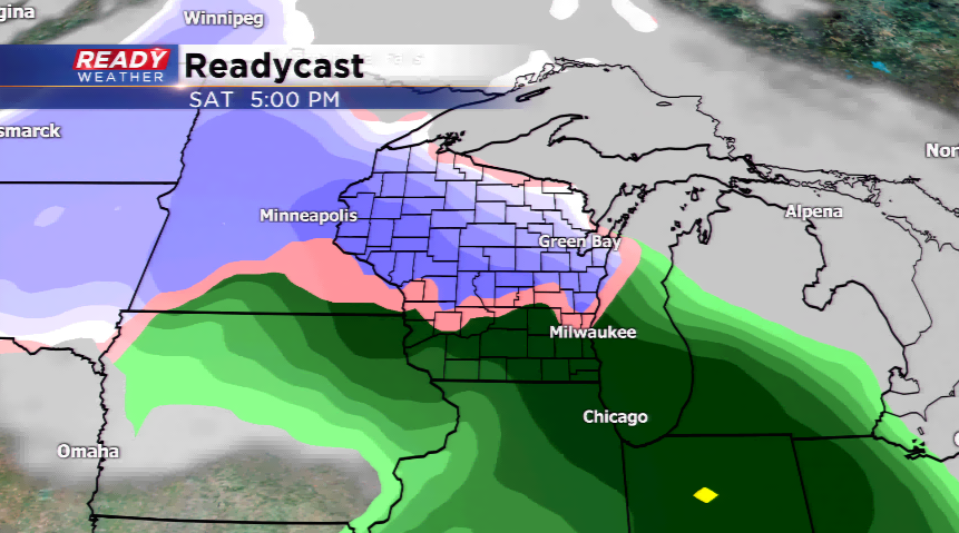
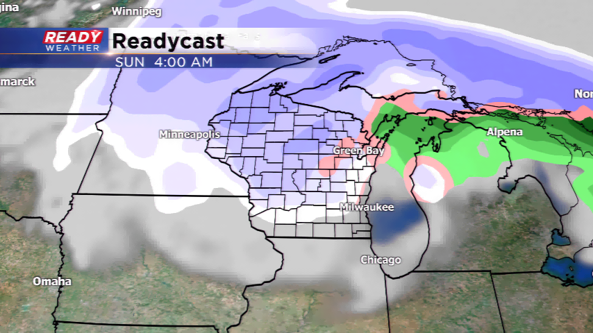
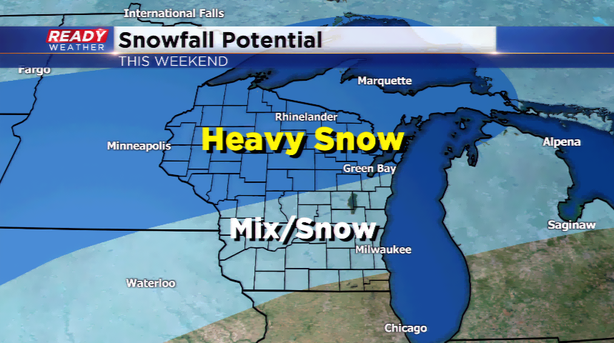
Temps then climb out ahead of the significant winter storm system for Saturday and Sunday. Highs will climb into the upper 30s and lower 40s for the weekend. This warm air will drive in a complex forecast around the strengthening low pressure system. The precipitation will start out as a light mix in the morning, then turn to all rainfall for the rest of the Saturday. A push of cold air behind the storm will filter in a changeover from rain to a mix and snowfall. The heaviest snow will fall in the northern tier of the Badger State. Southern Wisconsin will be on the tail-end of seeing any snowfall, which will stay under a few inches.
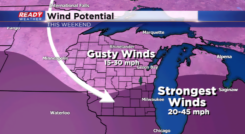
The dynamics with this system remain complex, so stay tuned to the forecast; changes are inevitable.