4:00 PM Update: Lingering showers continue. Severe weather threat is over.


Updated: 4:00 pm June 24, 2021:
Some lingering showers will remain possible over the next several hours; however, the severe threat is done. We expect the rain to be done by the early evening.
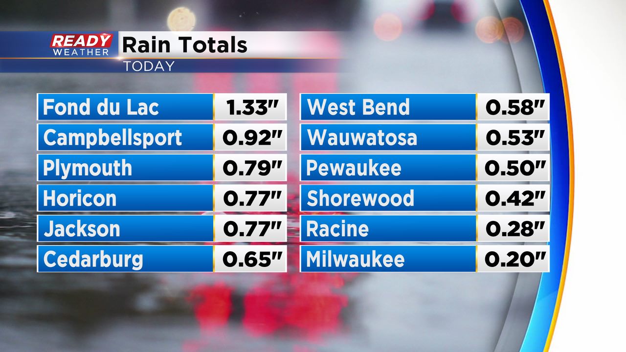
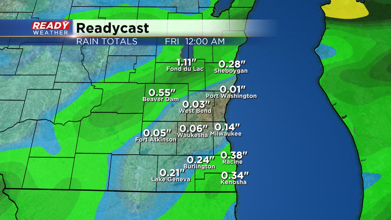
Take a look at the rainfall totals from today. The heaviest rain fell across Dodge, Sheboygan, and Fond du Lac counties. Every little bit helps as we chip away at the drought across southeastern Wisconsin.
______________________________________________________________________________________________________________
Updated: 12:45 pm June 24, 2021:
Storms with very heavy rain continue to develop and track across southeast Wisconsin. Storms have produced sporadic pea sized hail at times, but generally remain well below severe limits.
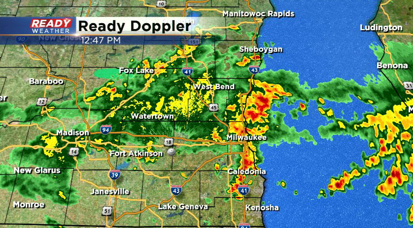
A few additional storms are also starting to pop up in northern Illinois. These are currently tracking northeast and could bring additional rain to SE WI this afternoon into early evening.
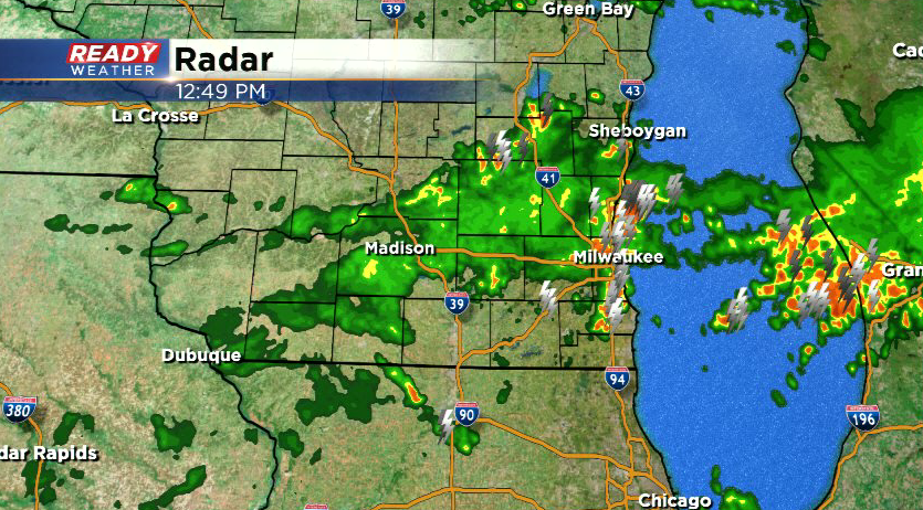
Keep the umbrella handy and remember to turn on your headlights if you encounter any storms!
-------------------------------------------------------------------------------------------
Updated: 9:22 a.m. June 24, 2021
Severe storms near Green Bay have weakened and are no longer warned. The activity is still strong with small hail and wind gusts to 40 mph and is currently moving through Fond du Lac and Sheboygan Counties. These storms are moving southeast and will likely move out over Lake Michigan or fizzle by late this morning but could make it as far south as Milwaukee.

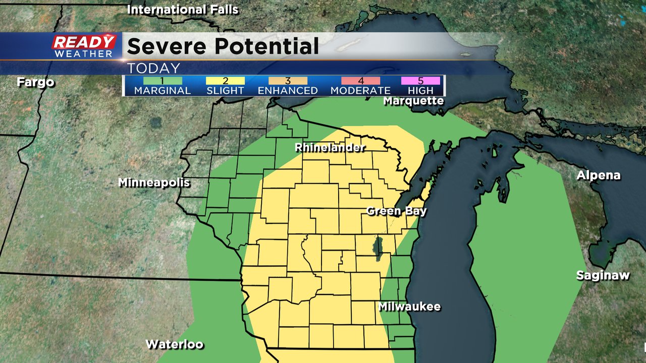
The latest risk for severe weather has expanded into all of our western counties in the slight risk for severe weather. The main threats are some hail and damaging wind. Any storms that pop up throughout the day could be severe.
------
Updated: 8:07 a.m. June 24, 2021
Some severe storms have developed around Green Bay with strong wind to 60 mph and hail around 1". A severe thunderstorm warning there has been issued until 8:45 a.m. up to the Fond du Lac border. If the storms hold together we could see a warning issued for our northern counties after 8:30 a.m. for wind and hail.
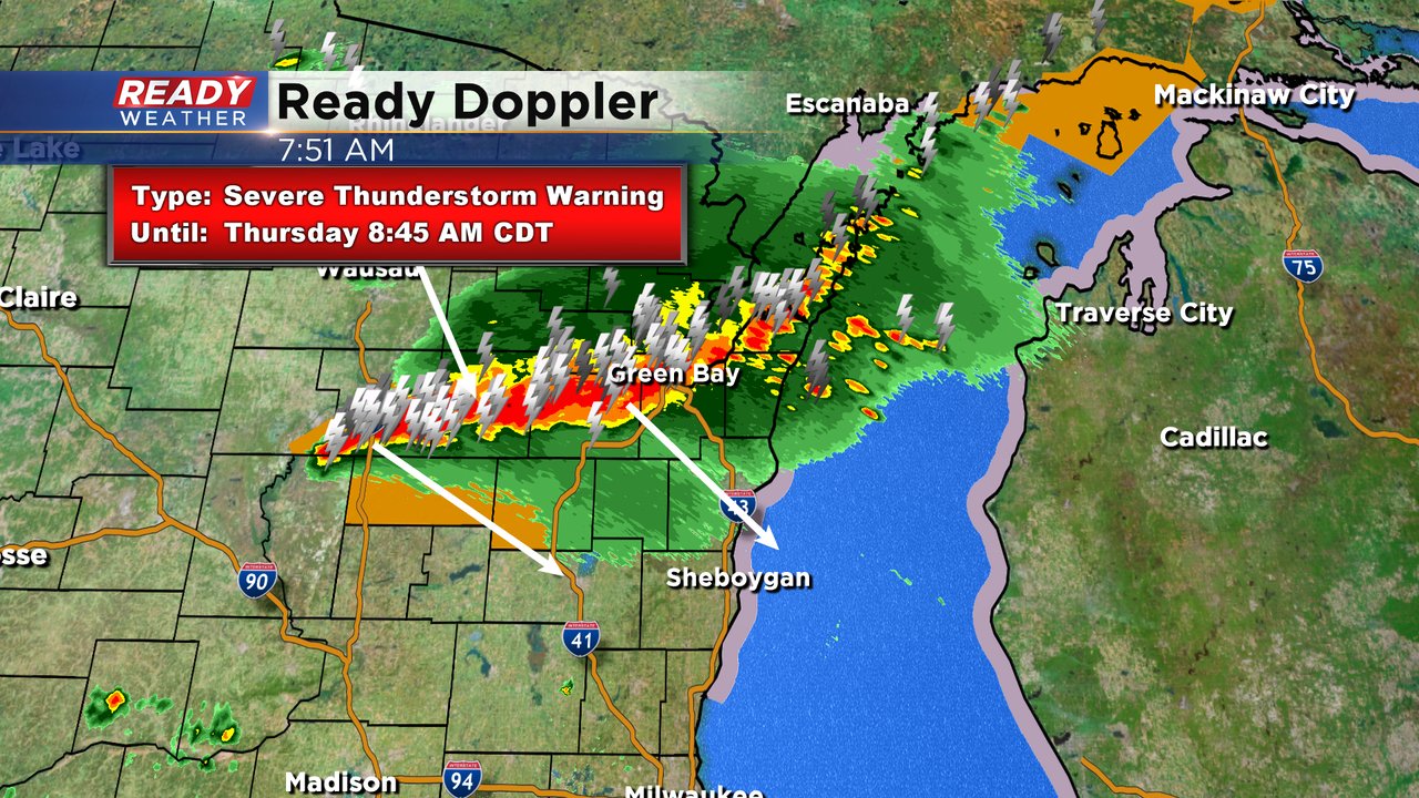
We're also watching the area of rain in Iowa that is not currently strong or severe. That activity could move in around midday and last through most of the afternoon with scattered showers and storms. This round could also be strong to severe with a risk for strong wind and hail.
-----
Posted: 6:53 a.m. June 24, 2021
A few rounds of storms will be possible the next few days with each day showing a chance for at least some stronger storms. Thursday morning we are watching two areas of rain. The first is in northern Wisconsin with some stronger thunderstorms. That activity is moving southeast and may clip some of our northern counties like Fond du Lac and Sheboygan before noon. We're also watching an area of rain in Iowa that could move into areas south of I-94 late morning as well. Unfortunately there's no development of rain between those two clusters which would give southeast Wisconsin a better chance for seeing some rain.

Besides a stray shower or storm most of southeast Wisconsin stays dry during the afternoon and evening with another chance for rain overnight. Our northern and southern counties have the better chance to see higher rain totals with at least a quarter inch or up to a full inch with stronger storms. Central counties that don't have as good of rain chances may only see a tenth or two of rain.
With temps staying mild in the 70s and dew points increasing we do have enough instability to see some stronger thunderstorms or even borderline severe. A slight risk (level 2) of severe weather includes our northwest counties of Fond du Lac and Dodge. The rest of southeast Wisconsin is in a marginal (level 1) risk. Strong wind with some hail will be the main threats with any severe storms.

As we go into Friday some lingering showers and storms may be possible during the morning. The rest of Friday looks fairly dry until the nighttime. Friday night through most of Saturday looks like our best chance for heavy rain and potential a washout type of rain. Rainfall totals through Monday show a little less rain than it did Wednesday but a nice soaking 1-2" of rain is expected for most of the area with spots near the IL border seeing closer to 3". I wouldn't be surprised if some areas got close to 5" of rain by the time this wet stretch of weather is done.

Download the CBS 58 Ready Weather app to track the rain and get alerts if warnings are issued.