5pm Update: Storm threat diminishing by the hour


5:00 pm Update, August 29, 2019
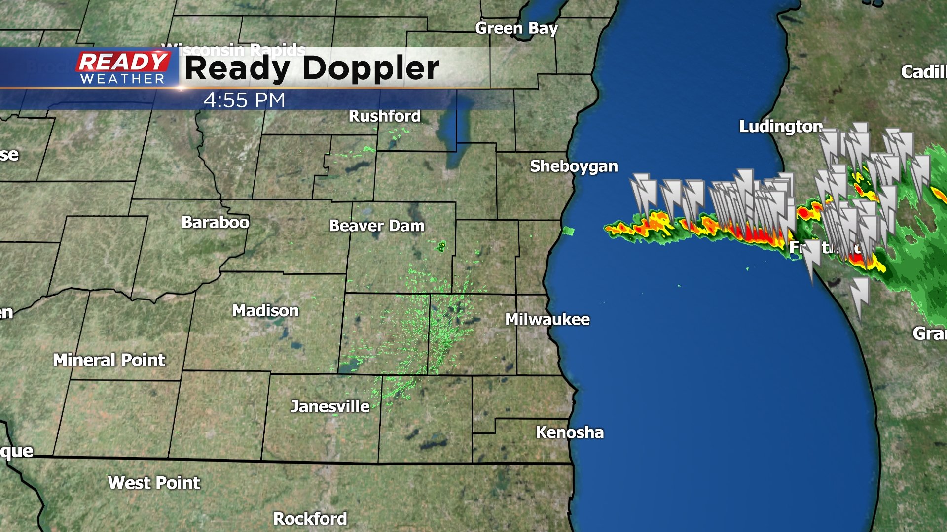
Beside a few large hail reports in Sheboygan County, the area pretty much was spared widespread severe weather on Thursday despite having an unstable air mass just ahead of a cold front. And with each passing hour, the chance of getting storms seems to be dwindling. The threat is well east and south of us now. Enjoy nicer weather coming for Friday but then there's another chance of rain showers on Saturday, but the bulk of the Labor Day weekend forecast looks nice.
Just another reminder on a day like this, to download the free CBS58 weather app. And make sure if you have done so, to update it on your phone since we just updated the app on our end. This is a great tool to have when you're on the go and need to check the radar.
____________________________________________________________________________________________________________
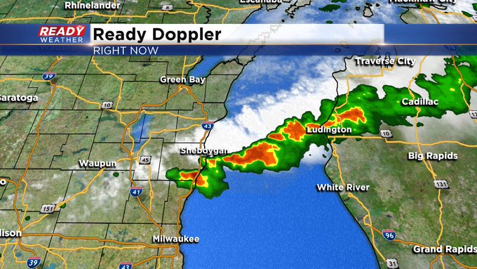
4:00 pm Update, August 29, 2019
The radar has quieted down in just the last while after storms fired up in Sheboygan and Ozaukee Counties. The cumulus clouds in the metro area aren't towering. This is a good sign because it's not showing "lift" in the atmosphere to create storm clouds. But this could change in the new few hours as a cold front works in the area from the northwest.

______________________________________________________________________________________________________________
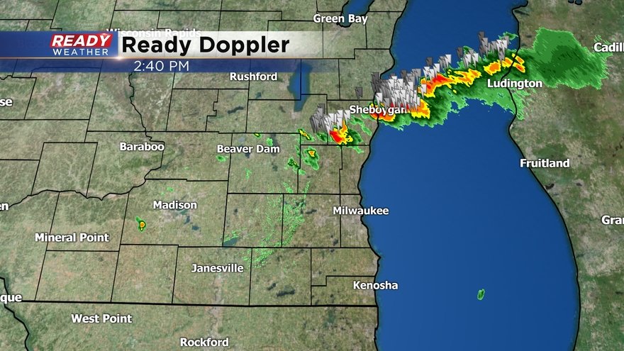
3:15 pm Update, August 29, 2019
The next three hours are the best opportunity for severe weather to pop up across southeast Wisconsin. This is all ahead of a cold front working through the region as we get into the evening hours.
Any of these storms could produce gusty wind, large hail, and frequent lightning. Stay with CBS 58 and cbs58.com for the latest weather information for the rest of the afternoon.
______________________________________________________________________________________________________________
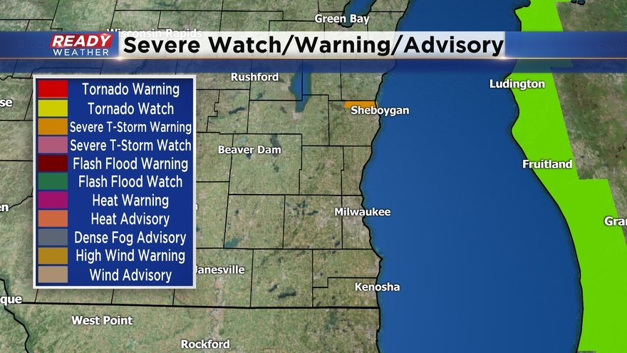
2:50 pm Update, August 29, 2019
A Severe Thunderstorm Warning is now in effect until 3:15 pm for northeast Ozaukee County and southern Sheboygan County. Large wind, frequent lightning, damaging hail, and heavy rain are possible. Stay indoors until the storms pass. The storms are moving to the east at 45 mph. A Marine Warning is also in place until 4pm on Lake Michigan, from Sheboygan to Port Washington. Wind gusts to 40 mph and large hail are all possible.
____________________________________________________________________________________________________________
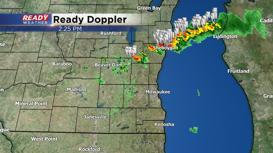
2:30 pm Update, August 29, 2019
A Severe Thunderstorm Warning remains in place the next 15 minutes for northeast Sheboygan County. Large hail, damaging wind, and frequent lightning are all possible. Storms are moving to the east at 30 mph.
____________________________________________________________________________________________________________
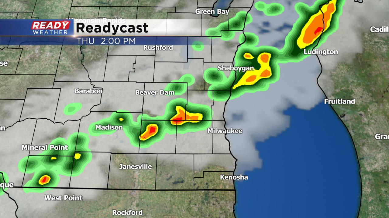
2 pm Update, August 29, 2019
The Storm Prediction Center says we have a 40% chance of a Severe Thunderstorm Watch being issued this afternoon.
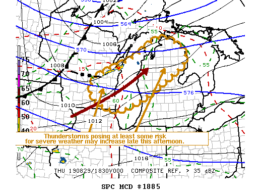
The best time would be between 3 and 6 pm this afternoon. Any storm could cause damaging wind and large hail. Heavy rain is also possible. The entire CBS 58 Ready Weather team is monitoring the storm developments carefully.
_____________________________________________________________________________________________________________
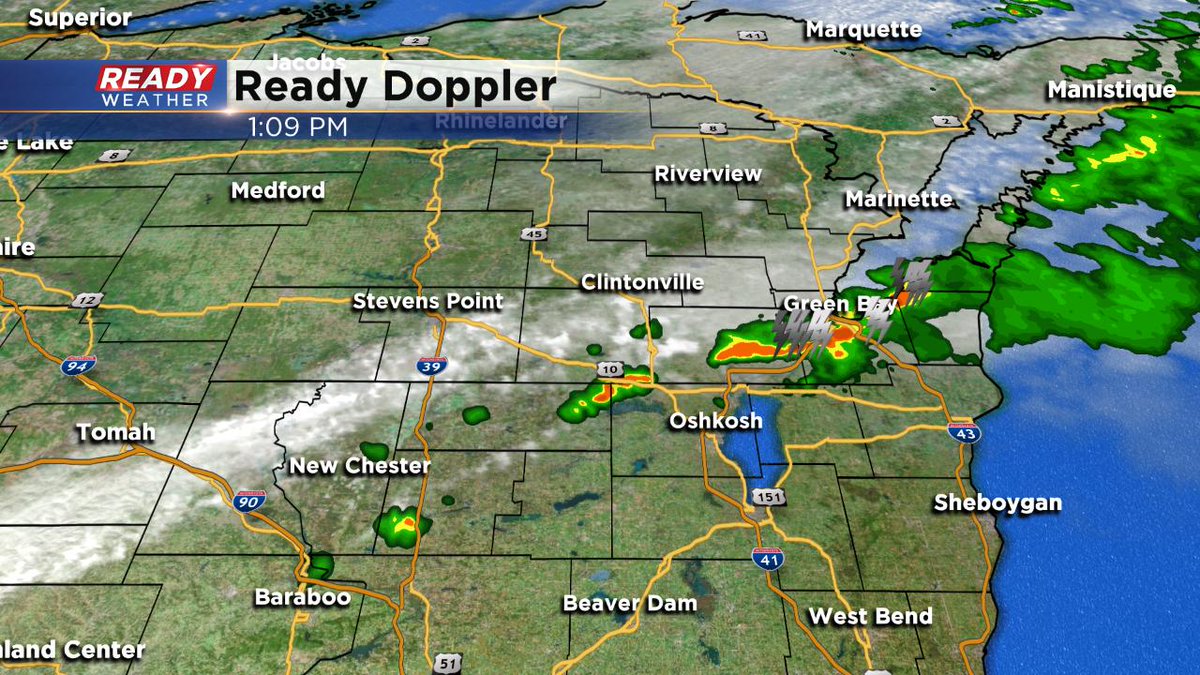
1pm Update, August 29, 2019
Most of the storms are now over Green Bay. Still waiting for our chance. It continues to be between 2 and 6 pm. Gusty winds, large hail, and frequent lightning are all possible. Stay tuned to CBS 58 on air or online for further updates.
______________________________________________________________________________________________________________
Noon Update, August 29, 2019
We're still in line for strong to severe weather this afternoon. Currently, the storms are pushing through the Fox Valley and are expected to be across southeast Wisconsin between 2 and 6 pm this afternoon.
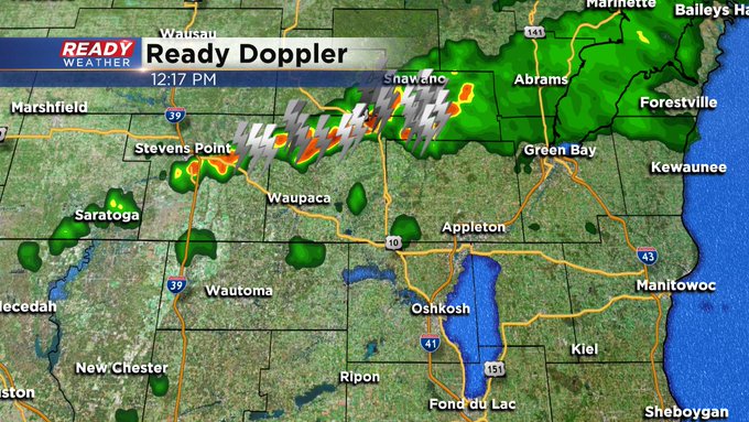
Some of the storms might be severe, producing damaging wind and large hail. The entire CBS 58 Ready Weather team is on top of the situation. Keep it tuned to CBS 58 and cbs58.com for further updates.
____________________________________________________________________________________________________________
After a picture perfect Wednesday we start out sunny Thursday morning before our next chance for rain arrives. As of Thursday morning a cold front was located in Northern Minnesota with rain and storms forming ahead of it. That front will quickly dive southeast across the state of Wisconsin arriving in our local area this afternoon.
Timing has sped up a little from Wednesday with storms arriving in northwest communities like Fond du Lac and Beaver Dam a little after noon and hitting Milwaukee and Waukesha around 3 p.m. before moving southeast.
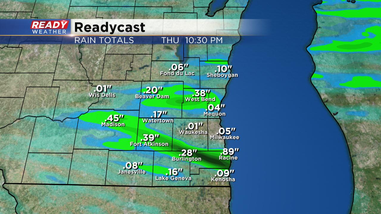
Not everyone will see storms, but those that do will pick up heavier rain with totals nearing 1" in spots.
Highs on Thursday will reach the low to middle 80s thanks to a strong wind out of the southwest gusting to 35 mph at times. All of that heat combined with some humidity will increase the fuel needed for strong to severe storms. Most of southeast Wisconsin is under the slight risk for severe weather. Those that aren't are under a marginal risk.

If severe storms do develop damaging wind and large hail will be the main threats. An isolated tornado may be possible.

Download the CBS 58 Ready Weather app to track the rain as it forms. The app will also give you alerts such as watches and warnings if they are issued.