Thursday Afternoon Weather Update: Slipping & Sliding Today


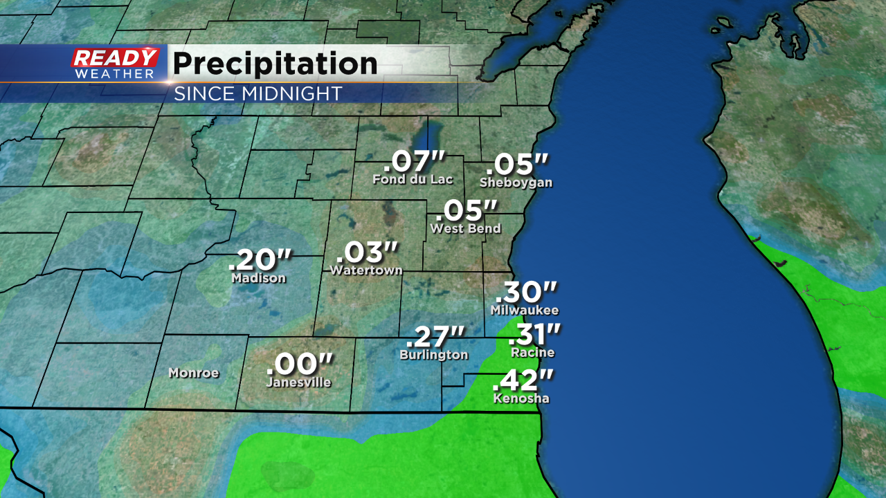
1 pm Update:
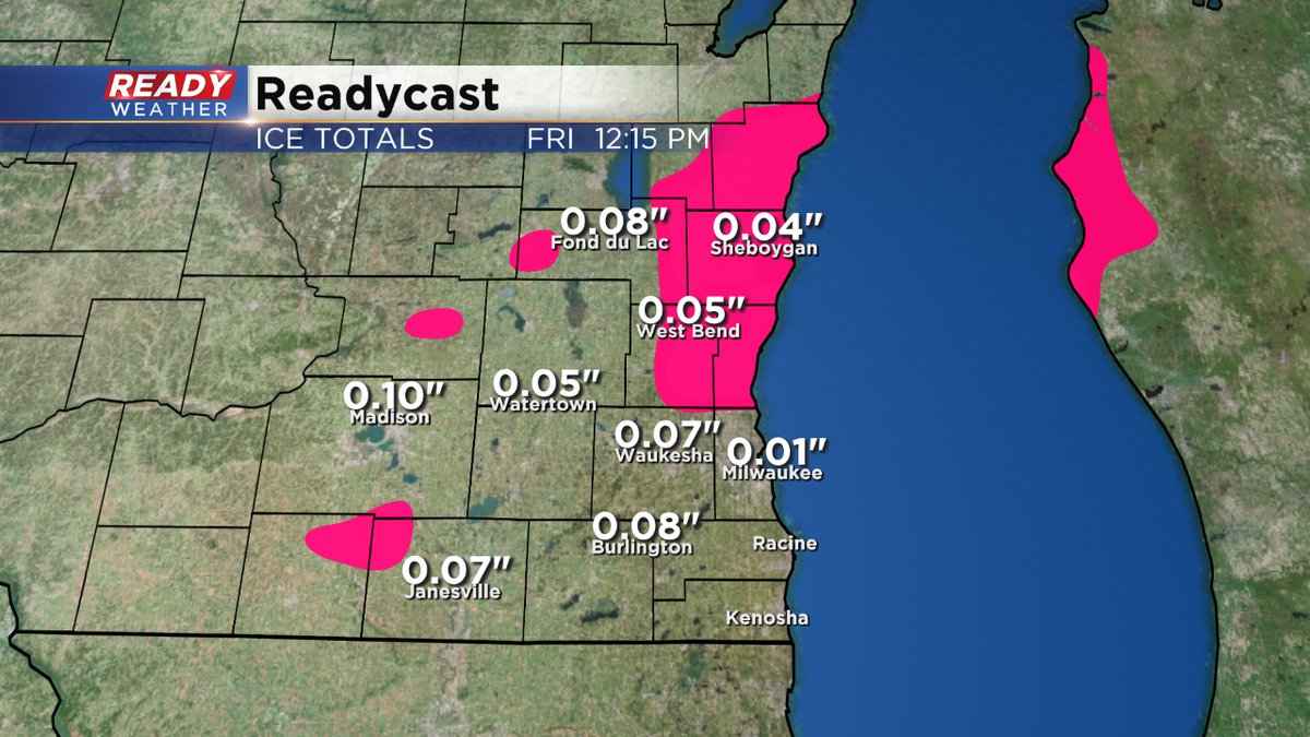
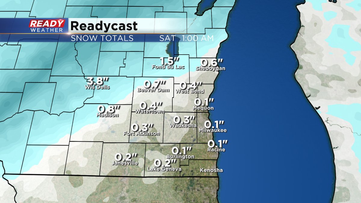
Wet weather has surged in this afternoon. Here's a look at what we've picked up since midnight
9:30 am Update...

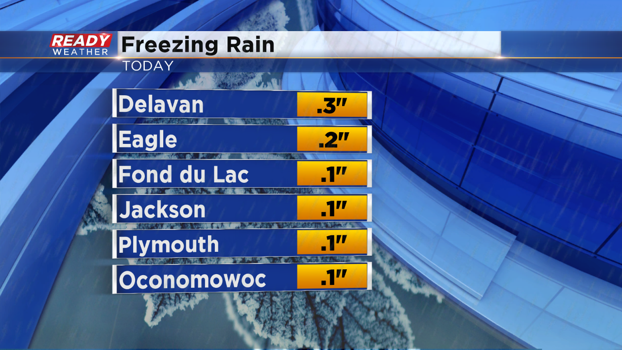
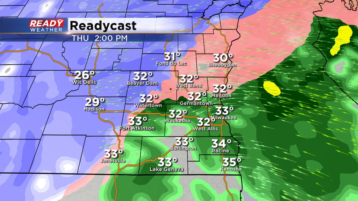
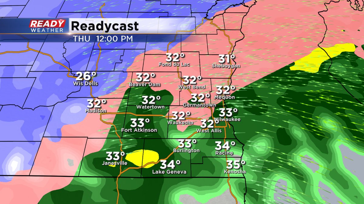
An updated Winter Weather Alert graphic for you. Both Waukesha and Walworth Counties are now included in the Winter Weather Advisory lasting until 6pm. Ozaukee and Jefferson Counties are already a part of it. And of course, the Winter Storm Warning holds until 6pm for Sheboygan, Fond du Lac, Washington, and Dodge Counties. Some of these locations have already received at least a tenth of an inch of ice. We could see at least that amount additionally the rest of the day. Around Milwaukee (and points south), look for mainly a rain event before much colder air arrives this evening, switching the rain and wintry mix to all snow showers. Flash freezing is possible too.
_____________________________________________________________________________________________________________
8 am Update...
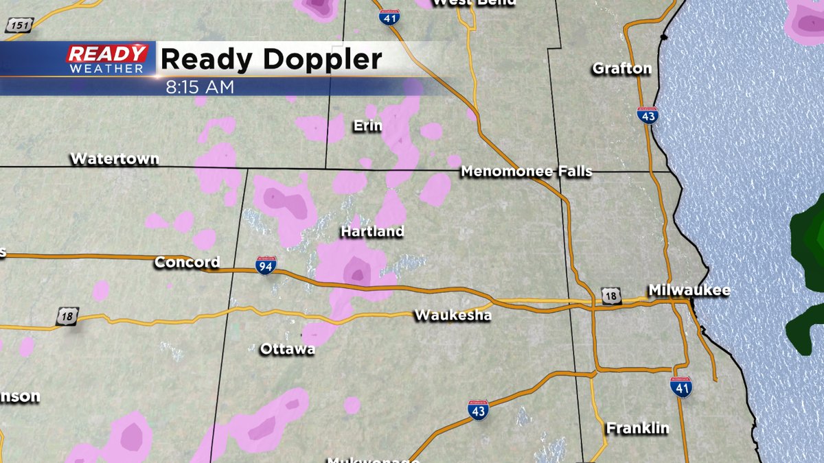
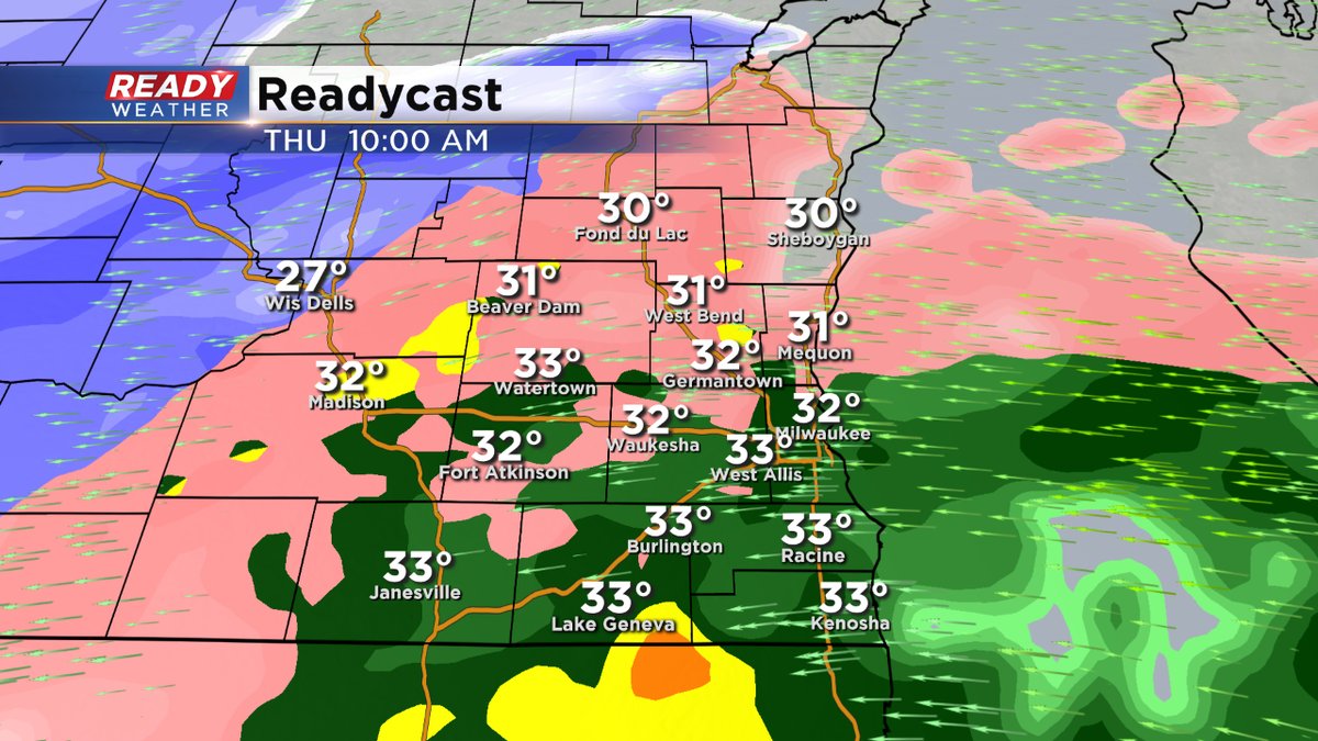
We've quieted down a bit across the metro. But more moisture will move into the area later this morning and afternoon. Again, the bigger focus for ice will be north of I-94 through the afternoon before we get a changeover to snow into this evening. Please watch the roads and sidewalks too. Of course bridges and overpasses.
______________________________________________________________________________________________________________
6 am Update...
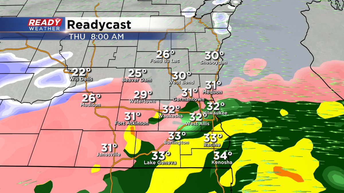
Still watching freezing rain come up from the southwest. We'll keep the ice going through mid-morning and then it switches over to rain. This will be in the metro. But the ice hangs on for most of the day north of I-94. Please be careful on the roads. Then a major dip in the temps tonight. Look for flash freezing then.
______________________________________________________________________________________________________________
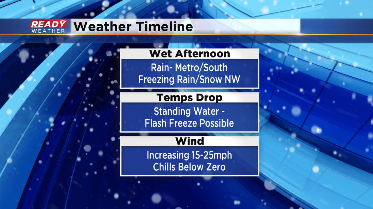
Milwaukee (CBS 58)--It'll be an icy mix and mess today. A Winter Storm Warning is in place all day for places well north and west of Milwaukee metro. Otherwise it's a Winter Weather Advisory through mid morning at least. Most of the freezing rain and drizzle will switch to rain around Milwaukee and Waukesha, points south, by 9 or 10 am. It stays frozen north of I-94 most of the day. Some spots in this location could see more than a third of an inch of ice. Watch the roads, power lines, and trees. A minor snow accumulation is possible.
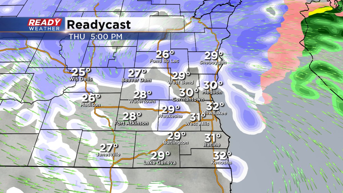
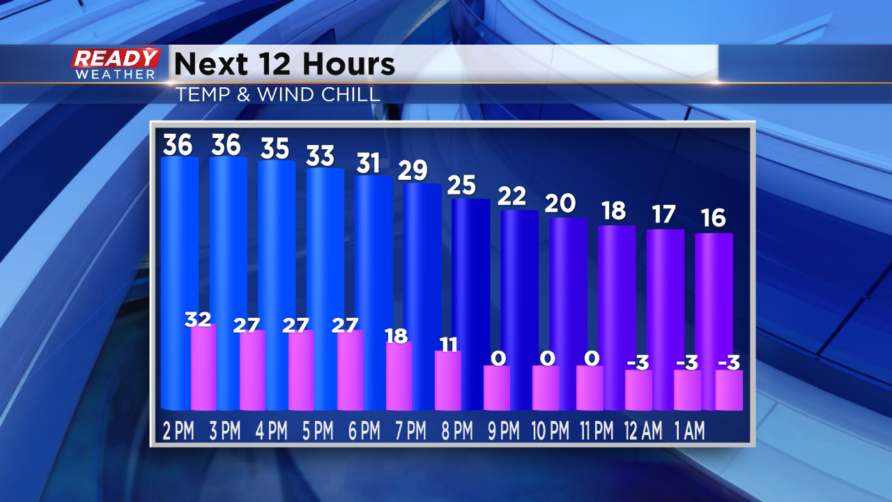
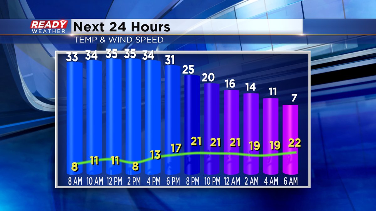
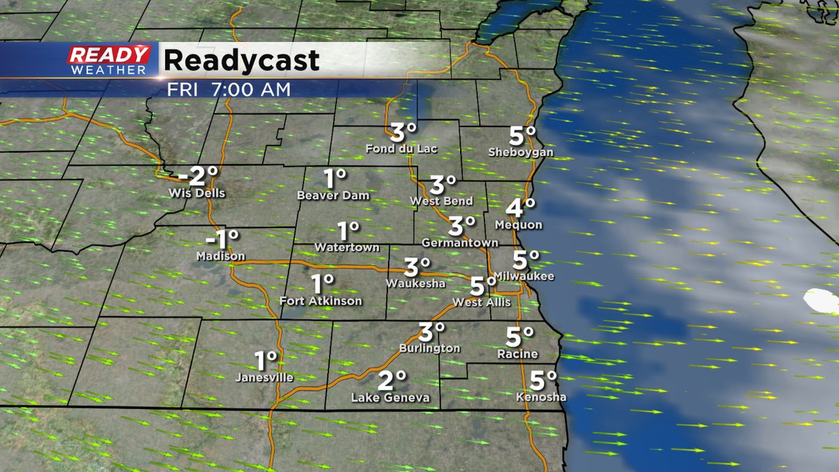
Much colder air arrives tonight. Any rain or ice we have will switch to snow showers, tapering off by midnight. The wind picks up, so the chills will go well below zero. Lows overnight in the single digits.
Friday and Saturday will give us quiet weather. Then more snow for Sunday and Tuesday respectively.