We're not done yet: Another round of rain arrives tonight

-
3:00

2020 murder of Bernell Trammell’s remains unsolved
-
1:44

Kenosha community comes together to gift students with repaired...
-
1:50

Following fatal fire, MFD returns to south side neighborhood...
-
2:09

Marquette parents express frustration as graduation date remains...
-
0:51

City leaders gather ahead of Denim Day to address sexual assault...
-
0:53

City officials gathered in King Park neighborhood for tree canopy...
-
5:40

’48 Hours’ episode to feature Waukesha County eye drop murder...
-
1:28

Opening weekend is here for Slinger Speedway
-
2:11

Meet CBS 58’s Pet of the Week: Kenobi
-
3:52

Life Time schedules charity cycle event to benefit Children’s...
-
5:23

CBS 58’s Feel Good Fridays: Earth Day, family skating and more
-
2:08

Windy Friday then a chance for frost this weekend

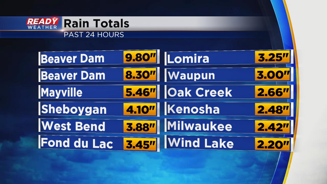
Very heavy rain fell Tuesday in a couple rounds leading to flash flooding in multiple locations. The heaviest of the rain ended around midnight going into Wednesday morning, but light steady rain will linger through the morning commute. Rain totals are very impressive especially in northern spots where in general 3-6" of rain fell. Beaver Dam got hit the hardest with rain totals near 10". Southern communities still got good rain with 1-3" there.
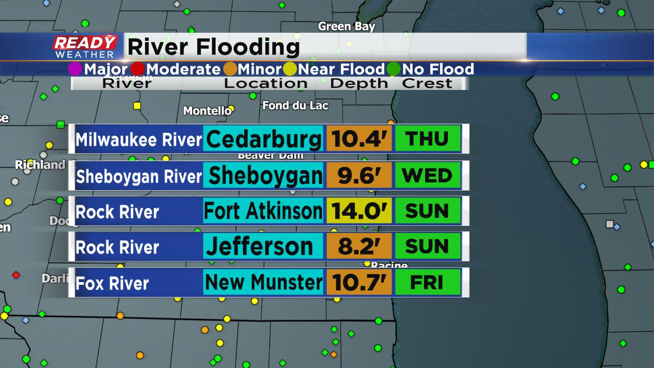
As the rain is ending, river levels are increasing. Multiple rivers in southeast Wisconsin are under flood warnings the next couple days. Water is expected to keep rising through the weekend before it starts to come down.
Unfortunately, we aren't done with the rain just yet. Another separate storm system arrives after sunset Wednesday and lasts through the morning commute on Thursday.
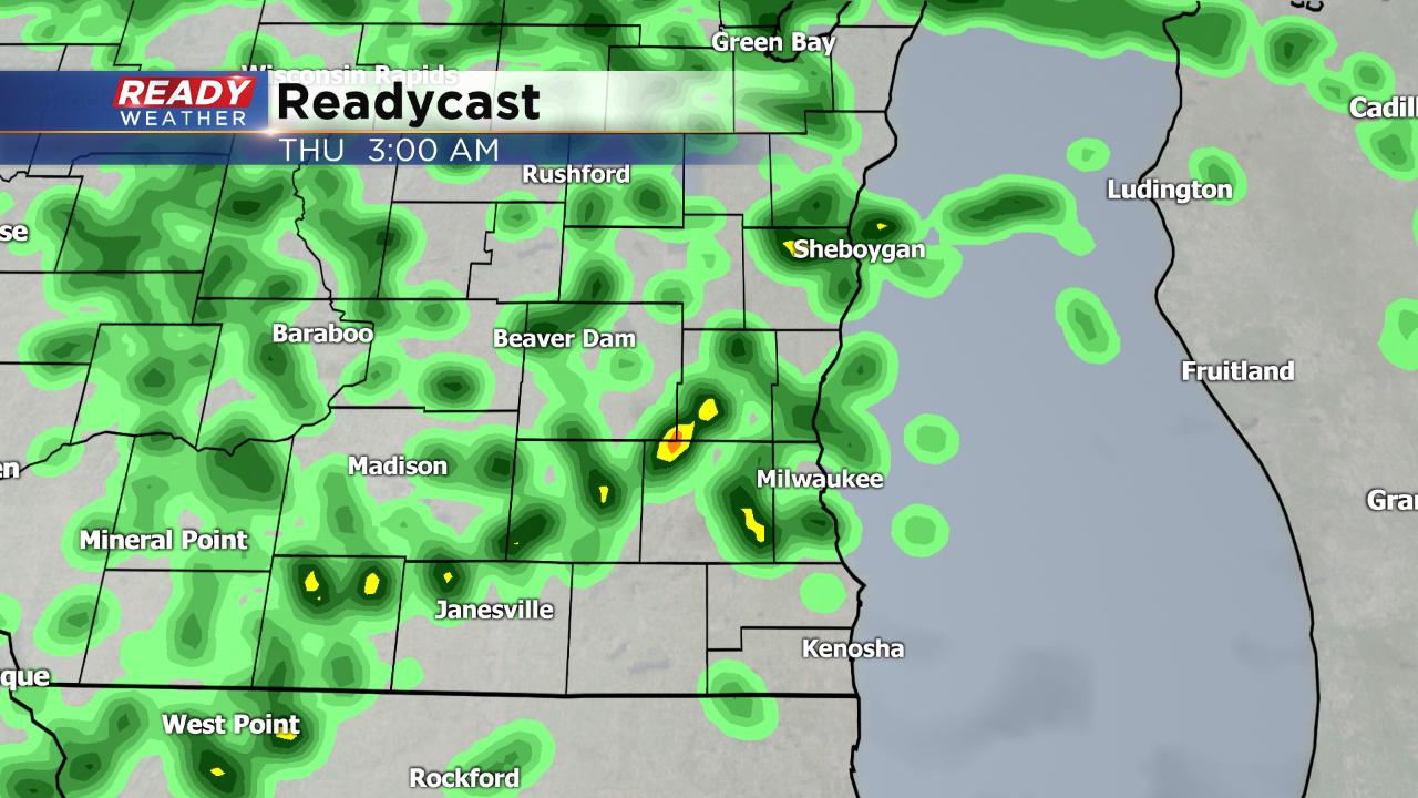
Rain will not be nearly as heavy as it was on Tuesday but another quarter to half inch of rain is possible. Any additional rainfall will make flooding conditions worse.

Expect a nice dry and sunny but cooler Friday before another round of likely rain on Saturday. Download the CBS 58 Ready Weather app to track any more rain as it develops.