A winter mess on the way!
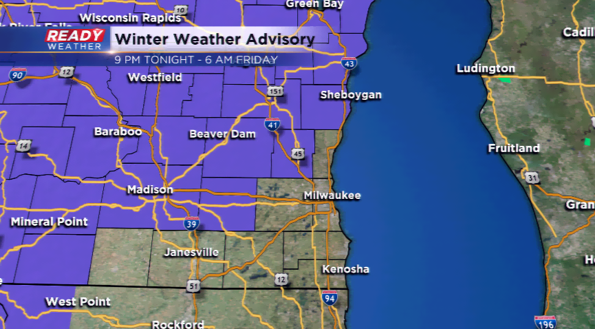
A period of light freezing rain, sleet, and snow is possible tonight into early parts of Friday. A brand new Winter Weather Advisory has been posted for Sheboygan, Fond du Lac, Dodge, Washington, and Jefferson Counties. It starts at 9pm this evening and runs until 6 am Friday.
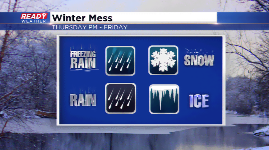
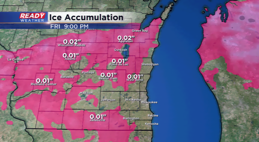
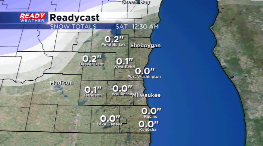
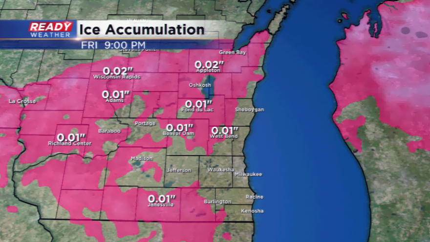
The main impacts will be the possibility for some icing, up to 0.10”, and a slushy inch of snowfall. Most computer models, including our model, keeps the precipitation lower than both of those numbers. In fact, there’s a chance this moisture rolling in could be a chunk of rain. The temperature difference of 1-3 degrees will make all the difference between a cold rain and icing.
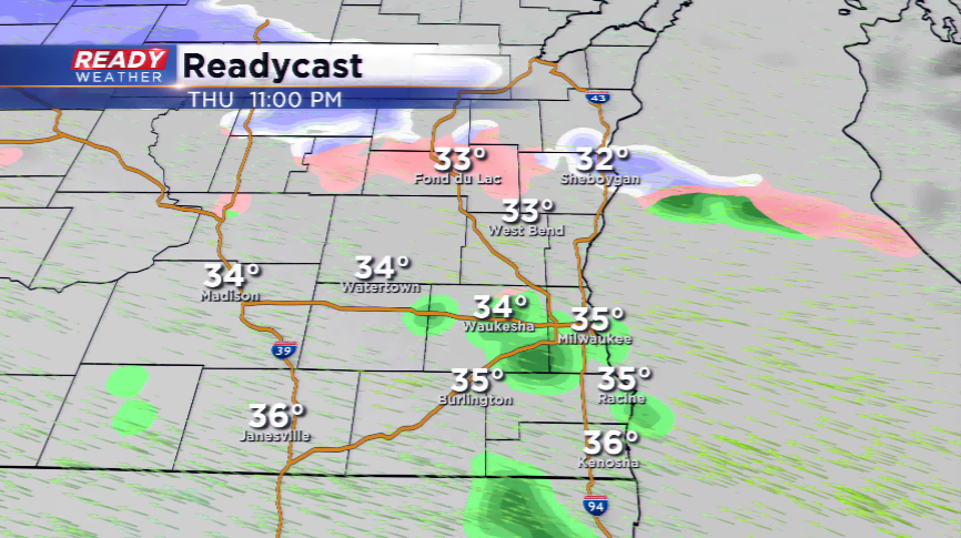
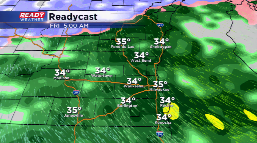
If you have to travel tomorrow morning, please give yourself extra time to get from A to B. The mix will be done with by mid-morning. Temperatures will rise above freezing by then.
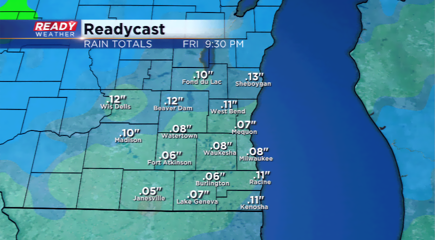
The rainfall totals will not amount to much, but we could see another 0.25” of rainfall. Flooding is still a concern in southeastern Wisconsin.