Another chance for light snow on Wednesday

-
3:32

Schlesinger’s Saturday Showcase (5/4)...Big party-theme weekend
-
3:06

One hiccup in the weekend forecast w/some Saturday storms
-
2:31

Man accused in fatal hit-and-run that killed 4-year-old had...
-
4:11

UW-Milwaukee encampment continues, protesters hold Muslim prayer,...
-
2:16

’No vet care, no food, no water’: Animals seized from sanctuary...
-
3:03

Mothers of Milwaukee Symposium to host inaugural event that includes...
-
1:45

At burn training, one Kenosha firefighter lives out a dream
-
1:00

Potawatomi Casino Hotel celebrates grand opening of sportsbook,...
-
1:21

Celebrate Cinco de Mayo at Chucho’s Red Tacos this Sunday
-
0:57

Weigel Broadcasting to launch MeTV Toons, new network dedicated...
-
4:59

CBS 58’s Feel Good Fridays: Museum member swap, Star Wars art...
-
2:49

Meet CBS 58’s Pet of the Week: Stealth

It's really turning out to be a very active week ahead in the weather department. Late December into January was fueled by unseasonably warm highs across the area and very little snowfall. Over the last week the pattern has broken down and more disturbances continue to move across the Midwest.
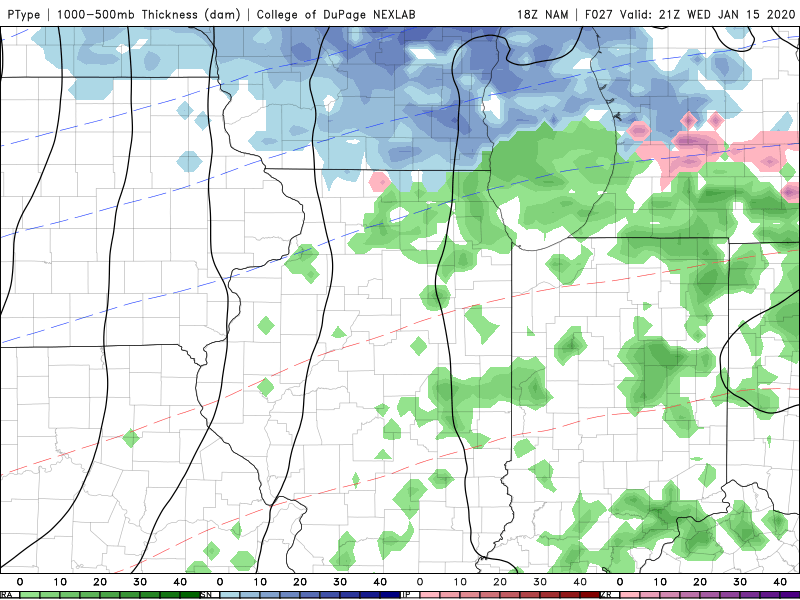
Our next chance for snow will arrive Wednesday morning into the afternoon. Light snow will overspread the area between 8 am and 10 am. The peak of the snow will be around Noon before moving out by the late afternoon. Winter weather advisories have been issued west of our area for tomorrow morning.
Overall snow accumulation will be between a dusting to an inch. An inch will be closer to our northern counties. This is not a big event and surface temperatures will limit problems on the roads for Wednesday.
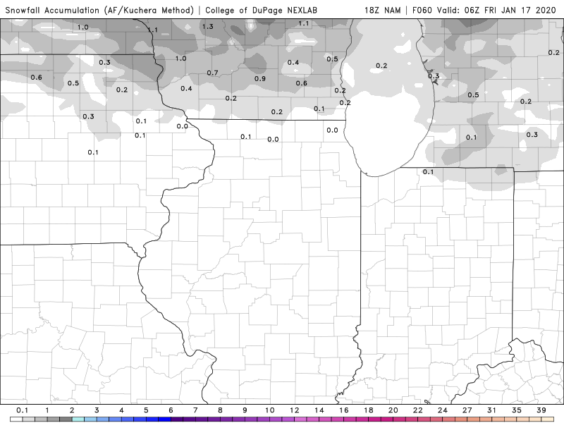
A much stronger system arrives Friday into Saturday. The chance for several inches of snow continues to go up.