More snow and arctic air arrive Thursday into Friday

-
3:06

One hiccup in the weekend forecast w/some Saturday storms
-
3:32

Schlesinger’s Saturday Showcase (5/4)...Big party-theme weekend
-
2:31

Man accused in fatal hit-and-run that killed 4-year-old had...
-
4:11

UW-Milwaukee encampment continues, protesters hold Muslim prayer,...
-
2:16

’No vet care, no food, no water’: Animals seized from sanctuary...
-
3:03

Mothers of Milwaukee Symposium to host inaugural event that includes...
-
1:45

At burn training, one Kenosha firefighter lives out a dream
-
1:00

Potawatomi Casino Hotel celebrates grand opening of sportsbook,...
-
1:21

Celebrate Cinco de Mayo at Chucho’s Red Tacos this Sunday
-
0:57

Weigel Broadcasting to launch MeTV Toons, new network dedicated...
-
4:59

CBS 58’s Feel Good Fridays: Museum member swap, Star Wars art...
-
2:49

Meet CBS 58’s Pet of the Week: Stealth

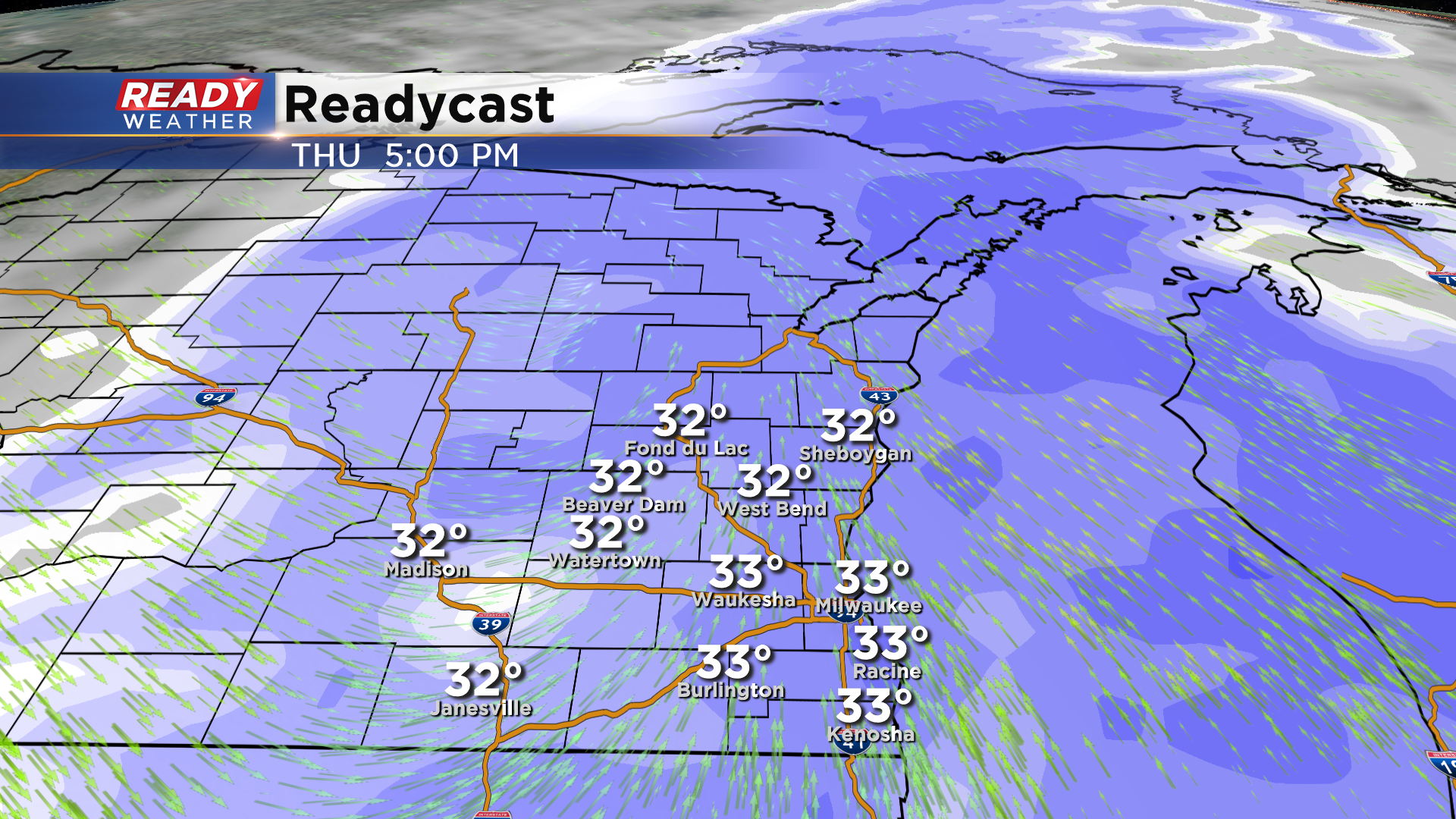
Another round of snow is set to arrive across southeastern Wisconsin on Thursday. Between 6 am and Noon expect a wintry mix before it turns over to all snow by lunchtime.
The Thursday evening commute looks very snowy across the entire metro. The snow will linger overnight into early Friday morning. Snow should be done by the morning commute on Friday. Roads Thursday evening will be slick and snowy.
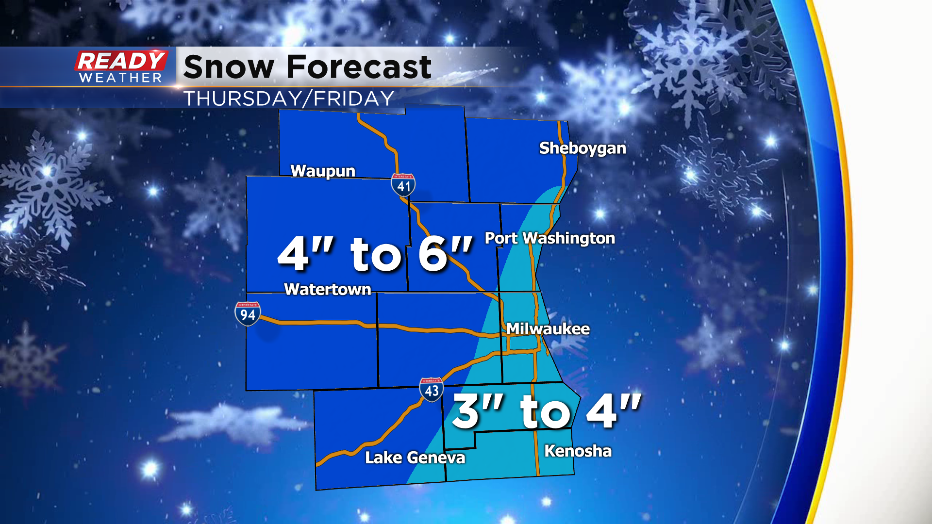
Most of the area will receive 3" to 6" of snow. The highest totals will be across our northern and northwestern areas. Some spots there could be over 6".
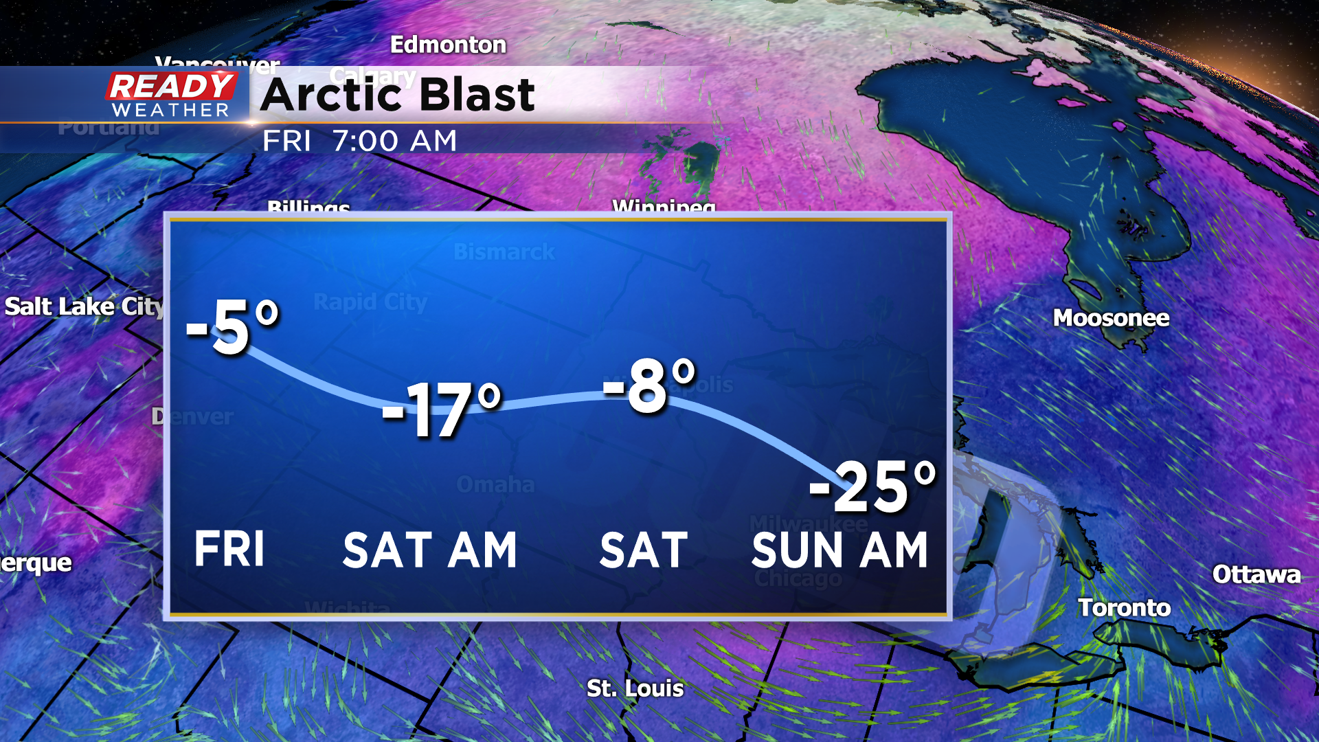
The coldest air of the season is set to arrive on Friday into the weekend as arctic air invades the Midwest. Take a look at the forecasted wind chill graphic above. Wind chills will be subzero for several days creating very dangerous conditions!