Severe weather is possible late Wednesday night. The damaging wind threat has increased.

-
2:31

Man accused in fatal hit-and-run that killed 4-year-old had...
-
4:11

UW-Milwaukee encampment continues, protesters hold Muslim prayer,...
-
2:16

’No vet care, no food, no water’: Animals seized from sanctuary...
-
3:03

Mothers of Milwaukee Symposium to host inaugural event that includes...
-
1:45

At burn training, one Kenosha firefighter lives out a dream
-
1:00

Potawatomi Casino Hotel celebrates grand opening of sportsbook,...
-
1:21

Celebrate Cinco de Mayo at Chucho’s Red Tacos this Sunday
-
0:57

Weigel Broadcasting to launch MeTV Toons, new network dedicated...
-
4:59

CBS 58’s Feel Good Fridays: Museum member swap, Star Wars art...
-
2:49

Meet CBS 58’s Pet of the Week: Stealth
-
0:54

Lake Express ferry leaves Milwaukee terminal for first time of...
-
2:58

Drying out today, but another quick round of storms is expected...

Most of our summer and severe weather season has been relatively quiet; however, the chances for strong to severe storms are going up for Wednesday night into Thursday morning.
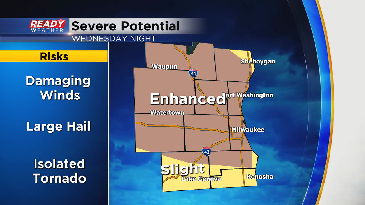
Ingredients look to come together for a significant damaging wind event for Wednesday night. A complex of storms is forecast to develop late Wednesday evening across central Wisconsin. This complex will gain steam during the late evening as it feasts on high heat and humidity.
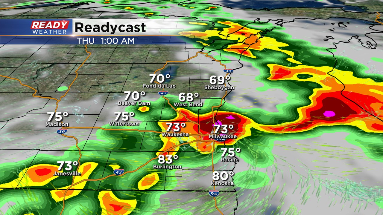
The track will take it toward southeastern Wisconsin between 11 pm and 4 am.
These complexes are known for strong damaging winds, small hail, and isolated tornadoes. If the complex travels for at least 240 miles, has 58 mph gusts along the length, and several 75 mph gusts it could be classified as a derecho.
We will continue to watch this closely over the next 24 hours as the system evolves. It's also possible that some of our area could be upgraded from an enhanced to a moderate risk if damaging winds look likely.