Tracking snow overnight into Saturday morning

-
3:06

One hiccup in the weekend forecast w/some Saturday storms
-
3:32

Schlesinger’s Saturday Showcase (5/4)...Big party-theme weekend
-
2:31

Man accused in fatal hit-and-run that killed 4-year-old had...
-
4:11

UW-Milwaukee encampment continues, protesters hold Muslim prayer,...
-
2:16

’No vet care, no food, no water’: Animals seized from sanctuary...
-
3:03

Mothers of Milwaukee Symposium to host inaugural event that includes...
-
1:45

At burn training, one Kenosha firefighter lives out a dream
-
1:00

Potawatomi Casino Hotel celebrates grand opening of sportsbook,...
-
1:21

Celebrate Cinco de Mayo at Chucho’s Red Tacos this Sunday
-
0:57

Weigel Broadcasting to launch MeTV Toons, new network dedicated...
-
4:59

CBS 58’s Feel Good Fridays: Museum member swap, Star Wars art...
-
2:49

Meet CBS 58’s Pet of the Week: Stealth

The active snow pattern continues across the area tonight and into Saturday! Another fast moving wave will create more snow across southeastern Wisconsin.
The snow will be light and fluffy thanks to the arctic air in place. Snow will likely hold off until after 3 am. It will take some time for the atmosphere to saturate.
Most areas by Saturday afternoon will have picked up 1" to 3" of snow. The snow will taper off by early Saturday evening.
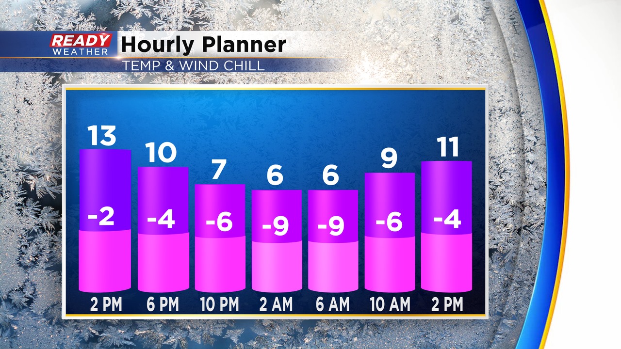
Roads will be impacted once again due to the very cold air. Please use caution early Saturday morning. Another shot of arctic air is coming for Sunday. Wind chills Sunday and Monday morning will be -20 to -30. We anticipate more wind chill advisories to be issued.
Finally, by the end of next week the arctic air will retreat as temperature get closer to normal.