Tuesday Early Afternoon Update: Pesky clouds, flurries, sprinkles before better weather takes hold


Updated: 12:30 p.m. Dec. 5, 2023
Still a few sprinkles and flurries into this afternoon. They'll be brief. Overall, look for a drying trend. The next few days, we'll see a nice modification with the temperatures. Low 50s for highs by late in the week. Then we sit and wait for a more impressive winterlike system this coming weekend. Could be mix to snow. Keep checking back for details.


_____________________________________________________________________________________________________________
Updated: 8:37 a.m. Dec. 5, 2023
The accumulating snow from Tuesday morning has just about wrapped up. A few more light snow showers or flurries will still be possible through early afternoon and might even mix with some rain lakeside, but any accumulation will be minimal at best.
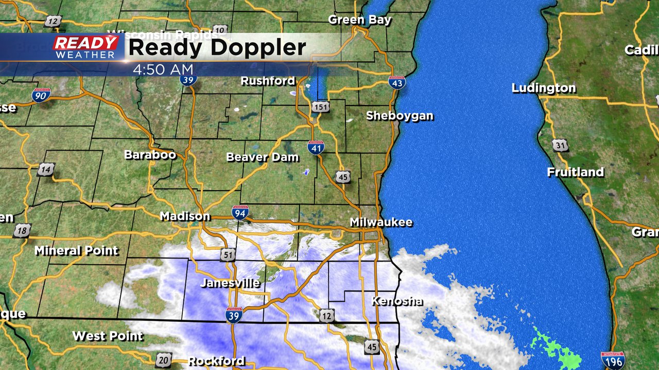
Here's a radar image that will update with time:

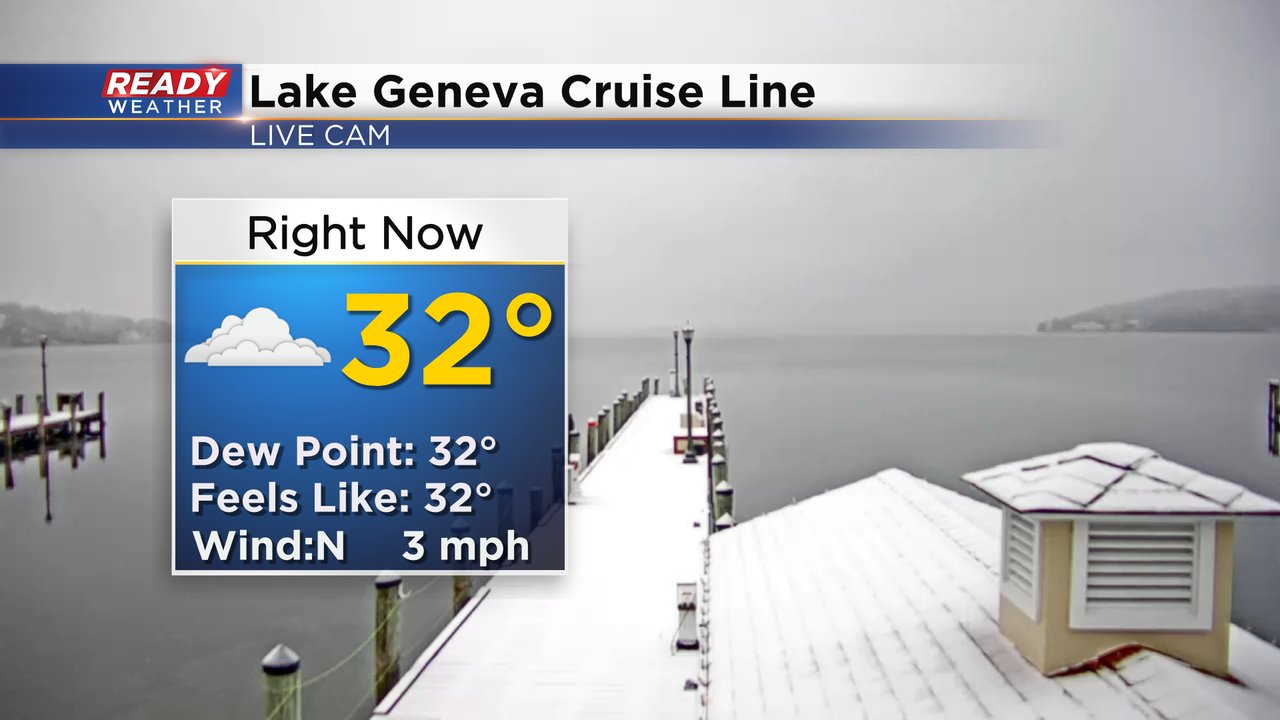
Some accumulating snow did occur in southern counties. Look at the dusting or a few tenths of snow that Lake Geneva got Tuesday morning. The next chance for any rain or snow after Tuesday will be this weekend where all eyes are on a messy storm system that could bring rain, mix and snow.
------
Updated: 5:03 a.m. Dec. 5, 2023
Light snow has arrived in southeast Wisconsin. So far most of the snow has stayed along and south of I-94 with light snow currently falling in southern Jefferson, Waukesha and Milwaukee Counties and all of Walworth, Racine and Kenosha Counties. These are the communities that have the best chance to see accumulating snow with less than an inch everywhere and most communities closer to a dusting than the inch mark.
Some slick spots will be possible for the Tuesday morning commute but mainly on rural highways and neighborhood streets. Freeways should just remain wet.
Here are the road conditions that will update with time:

Most of the accumulating snow will end by mid-morning Tuesday but some lingering snow showers or flurries or even some rain mixing in lakeside could linger into the early afternoon.
Download the CBS 58 Ready Weather app to track the snow.
------
Posted: 4:10 p.m. Dec. 4, 2023
A clipper system will arrive after midnight and provide a chance for some light snow overnight. The best chance for that snow will be from Midnight until 8 am.
While clippers tend to bring several inches of snow across our area, this system will slide further southwest. Most areas will receive around 0.5" of snow. Our western counties and areas near the IL/WI border could approach 1" of snow.

The overall impacts will be minor. Some side roads and elevated surfaces will have slick spots; however, main roads should be ok for the morning commute.
Other than some lingering drizzle or a light mix along the lakefront, the afternoon will be quiet.