The summer-like heat and humidity returns

-
2:06

’It’s such a strong historical aspect of Waterford’: Community...
-
3:21

Old text messages between GOP operatives spark anger; voting...
-
2:04

’I just wanted to get the bus to stop’: 8th grader takes...
-
0:22

Milwaukee Diaper Mission celebrates documentary about the nonprofit’s...
-
1:31

Under 90 days until RNC: How fundraising, security is ramping...
-
2:18

’It’s certainly an honor’: Milwaukee Public Market named...
-
1:35

Is now the time to buy a home? New report shows home prices up...
-
1:18

Fans sendoff Milwaukee Bucks
-
1:55

One of the Wisconsin Humane Society’s newest intakes who has...
-
2:34

VISIT Milwaukee preview April 26-28
-
0:45

Milwaukee County Zoo announces groundbreaking of new rhino exhibit
-
6:16

’We Grown Now’ and ’Boy Kills World’ hitting the screens...

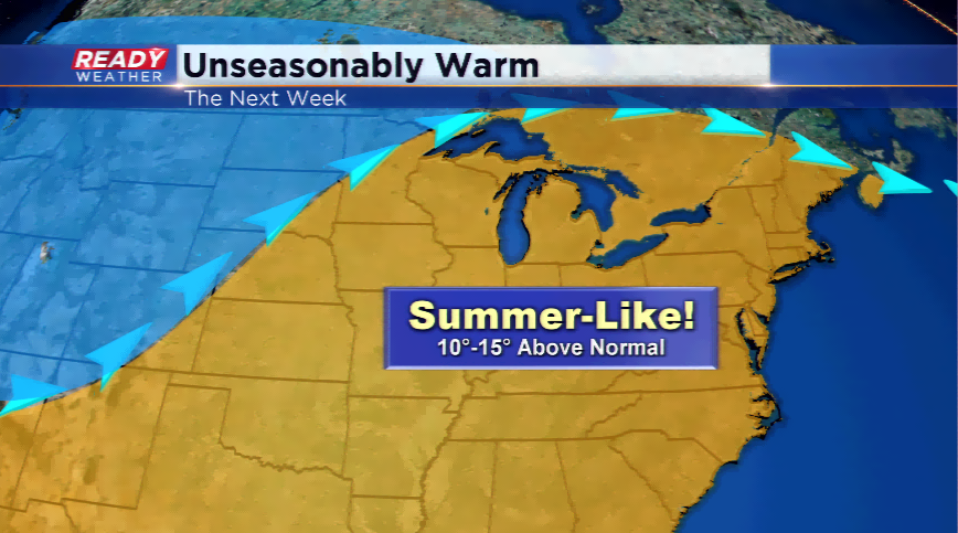
Today will be the last day in the next week it won’t feel like the dog days of summer. That’s right. Check your calendar, it won’t feel like the end of September.
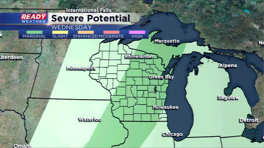
A strong upper-level ridge will grab hold of the Great Lakes and Badger State allowing a string of 80s to develop the next several days. The culprit will be a warm front; the warm front will track north and provide hit or miss chances of rain Tuesday morning. Most of the activity stays south of the border. Another chance along a weak cold front will blossom showers and storms. There is a chance with the right dynamics in place a few of these turn strong.
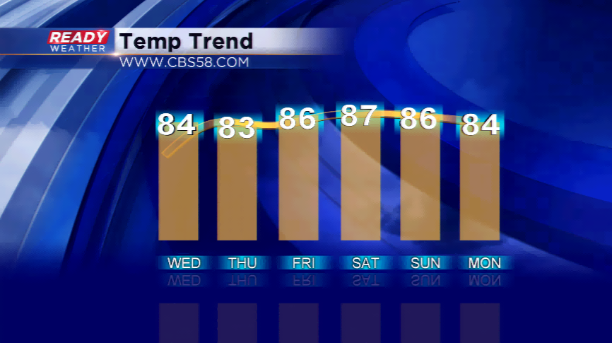
The longest streak of 80s so far this summer has been six consecutive days. The streak starts tomorrow and could last into next Monday. The ridge begins to break down by next Tuesday. A cooler, drier air ma