Tracking a mix of rain and snow overnight

-
3:32

Schlesinger’s Saturday Showcase (5/4)...Big party-theme weekend
-
3:06

One hiccup in the weekend forecast w/some Saturday storms
-
2:31

Man accused in fatal hit-and-run that killed 4-year-old had...
-
4:11

UW-Milwaukee encampment continues, protesters hold Muslim prayer,...
-
2:16

’No vet care, no food, no water’: Animals seized from sanctuary...
-
3:03

Mothers of Milwaukee Symposium to host inaugural event that includes...
-
1:45

At burn training, one Kenosha firefighter lives out a dream
-
1:00

Potawatomi Casino Hotel celebrates grand opening of sportsbook,...
-
1:21

Celebrate Cinco de Mayo at Chucho’s Red Tacos this Sunday
-
0:57

Weigel Broadcasting to launch MeTV Toons, new network dedicated...
-
4:59

CBS 58’s Feel Good Fridays: Museum member swap, Star Wars art...
-
2:49

Meet CBS 58’s Pet of the Week: Stealth

Just when you think we have turned the corner for Spring, winter weather remains possible across the area. Late tonight a disturbance will create a mix of rain and snow across southeastern Wisconsin.
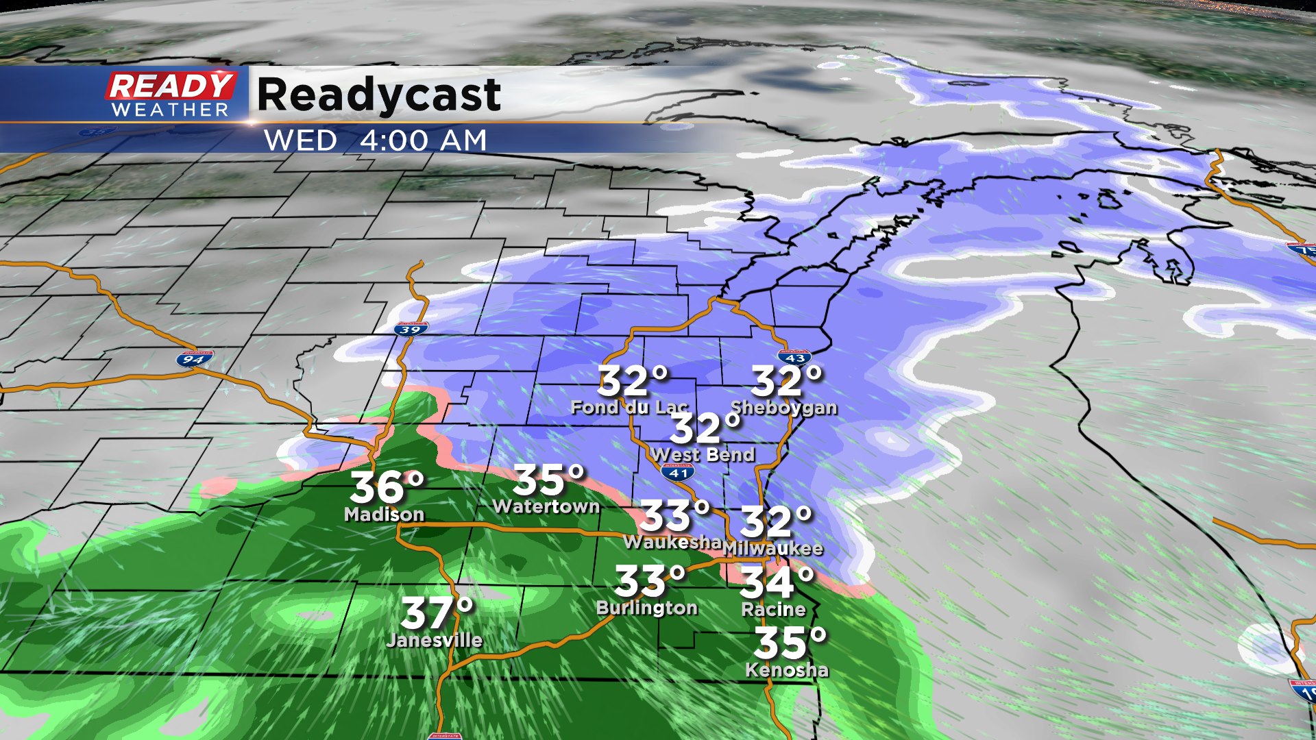
The winter weather should hold off until after midnight. Expect more of a mix of rain and snow along and south of I-94. The further north you are from Milwaukee the better chances for that mix being more snow.
Thankfully road temperatures and ground temperatures are relatively mild, so accumulation will be mostly confined to grassy areas. This will be a wet slushy snow that should melt by Wednesday afternoon. Plan on the mix to be wrapping up by 10 am.
Accumulation should be an inch or less, with the highest totals across Sheboygan and Fond du Lac counties.