Rain and some storms are possible later this evening

-
3:06

One hiccup in the weekend forecast w/some Saturday storms
-
3:32

Schlesinger’s Saturday Showcase (5/4)...Big party-theme weekend
-
2:31

Man accused in fatal hit-and-run that killed 4-year-old had...
-
4:11

UW-Milwaukee encampment continues, protesters hold Muslim prayer,...
-
2:16

’No vet care, no food, no water’: Animals seized from sanctuary...
-
3:03

Mothers of Milwaukee Symposium to host inaugural event that includes...
-
1:45

At burn training, one Kenosha firefighter lives out a dream
-
1:00

Potawatomi Casino Hotel celebrates grand opening of sportsbook,...
-
1:21

Celebrate Cinco de Mayo at Chucho’s Red Tacos this Sunday
-
0:57

Weigel Broadcasting to launch MeTV Toons, new network dedicated...
-
4:59

CBS 58’s Feel Good Fridays: Museum member swap, Star Wars art...
-
2:49

Meet CBS 58’s Pet of the Week: Stealth

Strong south winds will continue to gust close to 40 mph tonight as a cold front moves in from the northwest.
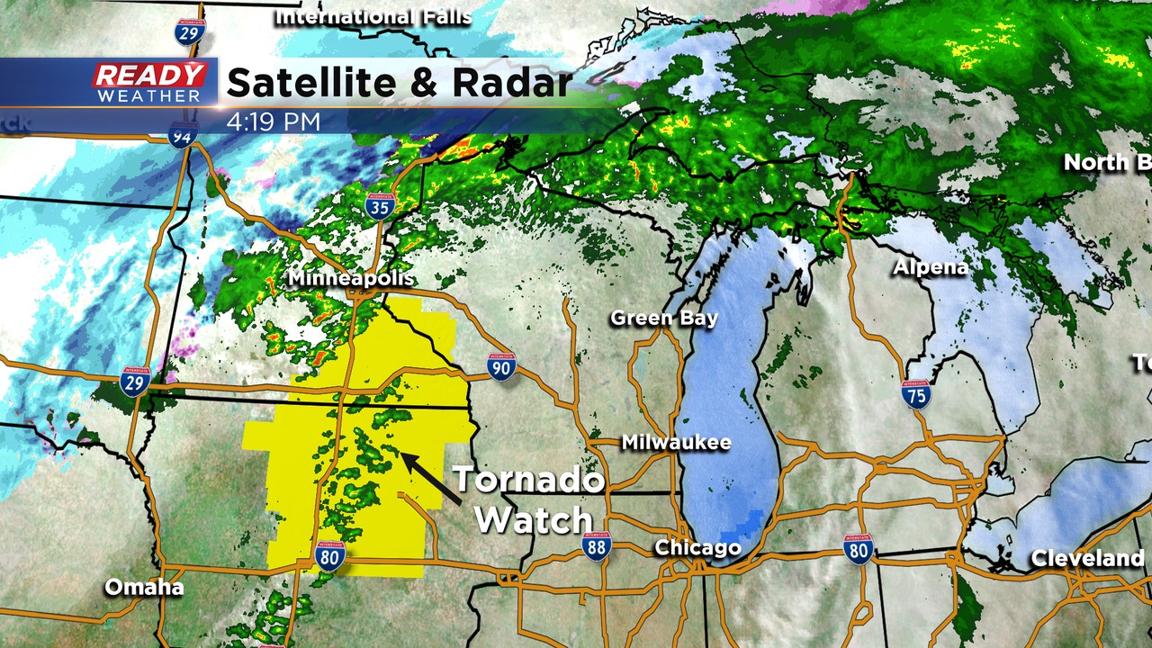
A tornado watch has been issued for Iowa and Minnesota this afternoon and evening. That area has the best instability! We don't anticipate any watches for our area.
There will be a narrow window for some showers and even some thunderstorms to move across southeastern Wisconsin between 9 pm and 1 am.
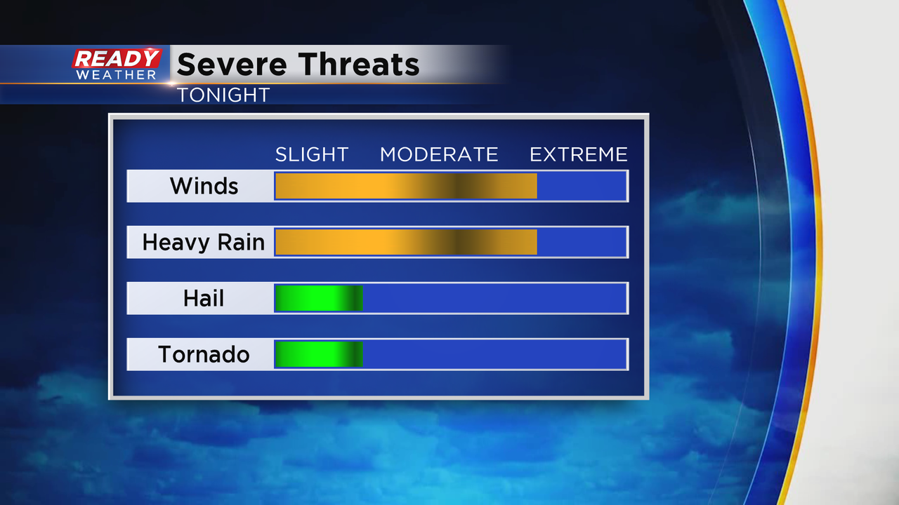
While we don't expect severe weather, winds aloft remain very strong. Heavy rain could mix some of those gusts down to the surface close to 50 mph. The greatest severe threat today and tonight is across western Wisconsin.
The front will clear the area overnight and we will expect plenty of sunshine for Thursday. Winds will remain westerly tomorrow with gusts over 35 mph and temperatures in the lower 50s.