Heavy Rain and Strong Winds Possible with Storms Tonight
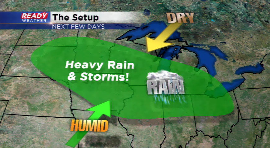
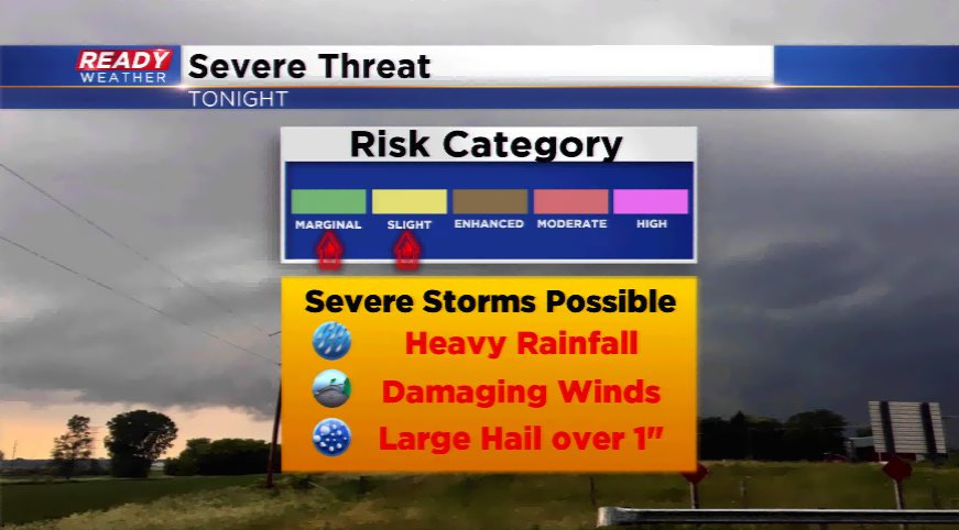
Mother Nature just will not budge. More rounds of showers and thunderstorms are likely to develop over the next few days. This could lead to strong to severe storms including more heavy rainfall.
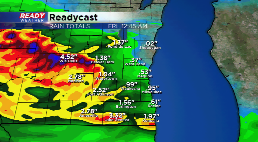
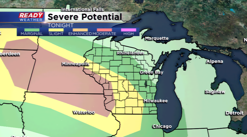
An upper-level ridge nearby will keep plenty of energy in our vicinity and allow for the development of showers and thunderstorms to occur later tonight. Storms will fire out west and march into the region after midnight tonight. The primary threats will be high winds and especially heavy rainfall. Locations all around SE Wisconsin could be targets for this heavy rain; however, obviously the flood-stricken areas are the biggest concern right now. It would only take a few additional inches of rain to create havoc.
Once the storms Thursday morning move out, there remains a chance the rest of the day depending on how quickly storms exit. Another round of overnight storms could produce more strong storms and heavy downpours into Friday morning. A third round of night storms could fire off this fire into Saturday morning.
It will likely take until late this weekend and early next week before things quiet down a bit.
