Tracking our next cold front and a chance for much needed storms
The hot temperatures continue today with highs in the middle to upper 80s to around 90 west of the lake. It's been an impressive run of unseasonably warm temperatures over the last 2 weeks. 13 out of the last 14 days have been above normal.
Unfortunately in this warm stretch, Milwaukee has not recorded any measurable rainfall. It's now 17 days and counting without rain, but that could change Tuesday evening.
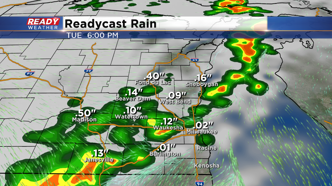
Take a look at the cool air to our west. A strong cold front will arrive Tuesday night with our next chance for showers and storms. That cold front will provide scattered showers and storms between 5 pm and 10 pm. There's an isolated chance for a few stronger storms; however, the bigger emphasis is on the colder air arriving toward the end of the week.
The forecast calls for a tenth of an inch to around a a half an inch of rain.
We go from near 90 on Tuesday to the low to middle 60s by the end of the week. A secondary shot of cooler air on Friday pushes back our next warm early next week.
