Rain/snow possible for some of Easter Weekend
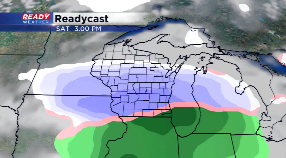
March came in like a lamb and is going out like a lion! A storm system with a deepening low pressure will slide into the viewing area Friday night and Saturday; this will produce a mess, but the good news is this will end in time for Easter.
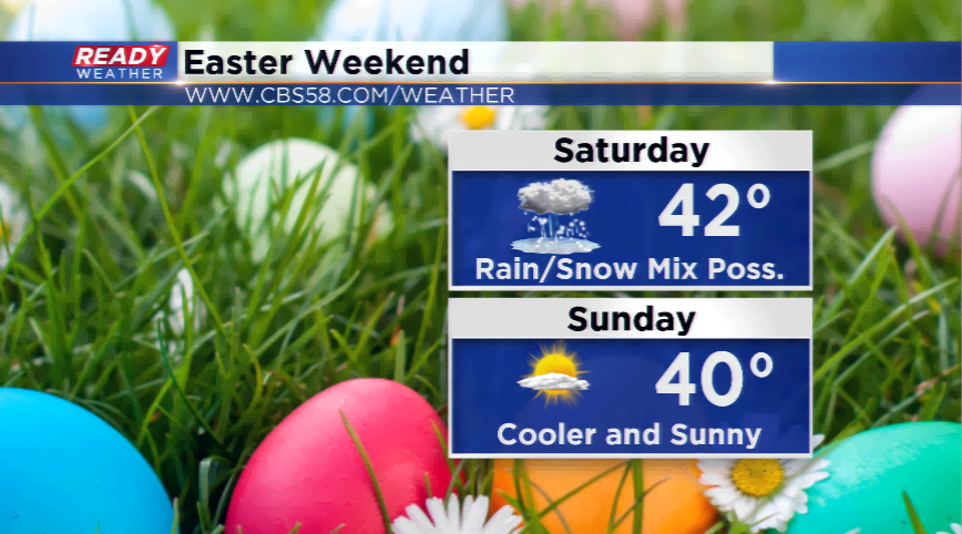
The timing and track of the low is still up in the air, the chance of some sort of precipitation is high, though. As of now, it looks like the precipitation will roll in by early Saturday morning and exit by late Saturday. Models have been struggling with the temperatures and the line of where the wintry mix will be and where mainly rain will take place. More to come on this over the next day or two!
Easter will usher in colder weather and also drier conditions. Highs will drop into the 30s and lower 40s for highs with plenty of sunshine.
