Mid Evening Update: Snow is ending with refreeze leading to icy spots overnight


Updated: Tuesday, October 31st 8:20pm:
A little snow remains over Racine and Kenosha, but most of the area is done with the snow for the day.

That afternoon round of snow came down hard, dropping a solid 2-4" of wet snow in many parts of SE WI. As of 7pm, the official total for Milwaukee is two inches

This marks the 8th earliest on record Milwaukee has had our first inch of snow, and the second most snow we've ever had on Halloween.


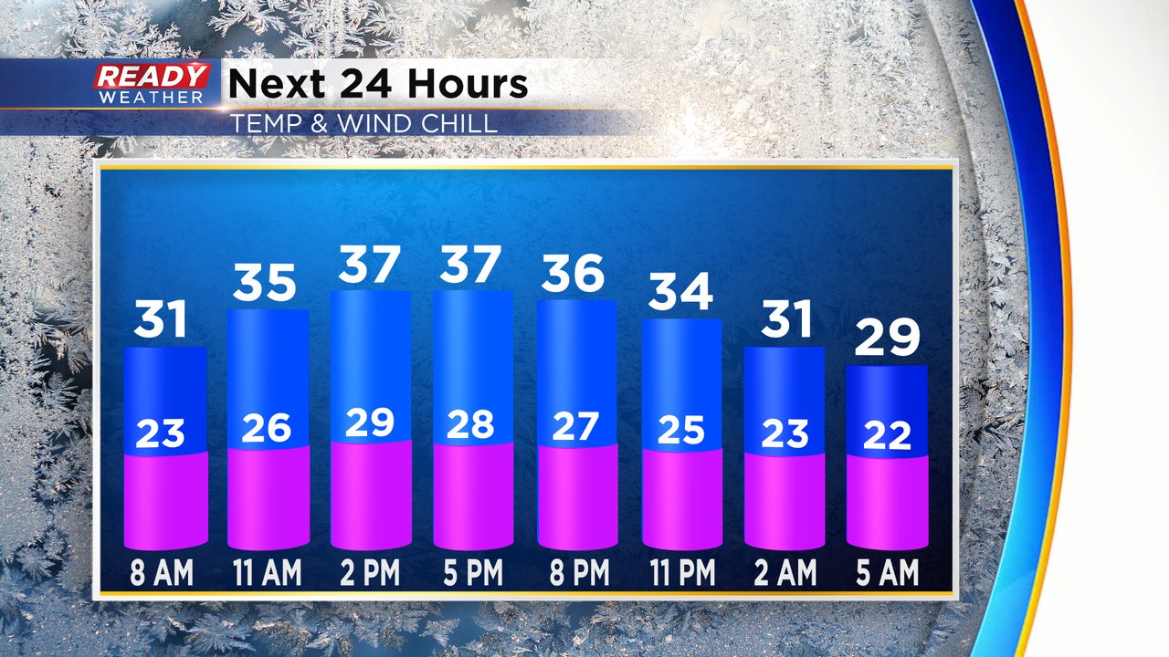
Skies will be mostly clear tonight, allowing temps to tumble into the 20s area-wide. Watch out for icy spots tonight and tomorrow morning as all of that slush and water refreeze.

-----------------------------------------------------------------
Updated: Tuesday, October 31st 6:20pm:
Moderate to heavy snow continues to fall across Milwaukee, Racine, and Kenosha counties as of this updated.

In addition to the snow and thundersnow, we've had a few reports of waterspouts off the shore of Lake Michigan within the lake effect snow bands as well! I wouldn't be surprised if there were a few spinning in the band off of Ozaukee county right now, but the sun has set so it would be very difficult to see. Mick Zupan snapped this photo of one of the funnel clouds seen from Sheboygan earlier this evening.

A few snow totals have trickled in over the last few hours as well, but snow was still falling in many of these locations near and south of I-94. We'll have a more complete snow totals list after the snow ends around 8pm.

-------------------------------------------------------
Updated: Tuesday, October 31st 4pm:
Moderate to heavy snow is pivoting through southeast Wisconsin with lightning and thunder being reported in the last ten minutes in Sheboygan!

Visibility is dropping to a half mile or less in the heaviest bands of snow. Snow rates of an inch per hour are possible in the heaviest bands.

An additional 1-2.5" of snow is expected now through 8pm as this area of heavy snow rotates through SE WI. Plan on low visibility and slick spots through the early evening.

------------------------------------------------------------------------------------
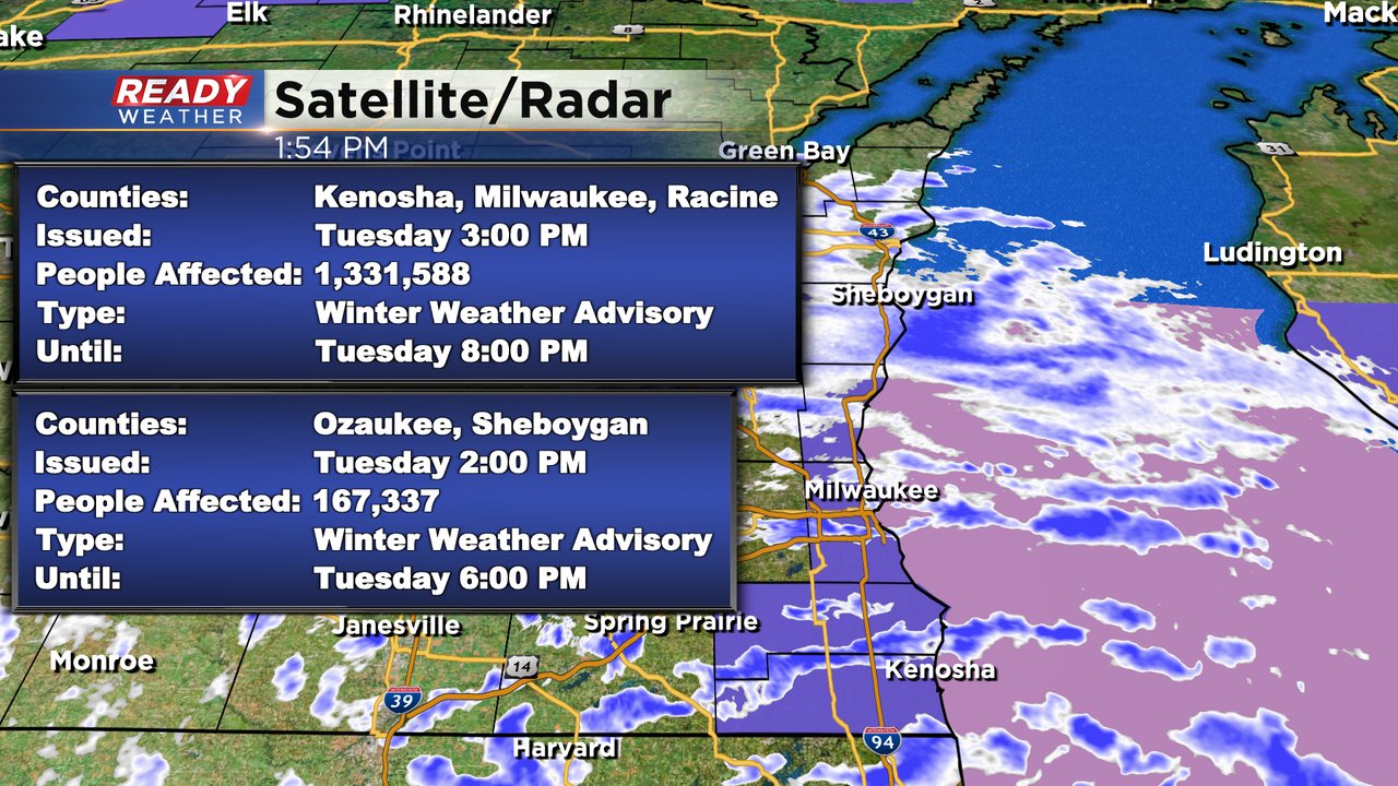
Updated: 2pm Oct. 31, 2023
The National Weather Service has now issued a Winter Weather Advisory for lakeshore counties from mid afternoon through mid evening as we anticipate a good burst of wet snow on a strong northerly wind that will limit visibility and may briefly accumulate to a few inches.
At this time we're also seeing plenty of graupel reports -

Updated: Noon Oct. 31, 2023
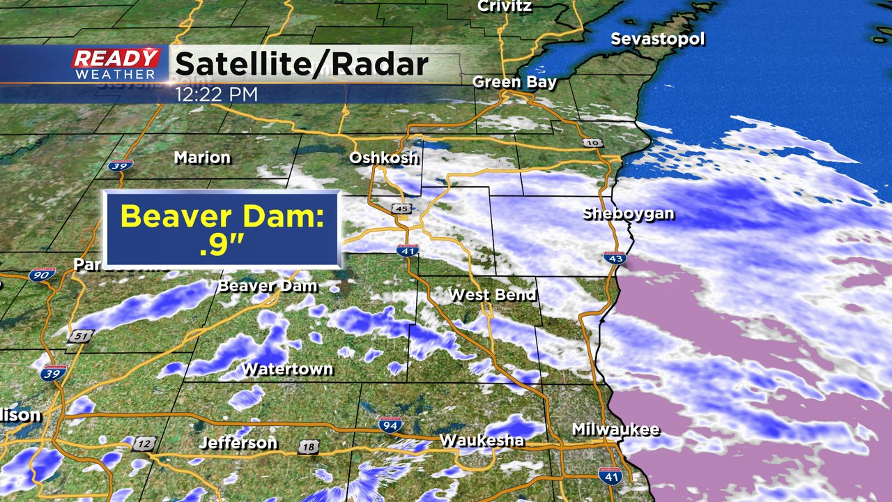
The initial steady north to south oriented band of snow has now passed by. The center of the Low pressure system bringing today's snowfall is centered right over our western locations. Winds have already turned more northerly there on the backside of this system. Moving forward there will be scattered light snow showers across the area and probably a quick burst of wet snow lakeside from 3-6pm. So far limited reports have come in as we expected snow to melt quickly.

Updated: 8:46 a.m. Oct. 31, 2023
A good band of snow is currently rolling across most of southeast Wisconsin but starting to dry out in some of our western counties. This is probably the heaviest and most impactful snow for the day. Visibility is a good indication of who is seeing the heaviest snow. Going into the 9 AM hour Waukesha, Sheboygan and Fond du Lac are seeing the heaviest snow with visibility under a mile in these locations.

The rest of Tuesday will feature scattered snow showers off and on and as temps warm above 32* the chance for accumulation will start to dwindle.
Here's a look at the current radar image that will update with time:

------
Posted: 5:03 a.m. October 31, 2023
Our snowy season is officially here! Some communities saw their first snowflakes of the season over the weekend and the first accumulating snow is expected Tuesday. Snow is already rolling in during the early morning hours and will continue moving east.
Light snow showers are expected off and on throughout the day until the late afternoon. Most hometowns start drying out this evening. The biggest snow impacts will happen during the morning hours with some slick roads expected and at times low visibility.

Snow totals haven't really changed much over the last few days. Most of southeast Wisconsin will see 0.50-1.50" of snow during the day Tuesday. The majority of that accumulating snow will happen on grass, patio furniture, cars, etc. Some sidewalks and driveways will likely see a dusting of snow but main roads should just stay wet.

In addition to the snow, it is going to be a cold Halloween. Air temperatures will stay in the 30s all day long. The wind starts from the SW then shifts to the NW and picks up during the day with afternoon and evening wind gusts reaching 25 mph. That wind will keep wind chill values in the 20s all day long so make sure the kids are bundled up for trick-or-treating.
Download the CBS 58 Ready Weather app to track the snow throughout the day.