Storms Likely Tomorrow Night, Some Strong to Severe

It could be a busy weather pattern for storms as we head into the mid and end of the week. Storms will ignite off the “ring of fire” Tuesday night and early Wednesday. Some of these storms could turn strong to severe. Main threats will be strong winds and heavy rainfall. This energy along the ridge will keep things active for a good portion of the week an
d possibly into this weekend. A few more nocturnal rounds of showers and thunderstorms will be possible with some being strong.

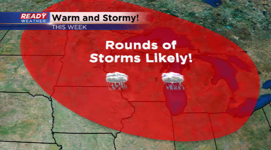
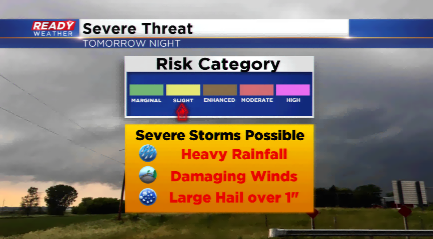
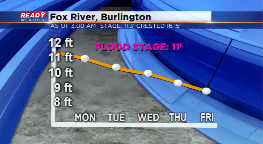
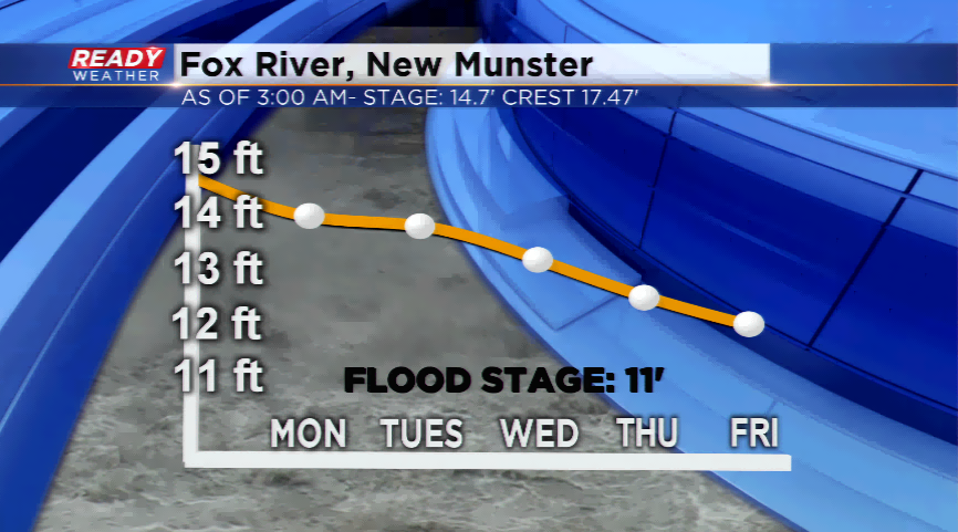
The active setup doesn’t bode well for the flood-stricken areas along the Fox. There has been good news with the water slowly going down and receding. The Fox River at Burlington is expected to go below flood stage by tomorrow morning. It could take until early next week for the Fox River at New Munster to drop below flood stage. Both crested last week and are not expected to rise unless h

eavy rainfall occurs this
week. Both areas remain under a Flood Warning until further notice.

Share this article: