Tracking severe weather Thursday
A strong low pressure area will approach from the west Thursday afternoon into the evening. That low will act as a vacuum, bringing plenty of moisture rich air across southeastern Wisconsin.
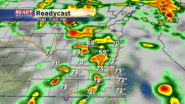
A cold front to the west will act as a focus for late afternoon and early evening storms, some of which could be strong to severe. Those storms are expected to increase in coverage across southeastern Wisconsin.
Our entire area remains under a slight risk for strong to severe storms between 4 PM and 8 PM. Hail, damaging winds, and even an isolated tornado can't be ruled out.
Now this isn't a clear cut severe weather event. Our computer models indicate some morning showers that could reduce the amount of instability across our area. If we can break out in some afternoon sunshine, storms that fire will develop in a more favorable environment. We are going to watch this closely for you.
Keep your eye to the sky tomorrow at State Fair with the impending storms. Download the CBS 58 Ready Weather App and take us with you!
